Canadians longing for consistency in the spring weather may soon get it.

However, it’s not shaping up to be the warm weather many may be craving this time of year, says Global News’ chief meteorologist.
“Going forward, I am predicting quite a bit of chilly air that’s going to linger even into the month of May,” said Anthony Farnell.
Read more: Rural Manitoba areas blasted by spring snow
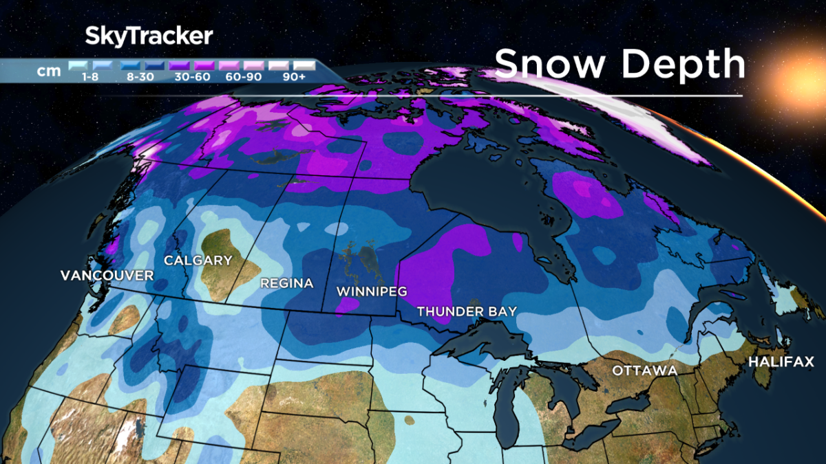
“The fact that there is so much snowcover in the Prairies, it tends to refrigerate the air above it and can prolong winter conditions even here in the Great Lakes, even in areas that don’t have snow on the ground.”
It has felt cold in parts of Canada since the spring equinox on March 20, Farnell said. While he cites the lingering cold air as a reason why, part of it has also been due to brisk winds that have played out recently across the country.
On Good Friday, high winds blew into Quebec and Ontario, causing more than 215,000 Canadians to lose power. Winds gusted up to 70 km/h in some communities.
On Saturday in British Columbia, an icy cold air mass hovering over the province shattered minimum temperature records, some more than 100 years old. Princeton had a record from 1895 quashed when the mercury dropped to -8.4 C on April 16. The old record was -6.7 C for that day.
Just before the weekend, all eyes were on Manitoba as a major storm dumped 29 centimetres of snow in Winnipeg, paralyzing roads, stranding small cars, closing schools and keeping most residents inside.
Sharing in the cold weather, Ottawa could get two to four cm of snow Monday night, and up to five cm of snow on Tuesday, according to Environment Canada. Toronto is also expected to be hit with a blast of wintry weather on Monday, with roughly two to four cm near Lake Ontario.

Get breaking National news
“So far this spring for Ontario, we have seen some slightly colder temperatures, and especially early in spring the weather can be quite variable,” said Sherry Williams, a Toronto-based meteorologist with Environment Canada.
“We’ve had some really nice days, but we’ve also had snow, and that’s just the cold air pushing farther south when we get snow.”
What’s causing this late chill across Canada circles back to the polar vortex from the North Pole, Farnell said.
“It can move and make appearances where it doesn’t typically show up,” he said.
“What we had was a disruption of that polar vortex in the month of March, and that tends to send pieces of cold across different parts of the northern hemisphere, and one of those chunks is sitting in the Prairies and here in Ontario … I wouldn’t be surprised if again this year we get that late frost and freeze threat, and that’s going to obviously impact farmers.”
Come mid-May though, Canadians can expect to see a change in the forecast, to much warmer conditions, Farnell added. Though it’s early for predictions, weather modelling right now shows another hot summer, which begins June 21, in the forecast for Canada, he said.
“Middle of May, we really start to turn a corner and turn into that summer all of a sudden. That’s been a lot more of a common occurrence. I don’t know if it’s climate change or just the cycle we are in, but we have had more cold Aprils than usual going back the last decade or so, and then it just turns hot come late May and June and in summers here,” he said.
“For those who are hoping for the humidity, watch what you wish for (because) I think it’s coming again this year.”
— with files from Global News’ Irelyne Lavery, Kathy Michaels, Skylar Peters and Ryan Rocca


Comments
Want to discuss? Please read our Commenting Policy first.