

After months of extreme and record-breaking drought, mother nature finally turned the taps on in B.C.

Global BC meteorologist Kristi Gordon said October started hot and dry and seemed to switch right into fall storms.
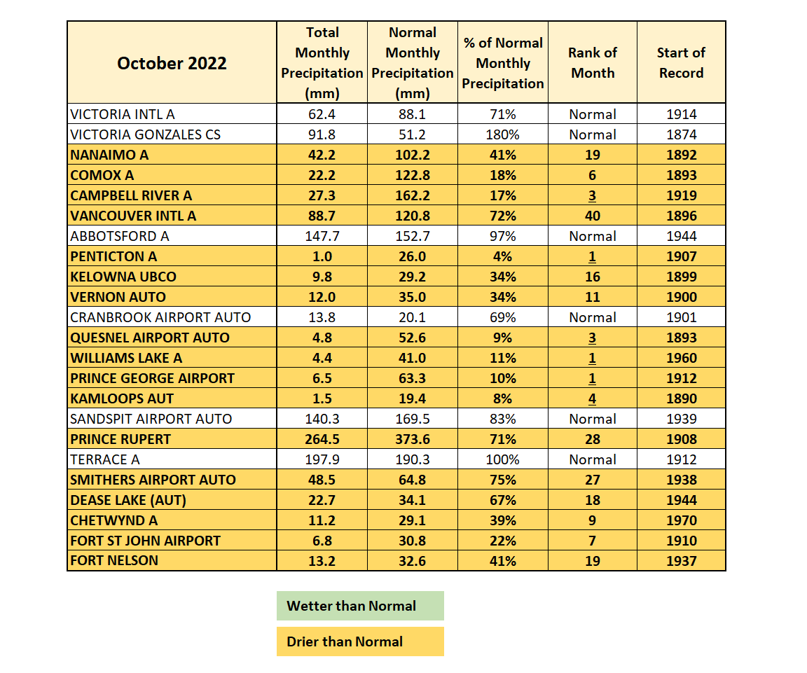
“It was completely dry for the first three weeks of October,” Gordon said. “Considering October has an average rainfall of 120.8 millimetres of rain, zero millimetres by Oct. 20 was concerning.”

On Oct. 21, mother nature flipped the “fall switch” Gordon said and the South Coast was pounded by several rainstorms, including two atmospheric rivers.


Between Oct. 21 and Oct. 31, the Vancouver airport received 88.7 millimetres of much-needed rain.

Get daily National news
“This is 70 per cent of the normal monthly precipitation in just 11 days,” Gordon added.
“This type of extreme weather of prolonged periods of drought and/or heat to periods of heavy rain is exactly what climatologists have been warning us about.”
Data provided by Environment Canada shows almost every area of the province was drier than normal during the month of October.
Two locations, Penticton and Quesnel, did not even see 10 per cent of normal monthly precipitation.
Comments
Want to discuss? Please read our Commenting Policy first.