

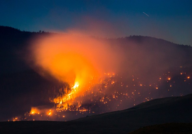
More than 100 wildfires are still burning in B.C., and most evacuation orders and alerts have now been rescinded completely.

But this season remains B.C.’s worst fire season in history but it is still far from over.
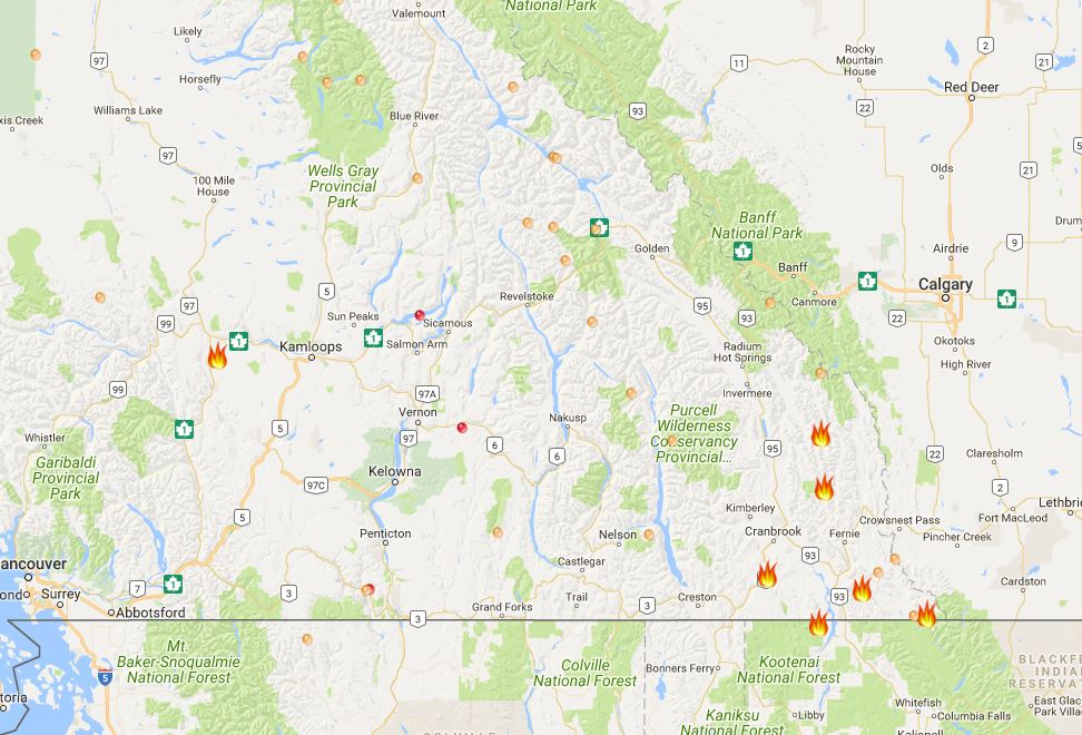
The B.C. Wildfire Service has provided a map of where the fires are located (it may not load in high traffic times so you might need to be patient).
The map is accurate as of Sept. 28, although the wildfire situation may change at any time. The larger flames on the map are considered “wildfires of note.”
FULL COVERAGE: Wildfires burning around B.C.
An interactive map created by NASA allows users to zoom in and see wildfire damage across the province.
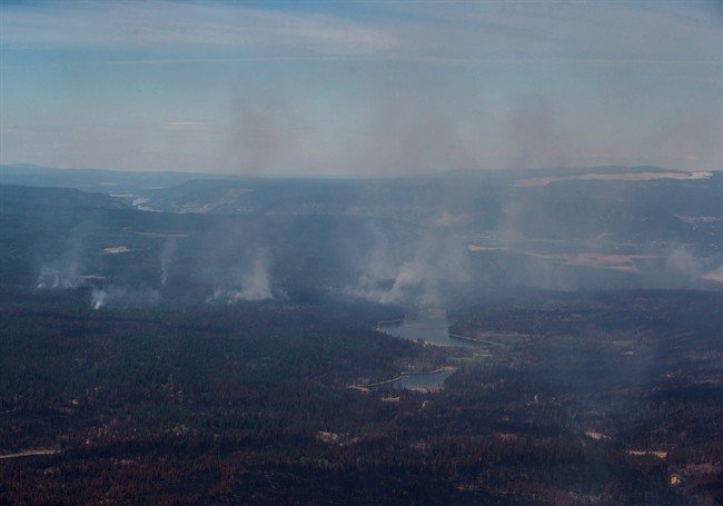
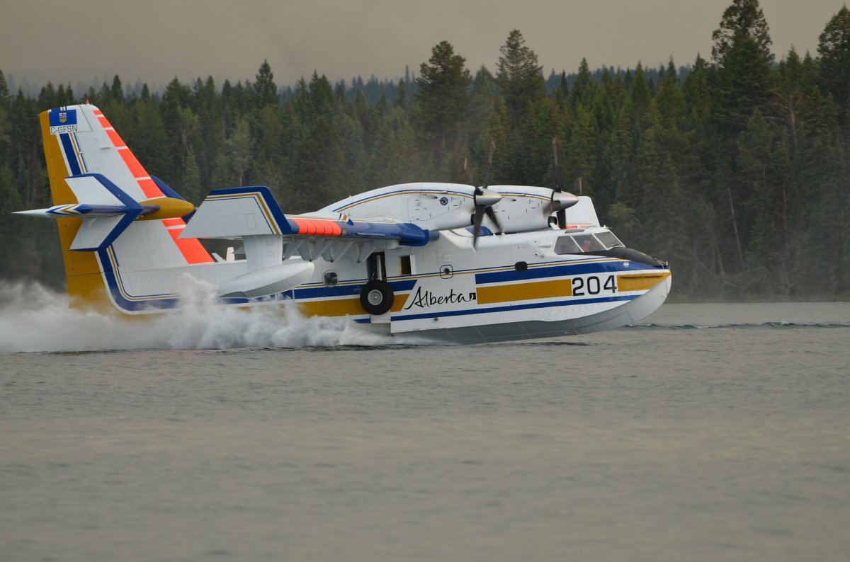
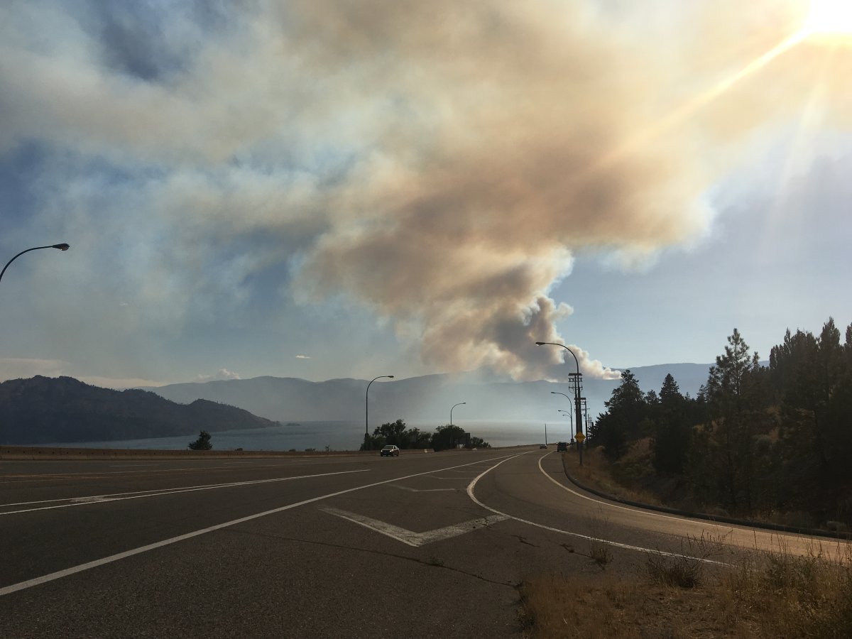
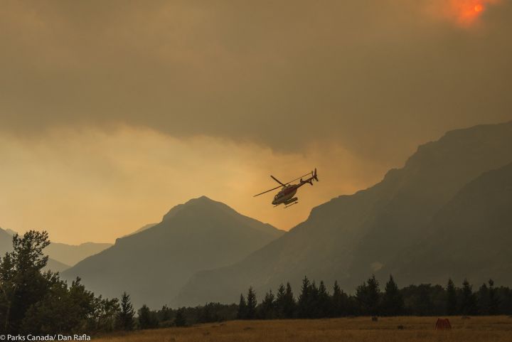
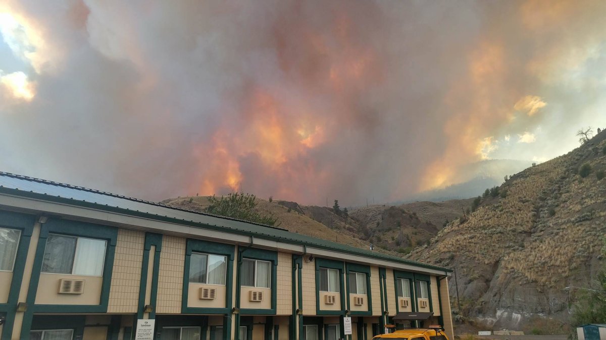
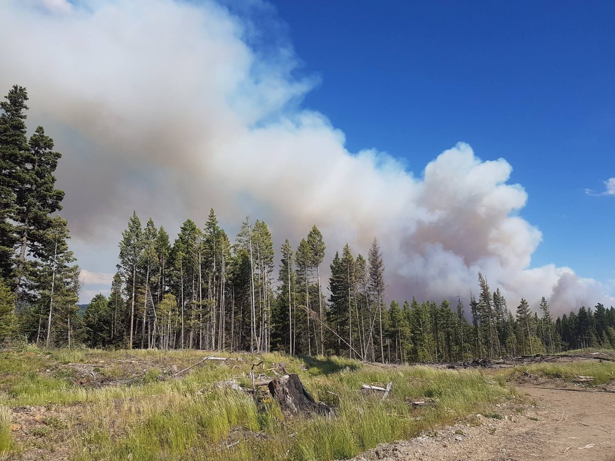
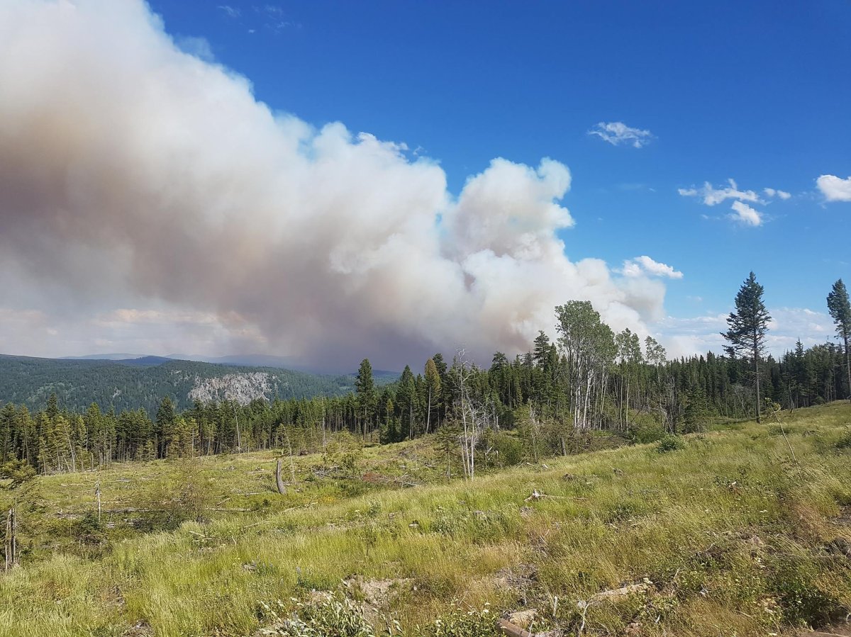
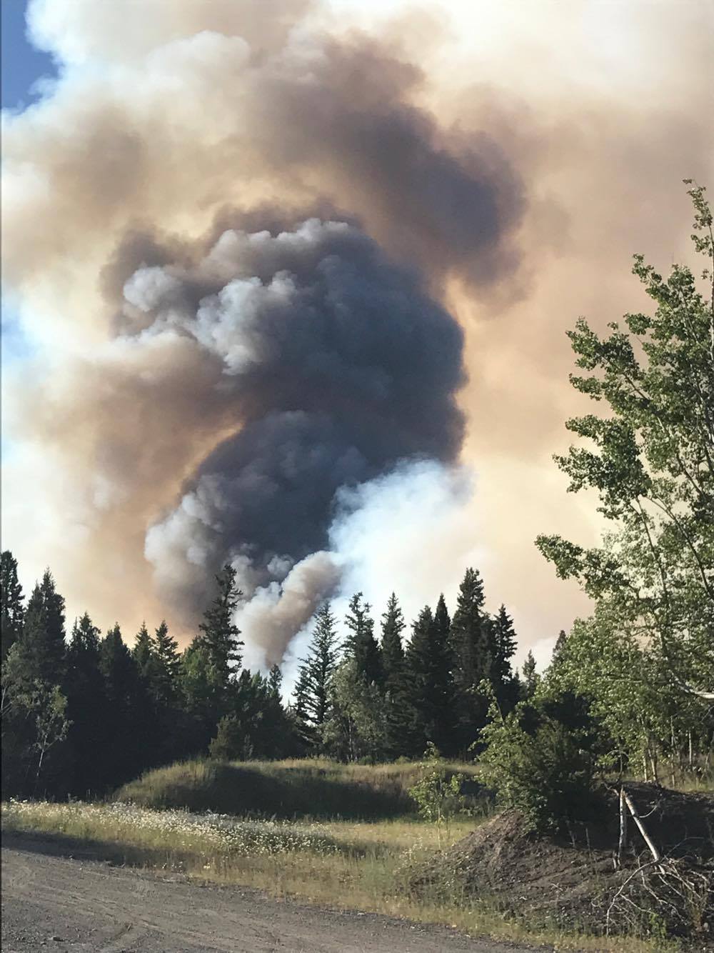
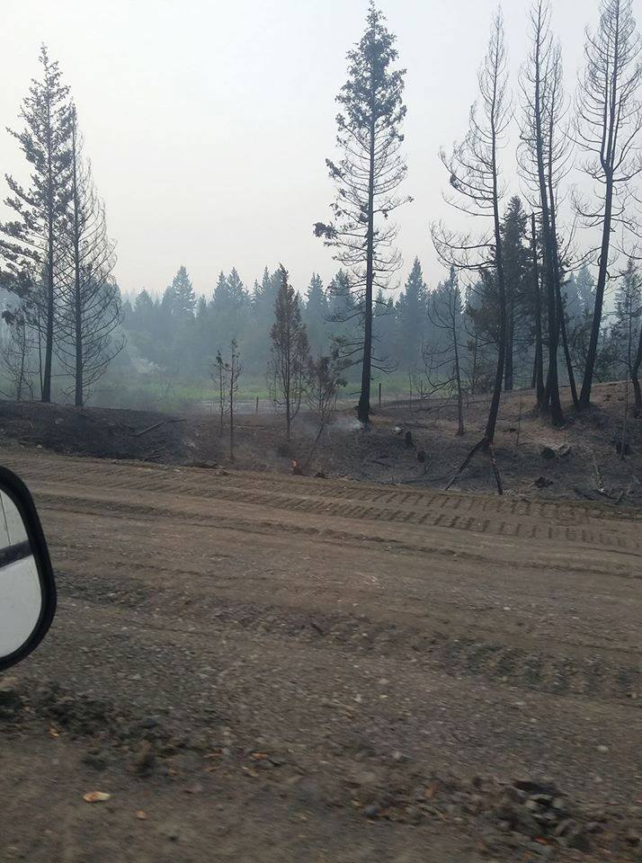
PHOTOS: Wildfires burning around B.C.
There are currently 7 wildfires of note in B.C.:
If you have a claim for compensation due to the wildfires during the provincial State of Emergency, please provide the following information: your name and your location; a brief description of the alleged damages/losses you are claiming and the date(s) occurred; and, the alleged cause or source of the losses/damages being claimed by you.
Claims for compensation will be investigated, and then assessed in accordance with the Emergency Program Act, and/or the Wildfire Act, and/or any other legislation that may apply.
For the Cariboo Fire Centre area: cariboofirecentreclaims2017@gov.bc.ca
For the Kamloops Fire Centre area: kamloopsfirecentreclaims2017@gov.bc.ca

-
![]() Massive Elephant Hill wildfire jumps containment lines
Massive Elephant Hill wildfire jumps containment lines -
![]() B.C. MP calls on Trudeau for ongoing help for wildfire-affected communities
B.C. MP calls on Trudeau for ongoing help for wildfire-affected communities -
![]() Firefighters battle blaze near Williams Lake
Firefighters battle blaze near Williams Lake -
![]() Wildfire now 7 km from Williams Lake, B.C.
Wildfire now 7 km from Williams Lake, B.C. -
![]() Volunteers step up to help B.C. wildfire victims
Volunteers step up to help B.C. wildfire victims -
![]() Slow motion video captures fury of B.C. wildfires
Slow motion video captures fury of B.C. wildfires -
![]() B.C. wildfires: Smoke looms over 100 Mile House
B.C. wildfires: Smoke looms over 100 Mile House -
![]() B.C. wildfires: New evacuation orders for Fletcher Lake area
B.C. wildfires: New evacuation orders for Fletcher Lake area -
![]() B.C. wildfires: More than 45K hectares torched by blazes
B.C. wildfires: More than 45K hectares torched by blazes -
![]() B.C. wildfires: Dense smoke choking Ashcroft
B.C. wildfires: Dense smoke choking Ashcroft -
![]() B.C. wildfires: Province will exceed firefighting budget if needed
B.C. wildfires: Province will exceed firefighting budget if needed -
![]() Train passengers witness B.C. fires burning next to rail lines near Ashcroft
Train passengers witness B.C. fires burning next to rail lines near Ashcroft -
![]() Wildfire evacuees frustrated as help en route
Wildfire evacuees frustrated as help en route -
![]() Alberta boy caught in BC wildfire chaos
Alberta boy caught in BC wildfire chaos -
![]() Single mom in Alberta scrambles to get young son out of wildfire zone
Single mom in Alberta scrambles to get young son out of wildfire zone -
![]() On the firefighting front lines in Little Fort
On the firefighting front lines in Little Fort -
![]() Small-town B.C. pub opens up for wildfire refugees
Small-town B.C. pub opens up for wildfire refugees -
![]() Confusion adding to stress for wildfire evacuees
Confusion adding to stress for wildfire evacuees -
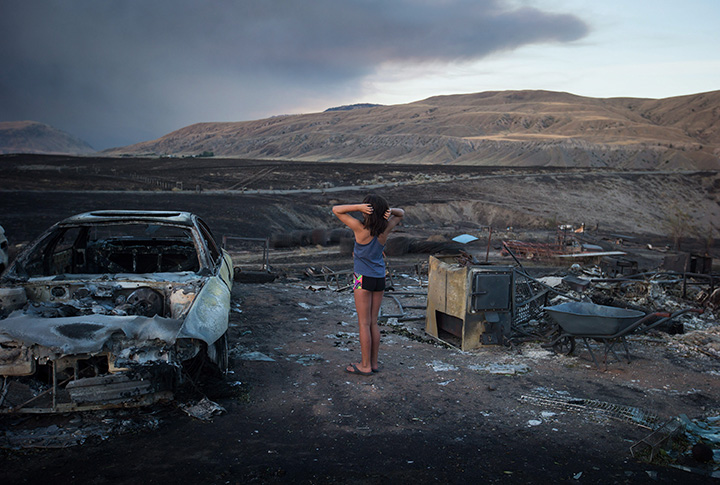
![]() A look at Boston Flats wildfire devastation
A look at Boston Flats wildfire devastation


READ MORE: Video shows terrifying drive to escape B.C. wildfire

-
![]() Ashcroft fire one of the biggest wildfires in B.C.
Ashcroft fire one of the biggest wildfires in B.C. -
![]() Wildfires burning around B.C.
Wildfires burning around B.C. -
![]() Fuel transporter drives through B.C. wildfire
Fuel transporter drives through B.C. wildfire -
![]() BC wildfires close highways around the province
BC wildfires close highways around the province -
![]() Wildfire burning near Princeton has grown to 1,500 hectares
Wildfire burning near Princeton has grown to 1,500 hectares -
![]() Thousands of people evacuated due to wildfires: Cariboo official
Thousands of people evacuated due to wildfires: Cariboo official -
![]() Wildfire burning close to Williams Lake Airport
Wildfire burning close to Williams Lake Airport -
![]() Wildfire encroaching on Cache Creek
Wildfire encroaching on Cache Creek


PHOTOS: The army in Williams Lake:


The Plateau Fire
*This is no longer considered a wildfire of note*
A series of fires in the Chilcotin Plateau have merged into what was called the largest fire in B.C.’s history.
This fire was previously listed as Chezacut, Tautri, Bishop’s Bluff, Baezaeko, Wentworth Creek, Arc Mountain, and others.
The fire, now 521,012 hectares in size, is being managed by two B.C. Wildfire Services teams, one in Puntzi and the other west of Quesnel.
There is currently an area restriction in place due to this wildfire. To locate this fire perimeter and the ten-kilometre buffer zone, as well as other area restrictions, check out this map.
Here’s a detailed description of how the firefighters are attacking this massive blaze.
Kleena Kleene Complex
*This is no longer considered a wildfire of note*
This wildfire, currently burning west of Highway 20, primarily along the Klinaklini River, approximately 200 kilometres west of Williams Lake, is now an estimated at 24,957 hectares.
An evacuation alert was lifted on Sept. 10 for the Kleena Kleene area.
There is currently an area restriction in place due to this wildfire. To locate this fire perimeter and the five-kilometre buffer zone, as well as other area restrictions, check here.

Elephant Hill
WATCH: Footage of the Elephant Hill wildfire

The Ashcroft-area wildfire is now estimated at 191,865 hectares and now 100 per cent contained.
All alerts related to this fire have now been lifted and it no longer considered a threat.
Cooler weather and spotty rain is helping the crews make excellent headway. Detailed review of the road networks right-of-way for danger tree assessment/falling is ongoing. Firefighters continue to mop-up, action hotspots and patrol the perimeter. There has been no additional growth or change to the fire perimeter.
Structures were lost due to this fire.
An area restriction under Section 11 of the Wildfire Act remains in effect in the area around the Elephant Hill wildfire, even though some of the evacuation orders have been lifted. The restriction continues to restrict public access to crown land in the area of the fire, except for residences and some commercial operators. It will remain in place until the earlier of noon on Oct. 31, 2017 or until the order is rescinded.
WATCH: New drone footage shows homes destroyed in Loon Lake due to wildfire


READ MORE: B.C. Wildfires 2017: How you can help


Diamond Creek
*This is no longer considered a wildfire of note*
This wildfire is burning approximately 70 kilometres west of Osoyoos, near Border Lake. It is now an estimated 12,453 hectares and still zero per cent contained.
The wildfire was discovered on July 23 in the Paysayten Wilderness of Washington state, approximately 10 kilometres south of the Canada/U.S. border. Since the first week of the fire, the BC Wildfire Service has been in regular communication with U.S. firefighting officials. This included several flights to monitor and assess the potential for the fire crossing the border into Canada.
A modified response is being used to manage this wildfire. The fire is burning in alpine forests and assessments indicate there is no threat to public safety and there is a limited threat to structural values at this time.
Due to public safety concerns, BC Parks has closed Cathedral Provincial Park.
U.S. officials indicate this wildfire was human-caused.
Verdant Creek / Parks Canada
*This is no longer considered a wildfire of note*
This 4,833-hectare wildfire is burning in Mount Assiniboine Provincial Park.
Due to recent rainfall and cooler temperatures, and in consultation with the B.C. Wildfire Service, BC Parks reopened portions of Mount Assiniboine Provincial Park for public use on Aug. 16.


Members of the public will once again be able to use:
- the north core area around Sunshine Meadows, including the Standish viewpoint and access trail, the Rock Isle loop and the Grizzly-Laryx Lake trails.
- the south area, including the Upper Simpson Drainage south of Og Lake and the extreme upper portion of the Mitchell River drainage (Cerulean, Sunburst and Elizabeth lakes and trails).
- the Assiniboine Creek drainage
The rest of Mount Assiniboine Provincial Park remains closed to public access due to wildfire risks.
This fire is believed to have been caused by lightning.
Travellers along Highway 20 are advised to be aware of heavy smoke in the region.
White River Complex
This now 26,399-hectare wildfire is burning about 37 kilometres northeast of Canal Flats. It is now 90 per cent contained, including natural features such as rock formations, and is being held.
The White River fire, the Grave Creek fire and the North White Fire have all merged and will now be called the White River wildfire.
These fires have been combined because these fires are near forest service roads that have restrictions in place.
All evacuation alerts related to this fire have been lifted.
Effective at noon on Sept 20, the area closure around the White River fire (and the Quinn Creek fire)has been rescinded.
However, the following Forest Service Roads remain closed:
- White River Forest Service Road, starting at the 32.5 kilometre mark
- White-East Fork Forest Service Road, starting at the 60-kilometre mark
- White-Schoefield Forest Service Road, starting at the 78-kilometre mark
- Lodgepole Creek R05956 SEC 1 Forest Service Road, starting at the 54.3-kilometre mark .
Harrop Creek
*This is no longer considered a wildfire of note*
This estimated 3,117-hectare wildfire is burning 10 kilometres south of Harrop-Procter. It is 10 per cent contained and being held.
Previous evacuations have been rescinded.
As of noon Sept. 20, The Regional District of Central Kootenay recinded the evacuation alert for the Harrop, Procter, Sunshine Bay and Kootenay Lake Village. For more information please call 250 352-6665 or visit the district’s website.
WATCH: Residents and ranchers near Clinton are calling on the provincial government for an apology and compensation after a controlled burn in their community went wrong.

Linklater Creek (formally Mount Robinson)
This wildfire of note is burning 18 kilometres southwest of Newgate, which is 65 kilometres southeast of Cranbrook.
It is not threatening any structures at this time and is currently ‘under control’.
It is an estimated 1,285.4 hectares in size in Canada but the majority of this fire continues to burn in the USA.
There has been minimal growth on the Canadian portion of this fire.
Additional information on this fire can also be found here.
Fire crews say people in the area can expect to see an increase in smoke from this fire during peak temperature times and windy conditions. Smoke is highly visible from Newgate, Lake Koocanusa and surrounding areas. The U.S. Forest Service is currently fighting this fire with air support including airtankers.
- B.C. child-killer’s attempt to keep new identity secret draws widespread outrage
- Inquest hears B.C. hostage was lying on her captor before fatal shooting
- ‘We’ve had to make a 180’: What Oregonians say they got wrong with decriminalization
- B.C. judge grants shared custody of family dog in landmark ruling
Previous evacuation alerts have been rescinded.
Lamb Creek
This estimated 2,215-hectare fire is burning five kilometres northwest of Moyie and 18 kilometres southwest of Cranbrook.
It is now an estimated 80 per cent contained.
The fire took 10 to 13 millimetres of rain on Wednesday. Fire behaviour is quiet allowing crews to make good progress.
All evacuation alerts have now been rescinded.
There is a Forest Service Road closure for the Lamb Creek Forest Service Road starting at the 1.5 kilometre mark of the Mineral and Lamb Creek Forest Service Road to the Whitney and Irishman Creek Forest Service Road junction.
Additionally, there is a full road closure for the Etna Creek Forest Service Road starting at the 0.5 kilometre mark to the Lamb Creek Forest Service Road Junction. A detailed map of this road closure can be found here.
Kenow Mountain
This estimated 15,448.8 hectare fire is burning in the Flathead Valley.
B.C. wildfire crews are are monitoring this fire that is burning in a remote area. While no structures or communities are threatened in B.C., the fire has crossed over into Alberta and as a result, has prompted officials to issue an evacuation order for the Waterton Lakes National Park and townsite.

Soowa Mountain
This 5,800-hectare wildfire has been burning along Soowa Mountain, predominately northward, and is now visible to the community of Elco and Highway 3. Structural protection is in place on one cabin not immediately threatened by this fire. This fire is currently not a threat to the community of Elko or to Highway 3.
It is zero per cent contained and was caused by lightning.
Quinn Creek
This 11,763.7-hectare wildfire is burning 30 kilometres west of the Elk River.
This lightning-caused fire originated in the Quinn Creek area, and winds moved it into the Bull Creek drainage. It has not moved out of this drainage. Crews are mopping up accessible areas of the fire. This fire has responded to the cooler temperatures and precipitation in the area.
Previous evacuations for this wildfire have now been rescinded.


Comments