

So far, the winter season in B.C. has been pretty mild.

Residents in the Okanagan have been playing tennis, and most of the South Coast has yet to see snow.
The average temperature across the province since the beginning of December has been one to seven degrees above the climate normal, and above-average conditions have been felt right across Canada and much of the U.S.
So why haven’t we seen “real” winter yet?
Let’s start with a quick explanation about where the cold air comes from.
The coldest air originates over poles.
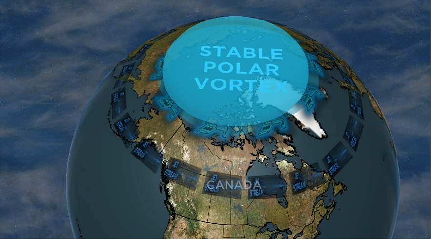
Despite the term “polar vortex” being recently used to describe a surge of arctic air into the lower latitudes, the technical definition of polar vortex is the swirling cold air and low pressure that sits over each pole.
Around this polar vortex is a polar jet stream.
When the polar vortex is stable and the polar jet is strong, the cold air stays over the poles.
That’s what occurred through most of December.
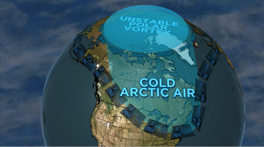
But, when the polar vortex becomes unstable and the polar jet weak, cold air begins to plunge south in large lobes or troughs of cold air.
This can happen over North America or any part of the northern hemisphere, and that’s when real winter settles in.

Get daily National news
So what makes the polar vortex unstable?
The strength of the polar jet and stability of the polar vortex depends on the difference in temperature between the poles and the equator.
The larger the difference, the stronger the jet and the more stable the polar vortex.
But earlier this month, the polar vortex experienced a Sudden Stratospheric Warming or SSW.
Some experts believe this SSW may have been caused by two major weather events: a record-setting high-pressure system over Mongolia, and a record-setting “bomb cyclone” over the north Pacific that disturbed the stratospheric winds of the polar vortex.


There is much uncertainty around why the SSW occurred, but we do know the polar vortex is now unstable.
Winter is coming!
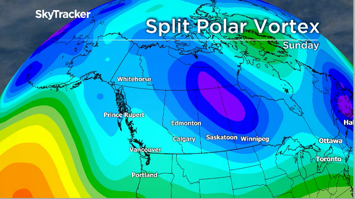
The cold has settled into Eastern Canada but has yet to shift as far west as B.C.
The current computer models are showing this shift will occur in the coming days.
Although the drop in temperature will not be dramatic in this province, it does mean the South Coast could finally get some snow.
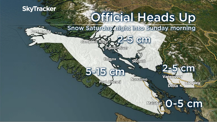
The forecast shows clouds increasing during the second half of Saturday on the South Coast. Enough cool air will be in place overnight that incoming moisture from a weather system advancing down the coast will fall as both snow, rain, or a mixture of both.
Higher areas of Metro Vancouver are expected to receive up to two to five centimetres of wet snow Sunday morning. On Vancouver Island, mainly about 200 metres elevation, five to 15 centimetres is forecast.
Environment Canada has issued a special weather statement for the Fraser Valley, including Chilliwack, Hope and Abbotsford.
Periods of snow are expected Saturday night through Monday morning, with the potential for significant snowfall Sunday night, Environment Canada said.
The first round of snow is expected to be fairly light, beginning Saturday night and becoming mixed with rain Sunday afternoon as the temperature rises. However, a more “significant” round of snow is expected to begin late Sunday afternoon with amounts up to 10 centimetres possible, the agency added.
In the longer term, a chilly low-pressure trough will linger into next week, keeping temperatures on the low side, but not abnormal for January.
Comments
Want to discuss? Please read our Commenting Policy first.