
A severe thunderstorm watch has been issued for much of B.C.’s Southern Interior.

Environment Canada says weather conditions are favourable for severe thunderstorms that could produce strong wind gusts, large hail and heavy rain.

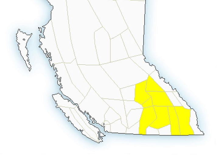
The watch, issued by the national weather agency at 9:26 a.m., covers the North Okanagan plus the Shuswap, North Thompson, North Columbia, West Columbia, Arrow Lakes, Kootenay Lake and East Kootenay regions.
- Calgary area ‘very uniquely situated’ for study of hailstorms, says researcher
- Saskatchewan boosts disaster aid in response to storm-packed spring and summer
- Flooding damage closes Telus World of Science for months, 68% of staff laid off
- Wildfire smoke transforms skies as air quality plummets across Canada


For the Vernon and Salmon Arm regions, Environment Canada’s forecast is calling for a high of 22 plus showers with thunderstorms and a risk of a severe thunderstorm. Rainfall totals could reach 5 to 10 millimetres.
It says during daylight hours, northwest winds will gust from 20 kilometres an hour to 40 km/h near noon. For the evening, it will become partly cloudy, with a 30 to 40 per cent chance of showers with a risk of thunderstorms, and overnight lows of 11 to 12.
Comments
Want to discuss? Please read our Commenting Policy first.