

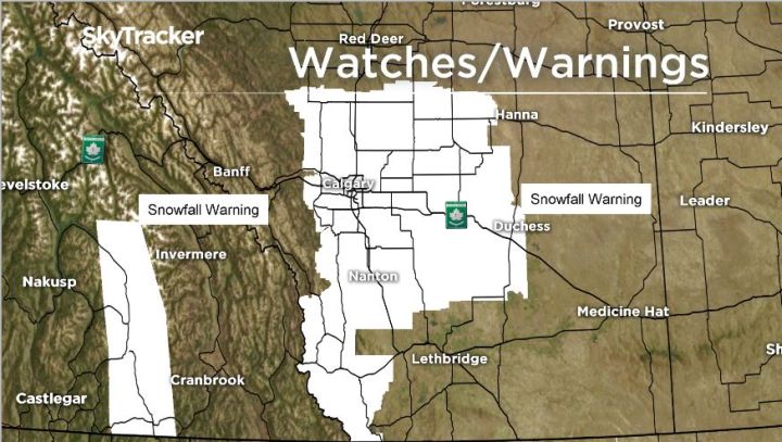
Another snowfall warning that was issued for southern Alberta on Saturday, including the city of Calgary was ended as of 5 a.m. on Sunday.

According to Environment Canada, between 10 to 15 centimetres of snow was forecast to first hit southern British Columbia before it was set to cross the Rocky Mountains into southern Alberta.
Forecast models suggested the heavier amounts would start along the foothills and into Calgary late Saturday afternoon, with snow likely to last overnight.

Get daily National news
Areas covered under the warning include Calgary, Airdrie, Cochrane, Olds, Sundre, Drumheller, Brooks, Okotoks, High River, Crowsnest Pass, Pincher Creek and Waterton Lakes.
To view the full warning, click here.
The warning came on the heels of record cold temperatures in the area.
READ MORE: Warmer weather to return to Calgary Monday
In a weather summary issued by Environment Canada on Friday afternoon, Cold Lake, Edmonton International Airport and Lloydminster all set new record lows for April 6 with temperatures ranging between -22.6 C, -25 C and -23 C respectively.
- Calgary hit by unexpected blast of spring snow, causing dozens of crashes
- False spring strikes again: Saskatchewan prepares for incoming winter weather
- Albertans’ interest in alternative forms of travel growing as fuel prices spike
- Massive avalanche closes Alberta’s Icefields Parkway until at least Saturday


Warmer weather is expected to return to Alberta on Monday, with highs that will be above 0 C in most places.
Peak temperatures are not expected to reach seasonal levels this week, although they will be close Tuesday and Wednesday. The average daytime high in Calgary is 9 C and 11 C in Lethbridge.
Want your weather on the go? Download Global News’ Skytracker weather app for IOS and Android.
Comments
Want to discuss? Please read our Commenting Policy first.