We’re getting a first look at some examples of possible mobility pricing models for Metro Vancouver.

The independent commission charged with developing the road pricing scheme has released seven maps showing potential pricing models as it enters the next phase of consultation on the concept.
Mobility pricing is intended to reduce traffic congestion while raising funds to pay for transit and infrastructure improvements.
The Mobility Pricing Independent Commission says the maps are examples only, and are not final proposals.
Example 1: Downtown Vancouver
The commission says this model reflects that downtown Vancouver is one of the top congestion areas in the region, but is well served by transit.
Under the model, anyone who drove past specific congestion points would be charged, however those fees could vary depending on level of congestion or proximity to transit.
READ MORE: Metro Vancouver mayor’s council sets up commission to introduce mobility pricing for drivers
It said the size of those charges and potential discounts are still being explored.
- Extortion suspects claiming refugee status ‘ludicrous,’ B.C. premier says
- Sentencing hearing underway for Maple Ridge man guilty of interfering with human remains
- ‘These boys were all of our kids’: Hockey community mourns players killed in crash
- B.C. government working on a deal to keep the Whitecaps in Vancouver
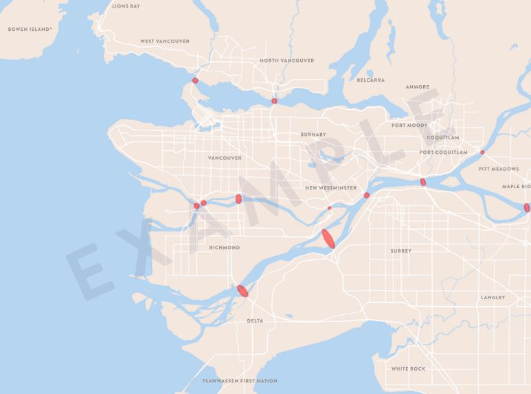
Example 2: Crossing point congestion points
The commission says this model reflects that bridges and tunnels in the region are key congestion points, and also make good natural boundaries.
Under the model, anyone passing the points would pay, with fees potentially varying depending on levels of congestion.
It said feedback has suggested that fees be low for all crossings, and that charges could be designed to be just enough to discourage some people from choosing their cars. Exact fees and potential discounts are still being examined.
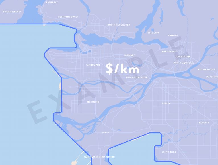
Example 3: One zone distance-based charges
Under this model, a distance based fee for driving would be applied region-wide during peak hours — a model the commission says would cover all congestion hot spots.

Get daily National news
It says anyone driving would pay; however, the charges could vary depending on location, time and direction of travel with lower fees in less congested areas.
Final fees and potential discounts for some people are still being examined.
Example 4: Burrard Peninsula congestion point charges
The commission says this model was drawn from the fact that Vancouver and contiguous suburbs encompass several of the most congested areas, and that it would also cover several key bridge crossings.
Under the model, anyone passing specific congestion points would be charged, but those fees could vary by level of congestion or access to transit.
It says charges could be developed to be just high enough encourage some people to get out of their cars, but that a final model and potential discounts are still being examined.
Example 5: Two zone distance-based charges
The commission says this model is a more targeted version of its one-zone distance charges, and would penalize people driving in the most congested area of the city during peak times.
Anyone driving in Metro Vancouver would see charges, however those outside the Burrard Peninsula would pay less and fees could also vary depending on time of day, direction of travel and access to transit.
It says a price structure and potential discounts and maximum charges are still being examined.
Example 6: Metro Vancouver hot spot congestion points
The commission says this model is an attempt to directly target the region’s worst congestion hot spots.
However, it says it is still investigating how to implement the idea without diverting traffic into other, undesirable areas such as neighbourhoods.
READ MORE: The NDP promised to eliminate bridge tolls, but could mobility pricing be on the way?
Under the model, anyone passing a congestion point would be charged, but fees could vary depending on congestion or access to transit.
Potential charges, along with discounts and maximum charges, are still being explored.
Example 7: Multi zone distance-based charges
The commission says this model is an effective way to target congestion hot spots during peak hours, without penalizing drivers who are not adding to congestion.
Under this model, all drivers in Metro Vancouver would be charged for driving during peak hours, however charges could vary by time, location and direction of travel.
It says the zones would allow charges to be lower in areas with less congestion or fewer transit options.
It adds that the zones could encourage drivers to seek alternate routes through less congested areas.
Potential charges, discounts and maximum fees are still being explored.
WATCH: New details on possible Metro Vancouver mobility pricing for transit

Early days
But even with early ideas on the table, Simon Fraser University transportation expert Gordon Price says there’s still not enough detail to say whether a distance-based or congestion point charge model would work better.
“Will congestion go down? Will transit be improved? But you’re going to have to have some pretty good examples of how you’re going to do that,” he said.
“Better yet — as they did in places like London — you deliver the increased transit.”
READ MORE: Mobility pricing report notes some of Metro Vancouver’s worst congestion points
Price added that typically, politicians will try to justify the system that is chosen once all the issues about that system come forward.
“That becomes irrelevant when you’ve made a choice. So I just don’t see anyone making a choice. It’s too early. A lot of the stuff is very schematic. The idea is there, but you really want to know the detail.”
The Mobility Pricing Independent Commission released its preliminary report on the scheme last month, which narrowed the choices for an eventual model down to either distance based pricing or some form of congestion point charges.
Further public consultation through an online portal is slated to begin later this month.


Comments