
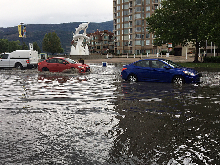
Heavy rain drenched the Central and North Okanagan on Saturday afternoon.

Earlier in the day, Environment Canada predicted that an air mass over the region was to become unstable in the afternoon, as an upper low-pressure system moved in from the north.
As a result, the national weather agency correctly forecasted severe thunderstorms capable of producing heavy rain.
“The threat of isolated heavy downpours delivering upwards of 15 millimetres of rain over a short period of time will exist this afternoon,” Environment Canada said in a special weather statement on Saturday morning.
Along with the Okanagan, the Fraser Canyon, Nicola and South Thompson regions were also placed under the weather watch, which also noted the possibility of localized flooding.

Get breaking National news
Originally, Environment Canada issued the special weather statement at 4:38 a.m., saying severe thunderstorm watches and warnings may be issued later Saturday for these dry-belt regions, “as the rainfall warning criterion is only 15 mm an hour. This is enough to cause localized flooding, particularly on sloping terrain.”
Just over six hours later, at 10:58 a.m., the weather agency upgraded the statement to a severe thunderstorm watch.
- Old Man Winter wallops B.C.’s Mainland/Southwest region, major highway closed
- Calgary hit by unexpected blast of spring snow, causing dozens of crashes
- False spring strikes again: Saskatchewan prepares for incoming winter weather
- Albertans’ interest in alternative forms of travel growing as fuel prices spike


The Arrow Lakes and Kootenay Lake regions were added to the weather watch.
Then, at 1:33 p.m., the severe thunderstorm watch was upgraded to a severe thunderstorm warning.
“At 1:30 p.m., weather radar indicates a strong thunderstorm, about 30 kilometres east of Vernon, and 10 km east of Lumby on Highway 6, that is producing heavy rainfall,” said Environment Canada. “This thunderstorm is moving eastwards along the highway at 20 km/h.”
At 2:17 p.m., Environment Canada said it was tracking two storms, one over West Kelowna and the other over Wilson Landing, both of which were heading east.
At 3:34 p.m., the severe thunderstorm warning was downgraded to a severe thunderstorm watch, with the South Okanagan being included in the weather alert.

Comments
Want to discuss? Please read our Commenting Policy first.