


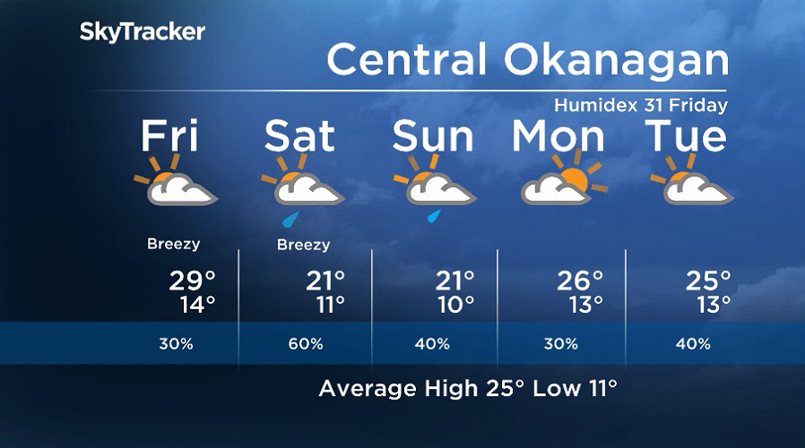
Sunshine returned to start Thursday, but clouds are expected to slide in as temperatures spike into the upper 20s.

A carbon-copy setup is expected for Friday, with a chance of showers added into the afternoon, with a higher risk in the North Okanagan and Shuswap.

The weekend brings a return to unsettled weather, with a chance of showers and risk of a thunderstorm on Saturday, as an upper-level, low-pressure system passes by.



Get daily National news
Get daily Canada news delivered to your inbox so you'll never miss the day's top stories.
By providing your email address, you have read and agree to Global News' Terms and Conditions and Privacy Policy.
Daytime highs will drop into the 22 to 24 range over the weekend as showers continue into Sunday.
Sunshine returns on Monday, as daytime highs return to the mid-20s with a chance of showers returning mid-week.
For weather on the go download the Global News SkyTracker Weather App for iPhone, iPad or Android.


Comments
Want to discuss? Please read our Commenting Policy first.