
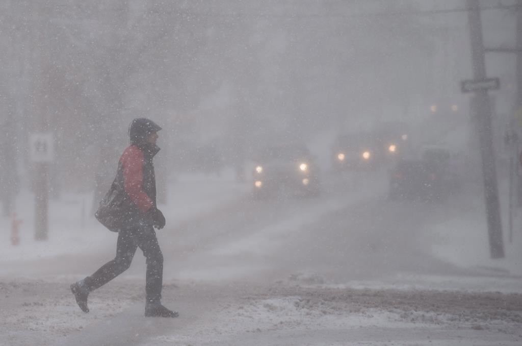
Environment Canada issued a number of special weather statements and warnings on Thursday as a winter storm is expected to bring snow, mixed precipitation and icy conditions to all four Atlantic provinces until at least Friday evening.

Rain, heavy at times, is expected for Halifax Metro and Halifax County West, according to Environment Canada. Ice buildup due to freezing rain is also expected.
The warning said snow will begin over central Nova Scotia on Thursday morning and change to freezing rain in the evening, then to rain on Friday morning as temperatures rise above freezing.
READ MORE: Mayors pleased with flood study of Chignecto Isthmus, land connecting N.S. to N.B.
Total rainfall accumulations of 15 to 30 millimetres are forecast, with the highest amounts expected along the Atlantic coast.
Localized flooding in low-lying areas is also possible, according to Environment Canada.
In response to the weather warnings, Halifax Regional Municipality (HRM) has enforced an overnight parking ban from 1 a.m. to 6 a.m. on Friday to allow crews to properly clear the streets and sidewalks.
“Residents are also reminded that in addition to the overnight parking ban … that tickets can be issued and vehicles can be towed any time, day or night, if they are parked in a manner that interferes with snow clearing,” HRM said in a statement.

Get daily National news
READ MORE: Bids sought for ways to protect Chignecto Isthmus from risk posed by rising seas
The overnight winter parking ban is in effect from now until March 31, according to the municipality.
Surfaces such as highways, roads, walkways and parking lots will become icy, slippery and dangerous. According to Environment Canada, there may be a significant impact on rush hour traffic in urban areas. Ice buildup may also cause tree branches to break.
Utility outages may occur as well. As a result, Nova Scotia Power is activating its emergency operations centre (EOC) at noon on Thursday in advance of the winter storm.
“We are keeping a close eye on this storm. With a prolonged period of mixed precipitation in the forecast, which can change with even minor temperature fluctuations, we are making preparations accordingly,” Matt Drover, storm lead for Nova Scotia Power, said in a press release.
READ MORE: Carbon tax revenue to go to climate change fund, not rebates: N.B. minister
“We’re staffing up our customer care centre and moving crews into position throughout the province to ensure we can respond as needed for our customers.”
According to Nova Scotia Power, if outages occur, crews will restore power as soon as conditions are safe. In situations where there are multiple power outages, Nova Scotia Power said it will restore power in phases to ensure critical services like hospitals can stay open before beginning work in other areas.


“Larger outages on transmission lines and in substations are restored ahead of smaller outages to restore electricity to the greatest number of customers,” Nova Scotia Power said.
In northern New Brunswick, residents can expect between 15 and 35 centimetres of snow between Thursday afternoon and Saturday.
Up to 15 centimetres of snow and ice pellets are also in the forecast Friday for the northern Avalon Peninsula in eastern Newfoundland, where a punishing storm last month kept St. John’s shut down for an entire week.
READ MORE: N.B. still working on long-term energy strategy
The rest of the Avalon Peninsula and the Burin Peninsula can expect freezing rain, while the bulk of the island of Newfoundland is being warned that anywhere from 10 to 35 centimetres of snow is on the way, with the heaviest snow expected in central and western Newfoundland.
With a storm event forecasted, the City of Saint John’s transportation and environment services said crews will be working to keep the city streets and sidewalks safe for motorists and pedestrians.
“With a combination of snow, freezing rain and strong winds, motorists should prepare for changing and deteriorating travel conditions, and are reminded to drive carefully,” the city said in a statement.
According to the city, “major arteries, highway connections and emergency routes will be cleared constantly during the storm, with major bus routes and streets connecting schools, community centres and business districts as the second priority.”
Prince Edward Island is expected to endure a messy mix of ice pellets, freezing rain and up to 15 centimetres of snow.
— With files from the Canadian Press
Comments
Want to discuss? Please read our Commenting Policy first.