

A temperature roller-coaster with flurries and strong winds expected.

Wednesday
Clouds linger at times on Wednesday with a chance of flurries overnight into early Thursday.
Below seasonal daytime highs in the mid-single digits for much of the province.
Thursday
Temperatures improve, but remain cooler than normal with a few sunny breaks expected.
Winds pick up later in the afternoon.
Weekend outlook:
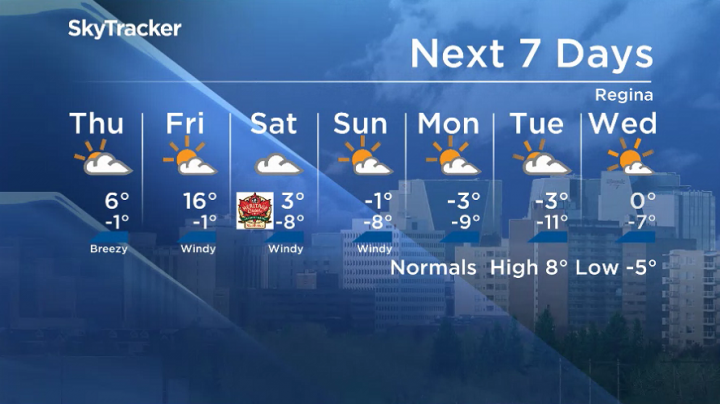
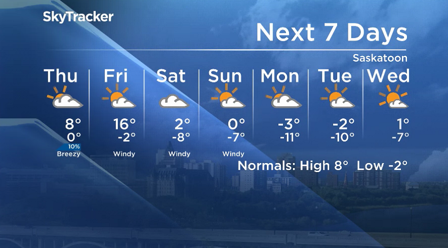
Big warm-up Friday as temperatures soar into the mid-teens, but that is short-lived.
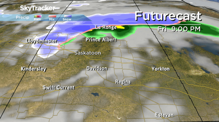
A rain-snow mix slides through northern and central parts of the province in the evening, lingering into the overnight periods as well.
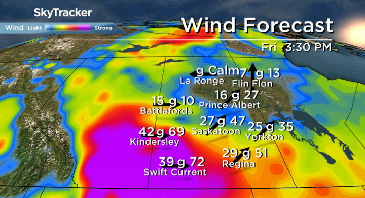
Winds pick up significantly. Some central and southern areas could see gusts in the 50 – 75 km/h range Friday, staying strong into Saturday.
A cold front crashes through dropping daytime highs from low-single digits on Saturday to the freezing mark by Sunday.


The Your Saskatchewan photo for October 23 was taken by Brenda Peters in Saskatoon.

The Saskatchewan weather outlook is your source for the province’s most accurate forecast and is your one-stop-shop for all things weather with comprehensive, in-depth analysis that you can only find here.
For weather on the go download the Global News SkyTracker Weather App for iPhone, iPad or Android.
Comments
Want to discuss? Please read our Commenting Policy first.