I think it’s fair to say most Canadians are done with spring and wondering what the summer weather will hold in 2019.

Between the lingering cold coast to coast in April and early May, to record flooding in Ontario and Quebec or a complete lack of rainfall in Saskatchewan and northern Alberta, extremes in spring can often signal what’s ahead for the summer season.
WATCH: Out-of-control wildfire threatens northern Alberta town

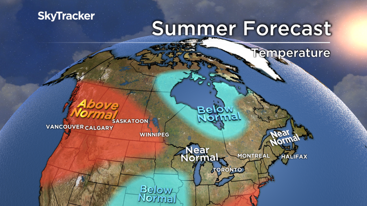
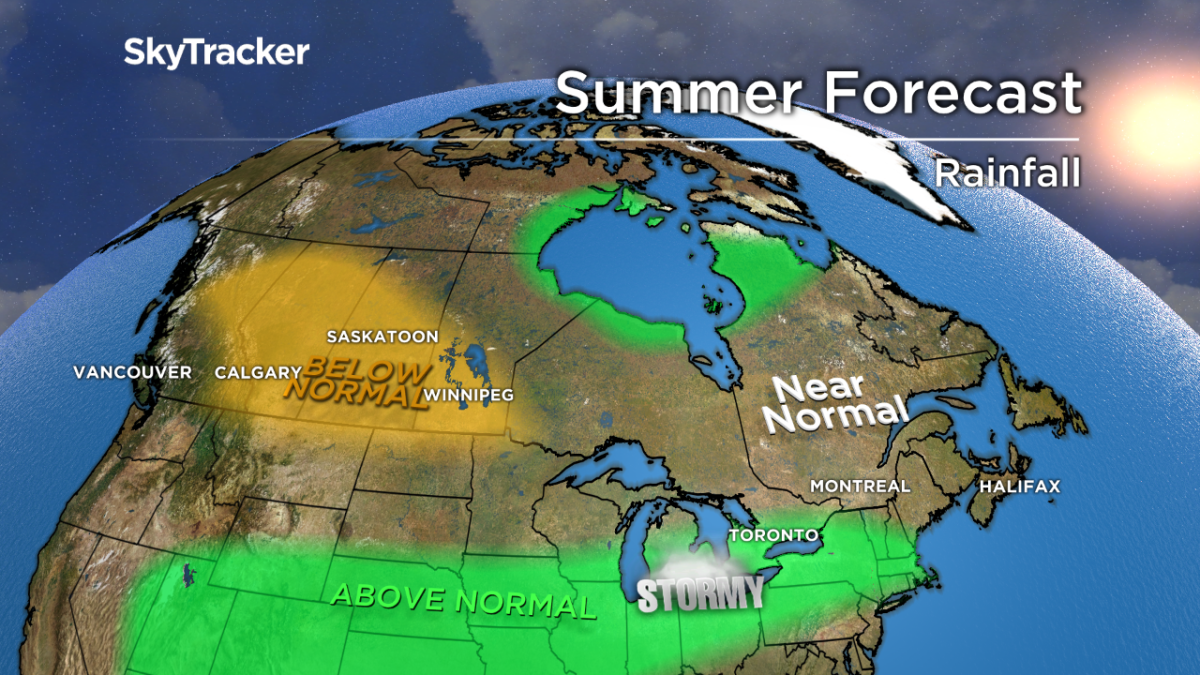
The overall trend is for the west to be warm, while in the east cooler to seasonal conditions will prevail. Where it’s been dry, it will likely continue to be dry and where it’s been wet, more rain and storms are on the way.
Here’s a detailed look at what to expect this summer across Canada.
British Columbia
It will likely be another hot and dry summer for much of B.C.
Last year, wildfires raged for weeks with the smoke so thick it blocked out the sun in many cities and towns across the province. In the north, the fire season is already off to a quick start and this will likely spread south as the temperatures continue to warm and the ground dries out.

Get daily National news
WATCH: Vancouver Island man goes viral as the ‘bunny whisperer’

Ocean temperatures have cooled just off the south B.C. coast, which may bring some relief in the form of cooler air later this summer to places like Vancouver and Vancouver Island.
Prairies
Drought conditions have been building through the western prairies for a couple years now, but have been made worse recently by a large spring rainfall deficit.
Saskatoon has only recorded 5mm of rain since the beginning of April with other cities like Regina and Edmonton not far behind. The dry ground and a summer ridge will bring more heat to the region through the heart of the summer.
WATCH: Hot and dry conditions not helping fight against Alberta wildfires

A below-normal severe weather season with low rain totals are expected. This could lead to more wildfires and a worsening drought for farmers.
Ontario and Quebec
The combination of a snow-filled winter and very wet spring led to another round of record flooding across Ontario and Quebec.
While the Ottawa River level has gone down since peaking in early May, all five of the Great Lakes and Lake St Claire will remain near all-time record highs through the summer.
Cool water temperatures and a saturated ground will also limit how hot it will get this summer. Seasonal temperatures are expected with frequent swings from hot to colder.
These swings will also bring a higher risk of severe storms. Above-normal rainfall and muggier than normal conditions are expected across southern Ontario. Near-normal rainfall is likely for the northern half of Ontario and much of Quebec.
Atlantic Canada
The cool spring weather will slowly give way to warmer conditions in June.
Overall, the summer should be near-seasonal but with lots of back and forth. A big change from last year is the cold waters that now surround Atlantic Canada. This will limit any lengthy heat waves but also act as protection, potentially weakening any tropical storms or hurricanes that approach the coastline.
WATCH: Soggy spring frustrates New Brunswick farmers

The hurricane season will likely be quieter than normal, in part because of a weak El Nino in the Pacific.
Yukon, NWT and Nunavut
A persistent trough will set up for most of the summer around Hudson Bay bringing frequent showers and storms and below seasonal temperatures. No strong signal exists for either warm or cold elsewhere across the north.


Comments
Want to discuss? Please read our Commenting Policy first.