

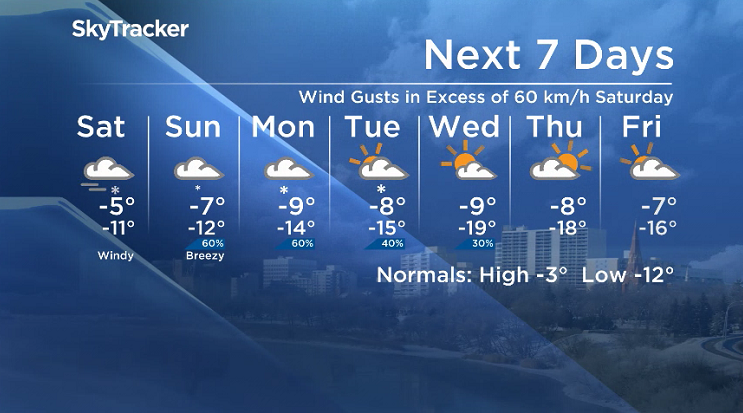
Winter Storm Warning

Environment Canada has issued a winter storm warning for Saskatoon and central Saskatchewan for heavy snow and strong wind expected Friday night and Saturday.
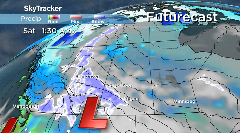
A developing winter storm is forecast to move through Alberta on Friday before spreading into western Saskatchewan on during the evening and persisting through to the next day.

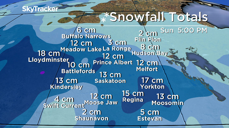
Total snowfall accumulations of 10 to 15 centimetres is expected by Sunday morning.
Poor visibility is also anticipated, with falling and blowing snow Friday night into Saturday as easterly winds pick up to 40 to 50 km/h with gusts to 70 km/h.
The agency is advising travellers to consider postponing non-essential travel until conditions improve and note that this system is affecting a large portion of the Prairies to varying degrees.
Visibility will be suddenly reduced to near zero at times in heavy snow and blowing snow and poor weather conditions may contribute to transportation delays.
Winter storm warnings are issued when multiple types of severe winter weather are expected to occur together.
Special Weather Statement
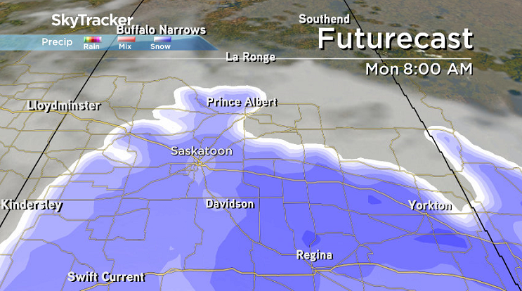
Environment Canada has also issued a special weather statement in eastern Saskatchewan for a major winter storm expected Sunday evening, Monday and beyond.
This winter storm will bring a prolonged period of heavy snow, strong winds, and blowing snow to the area, but there is a lot of uncertainty with this system as Colorado Lows can be notoriously difficult to forecast.
Total snowfall amounts of 15 to 30 cm should be expected and heavier local snowfall amounts are possible along with periods of poor visibilities in blowing snow that will also affect travel Monday and Tuesday.
Motorists planning to head out on roads are advised to use caution and check in with Saskatchewan Highway Hotline before heading out.
For the latest weather alerts download the Global News SkyTracker Weather App for iPhone, iPad or Android.
Saskatoon Forecast

Get daily National news
Friday
It was a chilly start to the second morning of March with temperatures sliding back to -19 with wind chills making it feel like -30.
Clouds quickly rolled in by midday as we warmed up into the mid-minus teens by noon with wind chills remaining in the -20s through the morning.
Winds will pick up during the afternoon with gusts upwards of 50 km/h possible as we rise up to an afternoon high a few degrees into minus single digits.
Friday Night
The much anticipated snowstorm will move in Friday night with snow starting very early Saturday morning, likely between midnight and 3 a.m. as we cool back into minus double digits.
As the low pressure system responsible for the snow approaches, winds will kick in even stronger, up to sustained speeds of 40 km/h with gusts in excess of 60 km/h possible overnight.
Saturday
Heavy snow will fall right through the day on Saturday with winds around 40 km/h and gusts upwards of 50 to 60 km/h at times making road conditions treacherous.
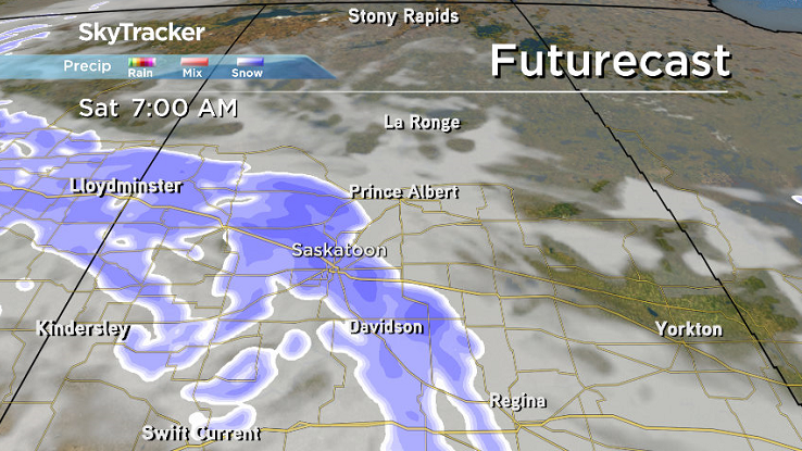
This is expected to be fluffy snow that’ll blow easily, so visibility is likely to be near zero at times with snow blowing across area highways creating conditions that Environment Canada is advising people not to risk traveling in if at all possible.


Temperatures are expected to top out in mid-minus single digits in the afternoon, but because of the strong winds it’ll feel like the mid-minus teens to the -20s with wind chill all day.
Sunday
We’ll be waking up to a fresh layer of 10 to 15 centimetres of snow on Sunday under mostly cloudy skies with some lingering snow likely as winds start to ease back during the day.
It’ll be an even cooler finish to the weekend with a daytime high struggling to make it into mid-minus single digits after starting out in minus double digits.
Work Week Outlook
Another wave is snow is possible to start the first full week of March with a trough expected to slide through the area before we get into some mid-week sunshine.
Depending on the exact track of the Colorado low attached to the trough, some models are slowing its track and pushing it closer to central Saskatchewan, which could result in some significant snowfall accumulations, possibly bringing us up to or even over a foot of snow (including the weekend snowfall amounts), by the middle of the week.

It’ll remain cool all week with daytime highs struggling to get into minus single digits some days, overnight lows in the minus teens and morning wind chills approaching the -30s.
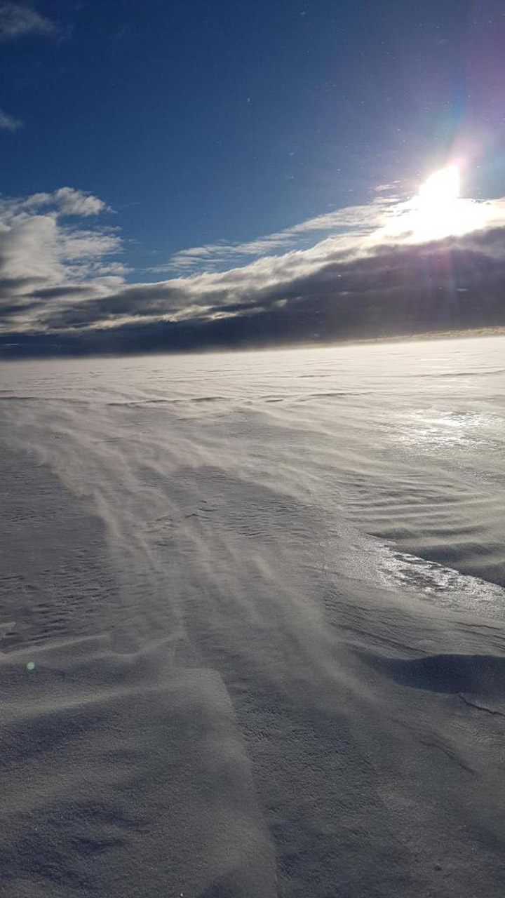
Canoe Lake was the setting for Balloo Gardiner to take the Your Saskatchewan photo for March 2:
Saskatoon weather outlook is your source for Saskatoon’s most accurate forecast and is your one stop shop for all things weather for central and northern Saskatchewan with comprehensive, in depth analysis that you can only find here.
Comments
Want to discuss? Please read our Commenting Policy first.