

It was a rude wake up call for Londoners Friday morning as the city got its first dose of winter overnight.

Environment Canada lifted a snow squall warning for London and Middlesex County late Friday morning, but not before the ground was blanketed in snow.
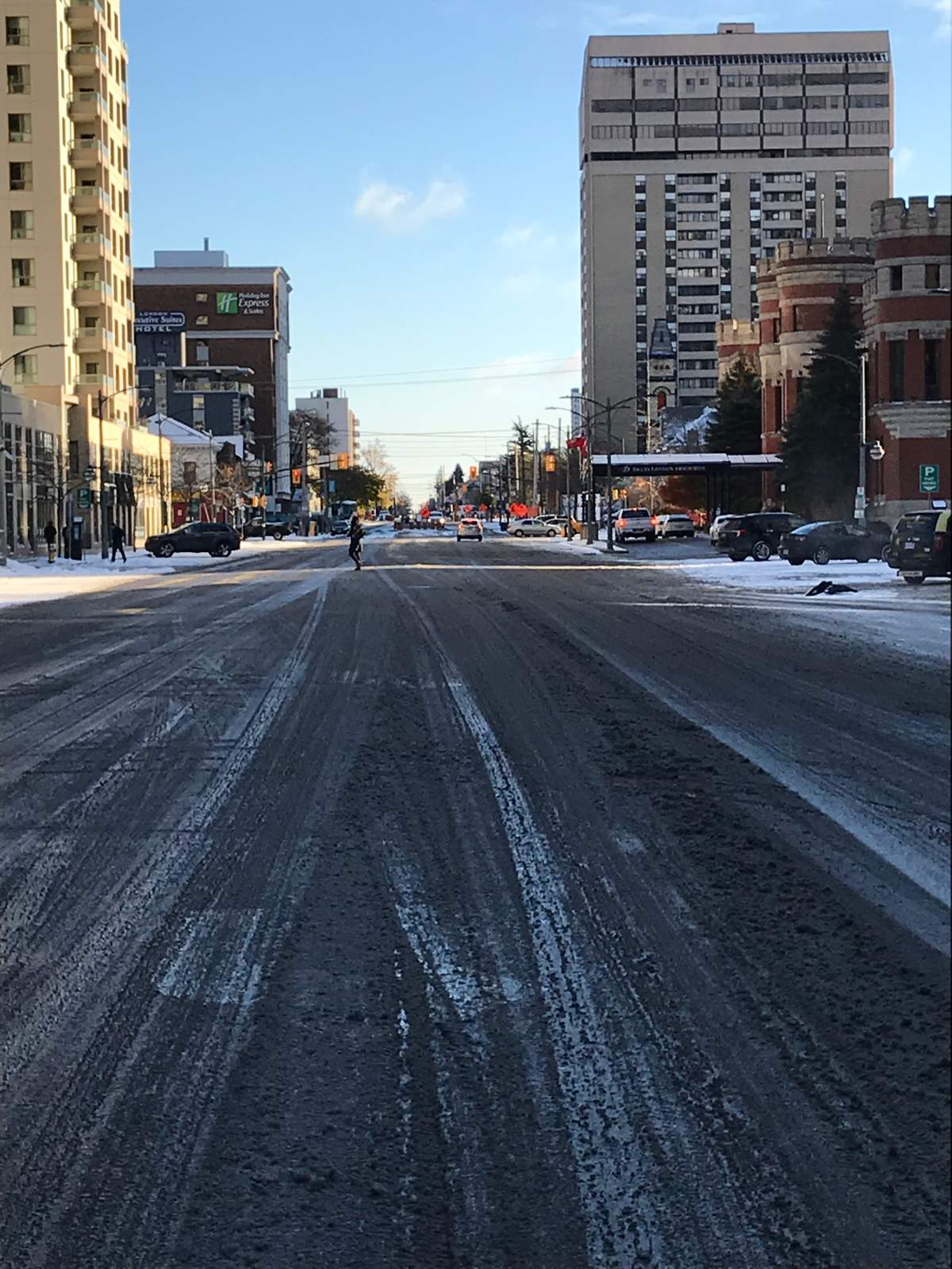
The city of London had snow plows and salt trucks at the ready for the arrival of the winter weather. Salt trucks were active overnight ahead of the morning rush.
The snow on the ground made for some slippery streets, but didn’t result in any school bus delays or cancellations.
London also broke a nearly 40-year-old record low temperature Friday. The mercury reached -8.8 C, surpassing the 1979 mark of -7.8 C.
Global News Chief Meteorologists Anthony Farnell says the cold weather has arrived a bit earlier than normal this year, but expects more seasonal temperatures to return by the beginning of next week.

Get daily National news
“This is a quick hitting arctic air mass that encompasses all of Ontario, but thankfully as quickly as it gets in here it’s going to be leaving. By Sunday, a lot of the snow that you see out of you window will be gone,” he said.
Although city salt trucks and snow plows have been hard at work through the overnight hours, roads were still slick during the morning commute, especially lesser traveled routes.
READ MORE: London snow plows, salt trucks ready to tackle winter weather as drivers warned to be extra cautious
West Region OPP Sgt. Dave Rektor says motorists’ winter driving skills will be put to the test.
“Driving slowly, keeping distance between vehicles, making sure your vehicle is sound for winter driving and making sure your skills are competent with the weather, those are the things that will keep everybody safe on our roadways,” he said.


After the cold air leaves the region later this weekend, Farnell says Londoners will get a bit of a break before the cold weather moves in full time.
“I am expecting towards the end of the month to get another blast of cold air which is going to come with some snow, and at that time it might be here to stay. We’ll be seeing quite a bit more snow, but we’ll at least get a break for a week or so,” he said.
He’s concerned that these bouts of cold temperature will once again make the area vulnerable to significant snowfall.
“Lake effect around London is always, especially when you have warm Great Lakes, which is what we have right now with Lake Huron sitting at about plus-11,” said Farnell. “So when that cold air comes across the water, lake effect is going to be a big deal this year.”
Farnell says Saturday could be one of the colder Remembrance Days on record, with temperatures hovering around -12 C during the early morning hours. He adds that the cold winds should die down throughout the morning Saturday, as the temperature begins to rise throughout the weekend.
Comments
Comments closed.
Due to the sensitive and/or legal subject matter of some of the content on globalnews.ca, we reserve the ability to disable comments from time to time.
Please see our Commenting Policy for more.