Hurricanes are growing with such intensity and power due to climate change that a peer-reviewed study argues we need a new category to classify these worst-of-the-worst storms.

Currently, hurricanes are categorized on the Saffir-Simpson scale, developed more than 50 years ago, which slots storms into five categories, Category 1 being the weakest and Category 5 representing the most destructive.
Storms that sustain winds of 252 km/h (157 mph) or over are considered Category 5s, but a growing number of hurricanes in recent years have far exceeded that, flirting with speeds around 325 km/h (200 mph).
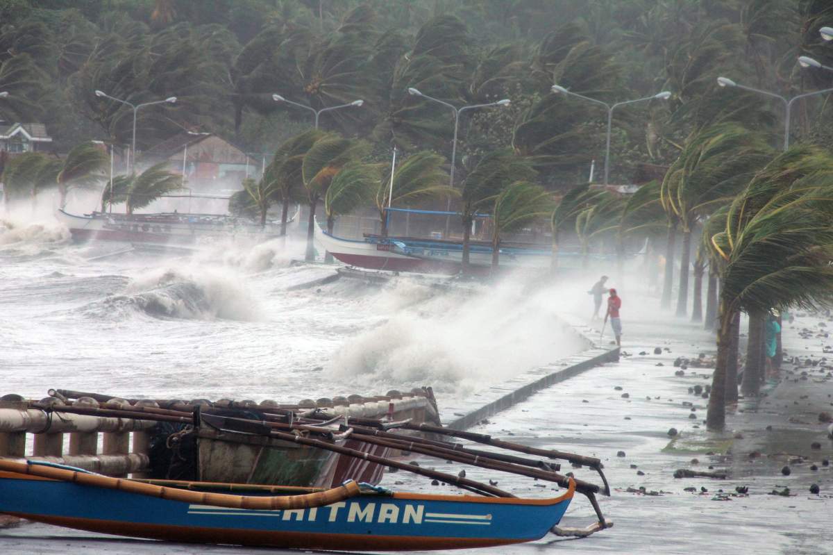
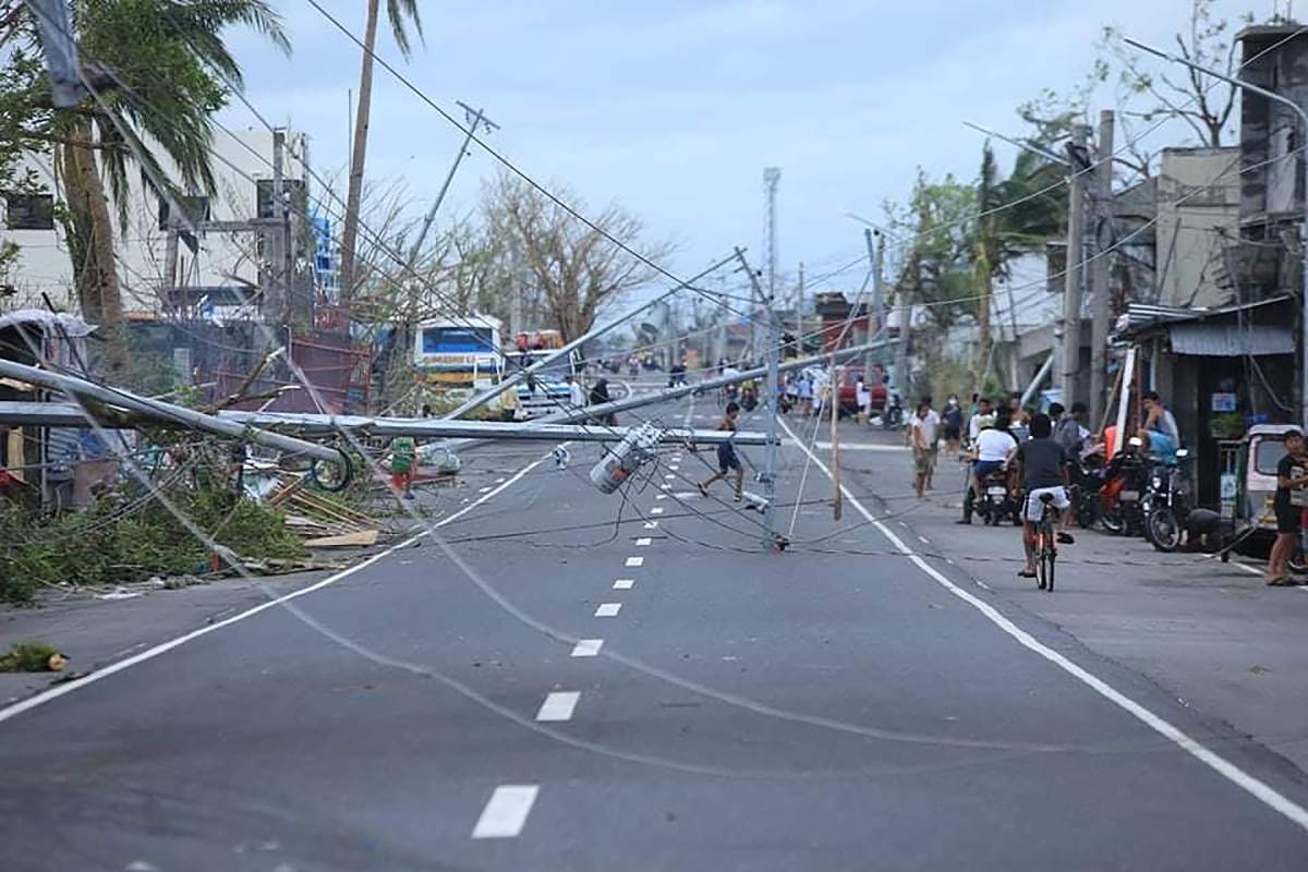
One such example is Typhoon Haiyan, which killed more than 6,300 people in the Philippines and reached wind speeds up to 315 km/h (195 mph).
Authors of a study published Monday in Proceedings of the National Academy of Sciences argue that storms like Haiyan should be in a class of their own, “to communicate that climate change has caused the winds of the most intense (hurricanes) to become significantly higher.”
They propose the creation of a Category 6 for hurricanes that exceed wind speeds of 309 km/h (192 mph).
Already, there have been five storms that would satisfy the criteria for a Category 6 hurricane since 2013: Typhoon Haiyan in 2013, Hurricane Patricia in 2015, Typhoon Meranti in 2016, Typhoon Goni in 2020 and Typhoon Surigae in 2021.
These storms are called hurricanes if they form east of the international dateline, and typhoons if they form to the west of the line. They’re known as cyclones in the Indian Ocean and Australia.
Researchers Michael Wehner and James Kossin, who authored the study, analyzed climate modelling data that indicates many more Category 6 storms are on the way as temperatures rise.
Category 6 hurricanes aside, the prevalence of Category 5 hurricanes also appears to be increasing in recent years, Global News meteorologist Ross Hull points out.
Monday’s paper looked at 197 Category 5 hurricanes between 1980 and 2021 and found that half of these storms occurred in the last 17 years of the period, between 2004 and 2021.

Get breaking National news
But why are storms intensifying? And how is climate change fuelling this process?
Hull explains that “hurricanes thrive on latent heat energy, they thrive on the warmth of the oceans.”
“So, the warmer the ocean is, the more powerful these storms can be.”
This doesn’t necessarily mean there will be more hurricanes, but the storms we do experience are likely to be more intense and destructive.
The National Oceanic and Atmospheric Administration (NOAA) explains how heat fuels the creation of hurricanes.
“Hurricanes start simply with the evaporation of warm seawater, which pumps water into the lower atmosphere. This humid air is then dragged aloft when converging winds collide and turn upwards. At higher altitudes, water vapor starts to condense into clouds and rain, releasing heat that warms the surrounding air, causing it to rise as well. As the air far above the sea rushes upward, even more warm moist air spirals in from along the surface to replace it,” the NOAA states.
This link between ocean surface temperatures and tropical storm intensity have been demonstrated in other recent studies, the NOAA notes.

As these more-intense hurricanes become more frequent, we need a better way to communicate the risk to the public, the paper by Wehner and Kossin argues.
The authors implore the international community to reconsider how the open-endedness of the Category 5 classification “can lead to an underestimation of risk, and, in particular, how this underestimation becomes increasingly problematic in a warming world.”
This is because there’s a huge difference between a storm with 250 km/h winds and 300 km/h winds. Monday’s study notes that the “destructive potential of the wind increases exponentially” as wind speeds rise.
In an interview with Global News, Wehner maintained that the researchers’ analysis of climate models shows that the “risk of Category 6 storms is increasing dramatically with warming.”
But the computational researcher also noted that creating a Category 6 won’t necessarily serve as a better warning system for the people who may be in the path of a destructive storm.
“Our work is solely intended to raise awareness about climate change,” he said. “To communicate the dangers of an impending storm to the public I think requires more than a single number.”
- Old Man Winter wallops B.C.’s Mainland/Southwest region, major highway closed
- Calgary hit by unexpected blast of spring snow, causing dozens of crashes
- False spring strikes again: Saskatchewan prepares for incoming winter weather
- Albertans’ interest in alternative forms of travel growing as fuel prices spike
“I criticize the whole idea of having a single number tell you what the danger is, because the dangers and risks are much more nuanced,” Wehner said. “The adding of a sixth category is useful for communicating the increased danger from climate change, but that’s the long-term, slow kind of danger. Whereas if you’re in the path of the storm, you need to know what to do now.”

The Saffir-Simpson scale only takes into account wind speeds when categorizing hurricanes, but it’s not just wind speeds that make a hurricane destructive. The storm surge that results from sea levels rising during hurricanes can cause devastating flooding, as can flooding from rainfall. Neither of these hazards factor into a hurricane’s category.
Wehner notes that recent research has found a link between climate change and increased storm surges and rainfall in hurricanes.
All of this goes to show that “dangerous climate change is here now,” Wehner said. “And it’s only going to get worse.”
National Hurricane Center director Michael Brennan agrees that the Saffir-Simpson scale is limited, but pushed back on the need for a new category.
“At NHC, we’ve tried to steer the focus toward the individual hazards, which include storm surge, wind, rainfall, tornadoes and rip currents, instead of the particular category of the storm, which only provides information about the hazard from wind,” Brennan wrote in a statement to Global News.
“Category 5 on the Saffir-Simpson scale already captures ‘Catastrophic Damage’ from wind, so it’s not clear that there would be a need for another category even if storms were to get stronger. In addition, most deaths in tropical cyclones occur not from the wind but from water — storm surge, rainfall/inland flooding, and hazardous surf — causing about 90 percent of tropical cyclone deaths in the United States. So, we don’t want to over-emphasize the wind hazard by placing too much emphasis on the category.”
As for Hull, he believes that it’s time to update how we categorize hurricanes but agrees that there is an over-emphasis on wind speeds.
“The Saffir-Simpson scale was developed in the 1970s. Our climate has changed since then, our observation skills and understandings of these storms have changed. So I think it only makes sense that we do update how we categorize them as well.”
“There’s obviously a focus on the winds, but there’s so many other parts of these storms that play such a big role in terms of the destruction that they deliver,” he adds, noting that some Category 3 hurricanes that spin in one spot for days can deliver destructive storm surges while some Category 5 storms that fail to make landfall can result in relatively little impact.
As our understanding of hurricanes improves, Hull reports that meteorologists are looking to refine their messaging around these storms in order to best warn the public of risks.
“We need to change just as these storms are changing.”


Comments
Want to discuss? Please read our Commenting Policy first.