
TORONTO – Google has invaded the Fortress of Louisbourg.

The national historic site, located in Louisbourg Nova Scotia, played host to a crew from Google Canada Monday, as it began to map the site as part of a deal between Parks Canada and the global Internet giant.
The deal will see national parks and historic wonders – from L’Anse aux Meadows in Newfoundland to British Columbia’s Pacific Rim National Park – turned into panoramic digital maps on Google Street View.
Read More: Google to map national parks, historic sites
Fortress of Louisbourg is the first stop on the whirlwind tour of Canada for the Google crew, who hope to have the project completed by the end of 2014.
The original settlement was founded in 1713 by the French and later fortified against the threat of British invasion.
Destroyed in the 1760s, the site of the laid untouched until modern times when archeologists began to reconstruct the settlement.
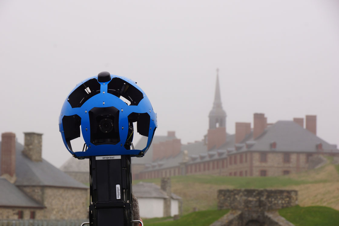
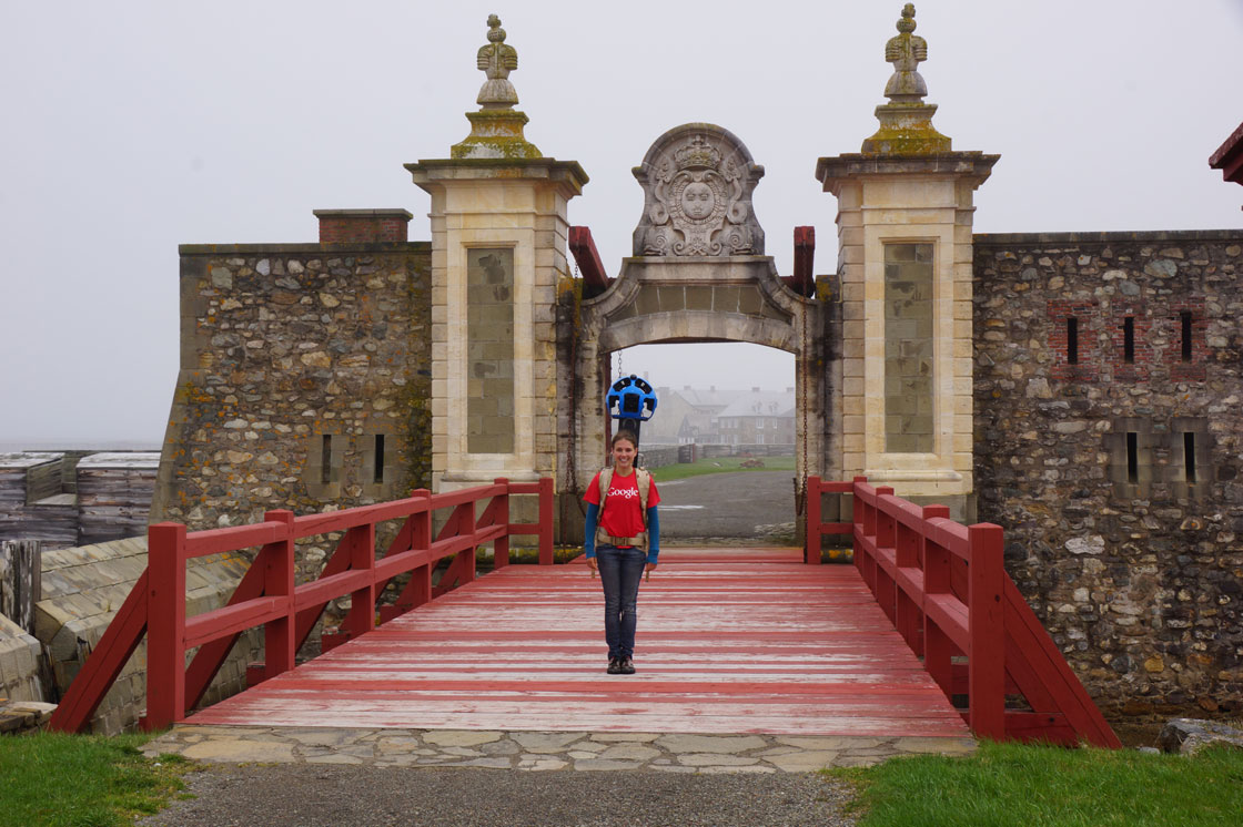
Google Canada’s team will map the grounds of the fortress, including the Dauphin Gate (pictured below) which once served as the main land entrance to the grounds.
The team will use the “Trekker” – a backpack-mounted camera that captures the 360 degree imagery.
The deal between Google and Parks Canada, announced in April, will see over 120 historic and national sites mapped in Canada.
“It’s a way that we see we can step into the psyche of a lot of Canadians and really be able to show these great, iconic places that belong to all of us in a new way,” said Andrew Campbell, vice-president of visitor experience for Parks Canada.
“If people are dreaming about going there, this gives them a way to explore before they go.”

Read More: Google maps Iqaluit with help from local residents
Some of the next places to be mapped will include Gros Morne in Newfoundland, Grasslands in Saskatchewan, Banff and Jasper in Alberta and the historic walls and citadel of Quebec City. Filming is to begin next month at Cape Breton Island’s Fortress of Louisbourg, which celebrates its 300th birthday this summer.


– With files from the Canadian Press
Comments