

Weather Advisory for Funnel Clouds Ended

Environment Canada has ended a weather advisory that was issued earlier in the day on Thursday for the Saskatoon, Regina, Prince Albert, Nipawin, Outlook, Moose Jaw, Yorkton, Wynyard and Canora areas for possible funnel clouds during the afternoon.
This weak rotation is normally not a danger near the ground, however, there was a chance this rotation could have intensified and become a weak landspout tornado.
READ MORE: Weather advisory for funnel clouds in Saskatoon, Regina, central Sask.
For weather on the go download the Global News Skytracker weather app for iPhone, iPad or Android.
Thursday Storm Recap
After slamming Saskatoon with a 106 km/h wind gust on Wednesday, dropping a funnel cloud three-quarters of the way towards the ground near Lloydminster and dumping heavy rain in thunderstorms in parts of the province, the low pressure system responsible for the wild weather continues its trek through Saskatchewan.
It is weakening as it slides through, but still poses a risk for rain, thunderstorms and even the potential for funnel clouds and weak landspout tornadoes.
READ MORE: 106 km/h wind gusts slams Saskatoon
Saskatoon Forecast
Today
Saskatoon started off the day with temperatures a few degrees into single digits under mostly cloudy skies with some rain early in the morning.
That low pressure system responsible for the stormy weather continues to bring in unsettled conditions with thunderstorms moving through by noon as we warmed into the low teens.
The risk for thunderstorms, showers and funnel clouds continues this afternoon as the mercury continues to climb up into the mid-teens for an afternoon high.
Tonight
Some showers are expected to stick around tonight as we cool back a few degrees into single digits once again.
Friday
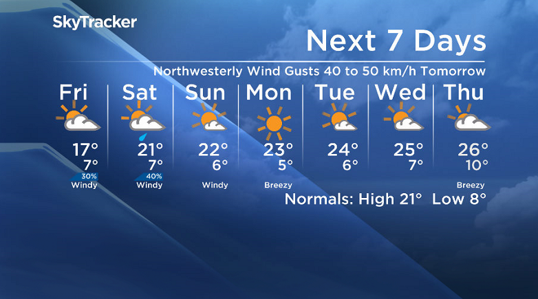
Behind this low pressure system, a cool northwesterly wind will kick in with gusts upwards of 40 km/h on Friday as clouds and showers clear out of the area during the day.
As a result of the cooler air sliding in, we’ll struggle to get up to a daytime high around 17 degrees in the afternoon.

Weekend
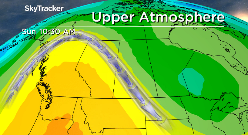
After a chance of morning showers on Saturday, clouds should clear out and give us some sunny breaks before an upper ridge starts to move in on Sunday and bring us back into even more sunshine!


Daytime highs will return to the 20s this weekend with northwesterly winds continuing as well with gusts at times up to 40 km/h.
Work Week Outlook
That upper ridge will continue to funnel in the heat and sunshine for the work week with daytime highs pushing up into the mid 20s by mid-week.
Breyanne Parkinson took this Your Saskatchewan photo in Cando:

Saskatoon weather outlook is your source for Saskatoon’s most accurate forecast and is your one stop shop for all things weather for central and northern Saskatchewan with comprehensive, in depth analysis that you can only find here.
- Canadian man dies during Texas Ironman event. His widow wants answers as to why
- On the ‘frontline’: Toronto-area residents hiring security firms to fight auto theft
- Honda’s $15B Ontario EV plant marks ‘historic day,’ Trudeau says
- Canadians more likely to eat food past best-before date. What are the risks?
Comments