Warning: This story deals with disturbing subject matter that may upset and trigger some readers. Discretion is advised.

Ground-penetrating radar began making headlines after Tk’emlúps te Secwépemc announced the discovery of 215 potential unmarked graves at the site of a former Kamloops Indian Residential School.
Since then, countless First Nations communities have employed the technology to conduct similar searches. But what is ground-penetrating radar and how does it work?
Kisha Supernant, director of the Institute of Prairie and Indigenous Archaeology and a professor at the University of Alberta, has been doing ground-penetrating radar work since 2018; she has so far helped 12 communities with residential school searches and has consulted with over 50.
Supernant spoke with Global News about ground-penetrating radar, the searches being conducted at former Indian residential schools, and how long they might take.
Note: The following interview has been edited for length and clarity.
Q. What is ground-penetrating radar?
Kisha Supernant: Ground-penetrating radar is a method that takes a radar signal and puts it into the ground in order to try and look at what’s happening below the surface.
In its very basic form, it takes an antenna, it sends a little wave down into the ground, that wave travels and bounces back to the antenna, and that’s the basic principle of how ground-penetrating radar works.
A series of waves go into the ground and you’re looking for change in what’s happening beneath the surface.
Q. What's the correct terminology? Unmarked graves? Anomalies? Reflections?
KS: We have heard a number of different terms used — anomaly, reflection, potential — but the main thing to understand with ground-penetrating radar is that we’re reading reflections of a wave going into the ground and we’re looking for change.
So the idea of reflection is accurate: you’re looking for a kind of reflection. “Anomaly” is often used because the areas of interest identified by ground-penetrating radar are ones that look different from the surrounding soil — they are anomalous.
We’ve had feedback from Indigenous communities, however, that the term anomaly is not what they’d like to use because of its other connotations. So my team has taken to using “reflections.”

Get breaking National news
One of the early misconceptions was that ground-penetrating radar was like an X-ray, but it doesn’t actually see bones or bodies; it looks for grave shafts — pits that are grave-shaped, about the right depth and the right orientation.
Q. What might a search look like for your team?
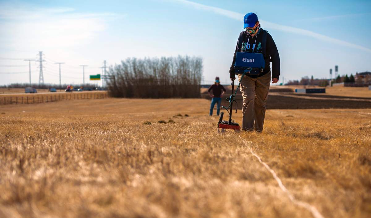
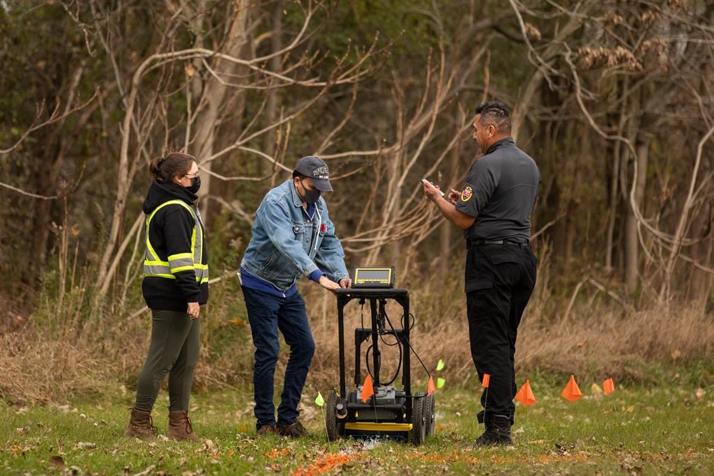
KS: Before we begin a survey, we always visit with the community and figure out what they want. Once that’s been determined we’ll walk around the site and decide where we want to lay out a grid.
Ground-penetrating radar surveys are done in rectangles or squares that can range in size but usually no more than about 30 metres by 30 metres. Then we set up the machine and it’s usually pushed on some sort of cart that’s attached to a wheel that measures how far you’re going.
Then we start capturing lines of data and we take a slice every 25 centimetres along the entire grid in order to make sure we’re capturing every centimetre underneath the ground.
This is with a single-channel ground-based antenna system. There are others that are being used but this is the most typical.
My team pushes in one direction and this helps minimize error and then we take each of those lines and make sure we’ve mapped the entire space.
Q. How far down can it penetrate?
KS: Ground-penetrating radar can penetrate a whole variety of depths. It really depends on the actual antenna you use. There are antennas at different megahertz and different wavelengths — the lower the number, the deeper it goes.
When it gets low, for example, a 100 or 200 megahertz antenna can go 10, 15, 20, 30 metres into the ground. If the wave is bigger, you lose a lot of that detail.
Most of the work happening for unmarked graves is using between a 250 and a 500 megahertz ground-penetrating radar, and that averages between two and three metres below ground-level in good condition. So you can go down far enough, but you’re not going down too far and losing detail.
Q. How long until this work is done?
KS: This is a long-term process and every school has a lot of land that was associated with it.
One of the things I try to work on with communities is that not every area needs to be searched with ground-penetrating radar. Some aren’t suitable for it or if they’re concerned about other ways in which children may have died or been disposed of, ground-penetrating radar isn’t going to show it.
It’s really important for communities to work with elders, survivors, land history, to say, “Here are the areas we want to search because we’re concerned specifically about children’s burials.”
If they’re looking for a single burial being somewhere out on the land there, something like historic human remains detection dogs (which can cover a much larger area) may be a more effective tool than spending weeks and weeks doing ground-penetrating radar and getting no results.

My team on average covers about an acre in a five-day period. So it’s a slow process and that’s in good, open, flat conditions. Then it takes potentially five times as long to get the results into a state where we can actually make sense of them.
People often question, “How do you know it’s not something else?” Well, there are a lot of things that we know how to identify: we know what a rock looks like, we know what a metal pipe looks like; we know what tree roots look like; we know what rodent burrows look like.
When we find a reflection, we try to assign a sense of confidence. How much does it look like graves look like in the scientific literature? We go through each one and we say, “How many of these traits does this have?” “Do two people independently see the same thing?” “Is it the right depth?” “Is it the right shape?” Et cetera. And then we assign confidence labels; my team uses possible and probable.
This is a process that is likely to take easily a decade from when you start to when you’re getting the answers you need. And where that endpoint is will depend on the community, what their needs are, and what kind of answers they’re seeking.

Q. Is ground-penetrating radar essential to this work?
KS: Technology can be a very helpful tool for communities, but we don’t need ground-penetrating radar. We don’t need technology to know children went missing.
We have extensive archival, historical records and community knowledge of this.
What technology can do is sometimes provide specific locations, and it helps communities protect and commemorate and do those other kinds of things. But we’re not out to prove this. There’s already plenty of proof.
I think that’s a really important message because there’s been this pushback of like, “Well, no bodies.” We don’t need bodies.
We have thousands upon thousands of pages of records on children who died. Technology is useful, but it is not the only way to find answers.
The Indian Residential Schools Crisis Line (1-800-721-0066) is available 24 hours a day for anyone experiencing pain or distress as a result of their residential school experience.
- Comox Valley issues State of Local Emergency due to flooding, 1 person may be missing
- B.C. government launches selection process for AI, data centre projects to compete for power
- Board of Metro Vancouver meets to address affordability, spending
- Virginia warehouse sale to ICE won’t proceed, B.C.-based Jim Pattison group says


Comments