
After a sunny start, Thursday’s forecast will see temperatures climb into the high 20s, with a few clouds expected to bubble up in the evening, along with a slight chance of thundershowers.

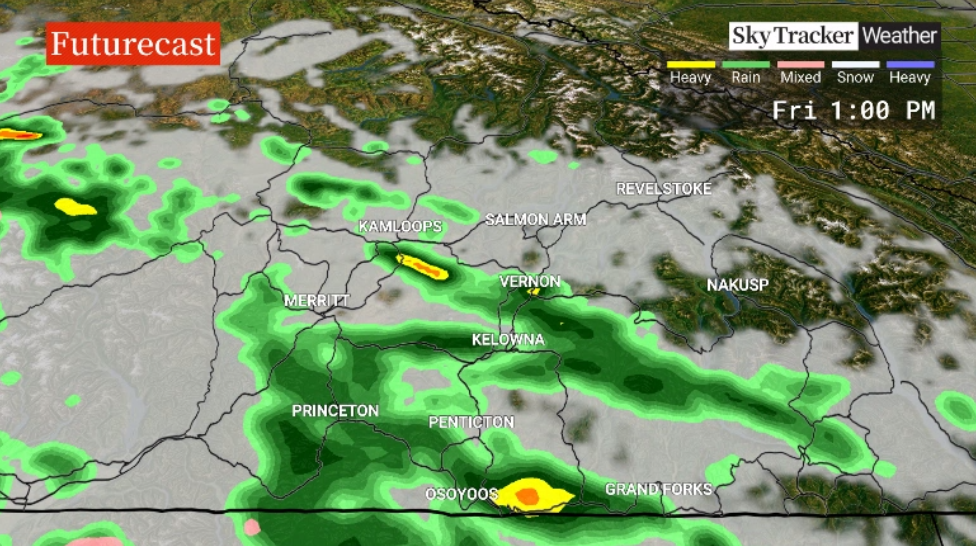
The first week of May will end with possible pockets of rain during the day with a risk of embedded thunderstorms.

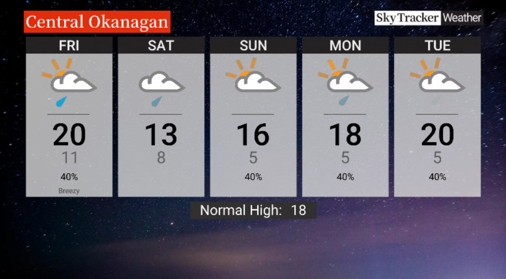
Friday’s high will barely reach the low 20s before getting dunked into the low teens on Saturday, along with lingering rain during the day, further enhancing the region’s flood risk.
The weekend, though, is likely to end on a slightly drier note, with Sunday seeing a chance of showers but afternoon highs recovering into the mid-teens.
- Parts of New Brunswick’s Saint John River at or near flood level
- River Watch: Flooding expected in some N.B. communities, residents warned to be prepared
- Gatineau homes at risk from rising waters as Ontario, Quebec face flooding concerns
- State of emergency declared in Peguis, Fisher River ahead of potential flooding


Get breaking National news
A risk of sprinkles will linger into the work week ahead as daytime highs eventually recover from the upper teens back into the 20s.
For weather on the go download the Global News SkyTracker Weather App for iPhone, iPad or Android.
Comments
Want to discuss? Please read our Commenting Policy first.