


A winter weather travel advisory has been issued by Environment Canada for London and Middlesex County ahead of Friday’s forecasted snow.

The advisory, which is also in place in Elgin, Lambton, Norfolk, Oxford, and Perth counties, replaces a special weather statement that had been in effect for London and Middlesex since Wednesday.
Forecasters with the national weather agency say widespread snow will push across southwestern Ontario and the Golden Horseshoe on Friday, impacting morning and evening commutes.
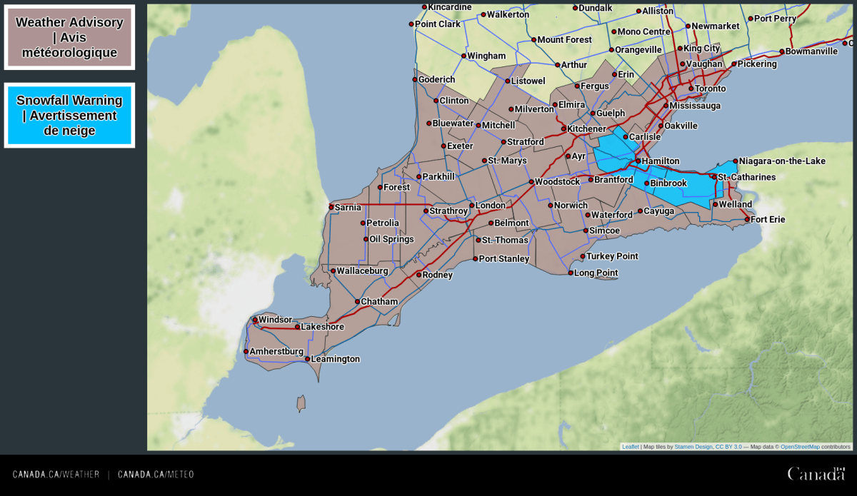
The snow will begin early Friday morning and taper off in the evening, according to the winter weather travel advisory, which notes the London region could see upwards of between 10 and 15 cm of accumulation.
In the Golden Horseshoe, snowfall warnings have been issued for Hamilton and northern Niagara, according to Environment Canada.
“Some uncertainty remains in total snowfall amounts. Upgrades to snowfall warnings may be required in some areas,” the advisory reads.
“Motorists should expect hazardous winter driving conditions and adjust travel plans accordingly. Be prepared to adjust your driving with changing road conditions.”
- Life in the forest: How Stanley Park’s longest resident survived a changing landscape
- ‘Love at first sight’: Snow leopard at Toronto Zoo pregnant for 1st time
- Carbon rebate labelling in bank deposits fuelling confusion, minister says
- Buzz kill? Gen Z less interested in coffee than older Canadians, survey shows
Friday’s snow will come a week after a winter storm rolled across southern Ontario with heavy snow, strong winds and thunder and lightning.


The short-term forecast for London and Middlesex calls for cloudy skies on Friday with snow and local blowing snow starting in the morning with a high of -1 C, feeling near -9 C with gusts up to 50 km/h.
Overnight into Saturday will see periods of light snow ending after midnight followed by cloudy skies with a low of -8 C, feeling like -12 C.
A mix of sun and cloud and a high of zero is expected on Saturday, and cloudy skies with a 40 per cent chance of flurries and a high of 1 C on Sunday.
Starting the workweek, Monday’s preliminary forecast calls for cloudy skies, a 60 per cent chance of flurries, and a high of -1 C.
The average high for this time of year is 2.6 C.
Comments