
Balmy and warm one day to sub-zero temperatures and snow the next — it’s been a wild week, weather-wise, in the Okanagan, with record-breaking temperatures set across the valley on Wednesday, including 22.5 C in Penticton.

However, cold air has been filtering into the region since Thursday, and Friday’s high will reach just 4 or 5 C, with the overnight low dropping to -3 C, along with projected snow.
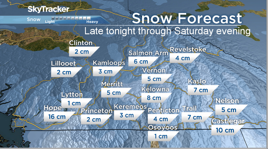
Global News meteorologist Peter Quinlan is projecting four to seven centimetres of overnight snow in the Okanagan, with snow starting in the early hours and falling steadily through Saturday morning.
The snow is projected to ease in the afternoon before tapering off Saturday night.
The plume of moisture is coming with an area of low pressure that’s moving inland from the coast of Washington state.

Get breaking National news
Friday will also see winds of up to 15 kilometres per hour, and a wind chill near -5.

For Saturday, the high will be 0 C, with the mercury falling to -7 C overnight under cloudy skies, along with winds of 20 kilometres per hour.
- Old Man Winter wallops B.C.’s Mainland/Southwest region, major highway closed
- Calgary hit by unexpected blast of spring snow, causing dozens of crashes
- False spring strikes again: Saskatchewan prepares for incoming winter weather
- Albertans’ interest in alternative forms of travel growing as fuel prices spike


Sunday’s forecast will be a mix of sun and cloud, a high of 0 C and a low of -6 C, with a 60 per cent chance of flurries.
Monday will be cloudy, with a high of -1 C and a low of -7 C.

Comments
Want to discuss? Please read our Commenting Policy first.