
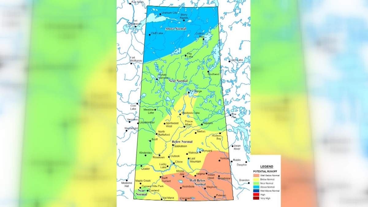
Most of southern Saskatchewan has the potential for a below to well below normal spring runoff, according to preliminary data released Friday by the Water Security Agency.

The north, however, could experience a normal to above normal runoff.
The WSA said it bases its estimates on a number of factors, including conditions at freeze-up and the snowpack.
Most of the southern regions experienced very dry conditions last summer and into the fall, and the snowpack is near normal to below normal.
The WSA says this projects to a below normal runoff for an area covering Prince Albert, Saskatoon and Melfort, dipping as far south as Maple Creek and Val Marie.
A well below normal runoff is currently forecast for the Moose Jaw, Regina, Weyburn and Estevan regions.

Get daily National news
It is the reverse in the far north, where an above-normal runoff is estimated by the WSA.
Extreme wet conditions were reported in the Uranium City, Stony Rapids and Cluff Lake regions before freeze-up, an area that also experienced historically high lake and river levels last summer.
Other regions of the province are forecast to have a near normal runoff.
Read more: Conservation group calls for environmental assessment on $4B Lake Diefenbaker irrigation project
- Advocate concerned about loss of family services after Prairie Harm Reduction closure
- Parents who don’t allow kids to have smartphones say social media ban would ease their minds
- Calgary’s mayor looks to reopen a downtown police station
- Major League Soccer evaluating all options for Vancouver Whitecaps: spokesman


While fall conditions were slightly drier than normal, the WSA said this has been made up by a near to above near snowfall season to date.
The WSA cautioned, however, that its runoff outlook could change with potentially eight to 10 weeks of winter remaining.
The agency said its first spring runoff forecast will be released in early March.

Comments
Want to discuss? Please read our Commenting Policy first.