

In behind all the snow that fell Friday and Saturday, temperatures fell too, but they will warm up again very soon.

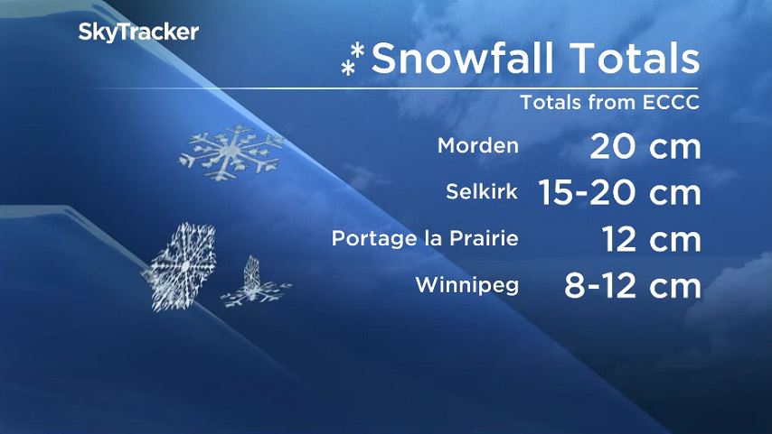
Here’s a quick look at some snowfall totals from Environment and Climate Change Canada from what fell Friday and Saturday.
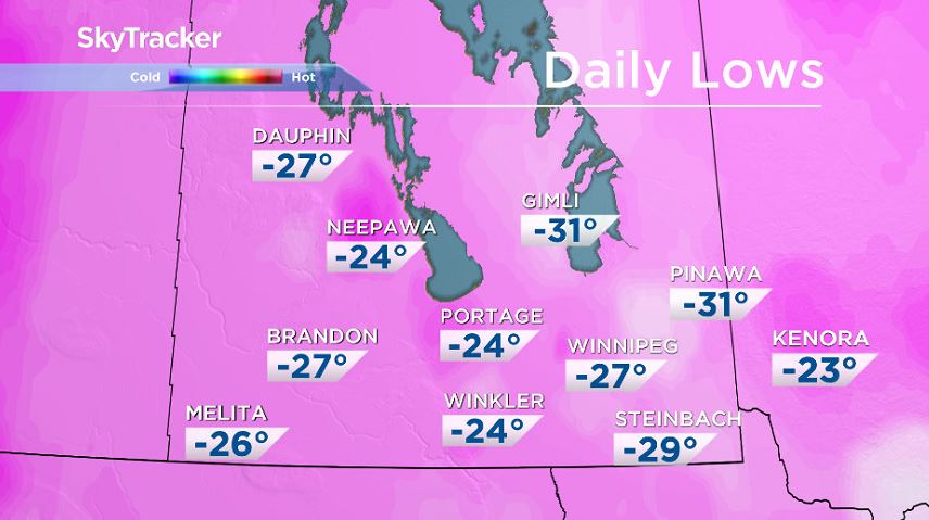
Temperatures during the snow storm were quite mild with a bit of a cool down afterwards.
Monday morning, temperatures were down near -30 C and windchill values were around -40.
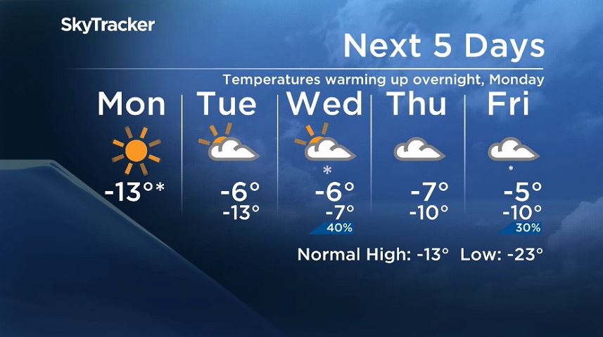
Temperatures will be on the rise quickly this week thanks to high pressure moving away and low pressure to the north. Southerly winds Monday night and into Tuesday will allow temperatures to climb to near -9 on Tuesday morning.


Coming in with milder weather will be some added cloud cover. Tuesday and Wednesday will be overcast and it’s likely the rest of the week will be very similar.
There’s the chance we’ll see a few flurries on Wednesday and around the end of the week as well, with a low pressure system moving into southern Manitoba. However, it doesn’t look like it will leave any substantial snowfall totals.

Get breaking National news
All week long, temperatures look like they’ll be above seasonal, just not terribly sunny past Monday.
Comments
Want to discuss? Please read our Commenting Policy first.