

It’s taken nearly two days, but Hurricane Dorian is gradually releasing the Caribbean from its grasp.

The deadly Category 5 storm, which has since been downgraded to a Category 3, first struck the Bahamas on Sunday, reaching near-record-breaking wind speeds upon landfall.
The storm pounded the islands of Grand Bahama and Abaco, causing widespread devastation in its wake. The Red Cross reported Tuesday that more than 13,000 homes have been badly damaged or destroyed — about 45 per cent of all homes on those islands. At least five people have died.
The eye of the storm was unrelenting and lingered on the islands for more than 30 hours.
The National Hurricane Center (NHC) described the storm as “stationary,” noting it was moving at a mere 1 mph.
It’s hard to say definitively if Dorian’s movement — or lack thereof — is unique, said Joel Cline, a tropical program coordinator at the NHC.
Cline pointed to Hurricane Harvey in Houston and Hurricane Florence, offshore in the Carolinas, as examples of storms that stalled to some degree over the past few years.
However, neither Harvey and Florence were as powerful as Dorian.
“Is it rare? It is not normal, but it does happen,” he told Global News.
WATCH: Dorian leaves 5 dead, 21 injured in the Bahamas

“For 36 hours over a tiny spot like the Grand Bahama Island area — seeing as it’s a single island instead of a single spot on a larger mainland — it might highlight the impact a bit more.”
In other words — the tiny islands weren’t physically enough to quell the storm.

Get breaking National news
“What made this situation unique is that Abaco and Grand Bahama Islands are very flat and small, so the land wasn’t enough to weaken the hurricane quickly like you’d see if this storm was closer to the mainland,” said Global News Meteorologist Anthony Farnell.
“It’s very unusual, yes, but not unheard of.”
What’s happening?
Meteorologists believe the storm got stuck over the Bahamas when it became caught between pressure systems, creating a push and pull effect.
Dorian was travelling west until Sunday when a high pressure system from Bermuda got in its way, according to Farnell.
“That ridge has been weakening as a trough developed to the north,” he said. “What that did was completely collapse the steering currents over the storm.”
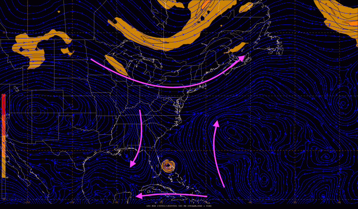
The map above depicts a “COL point” where a trough and a ridge in a pressure pattern intersect.
In meteorology, it is “the point of relatively lowest pressure between two highs and the point of relatively highest pressure between two lows.”
Cline said the combination didn’t provide a “mechanism to steer Dorian,” therefore keeping the storm in place.
“The arrows are not ‘pushing’ or over the hurricane region,” he said. “It stops moving.”


As of early Tuesday, Dorian’s strength had dipped to a Category 3 hurricane, but part of its eyewall remained draped over Grand Bahama Island by midday.
Dorian “mixed up cool water from the depths of the ocean,” Farnell said, helping weaken its wrath.
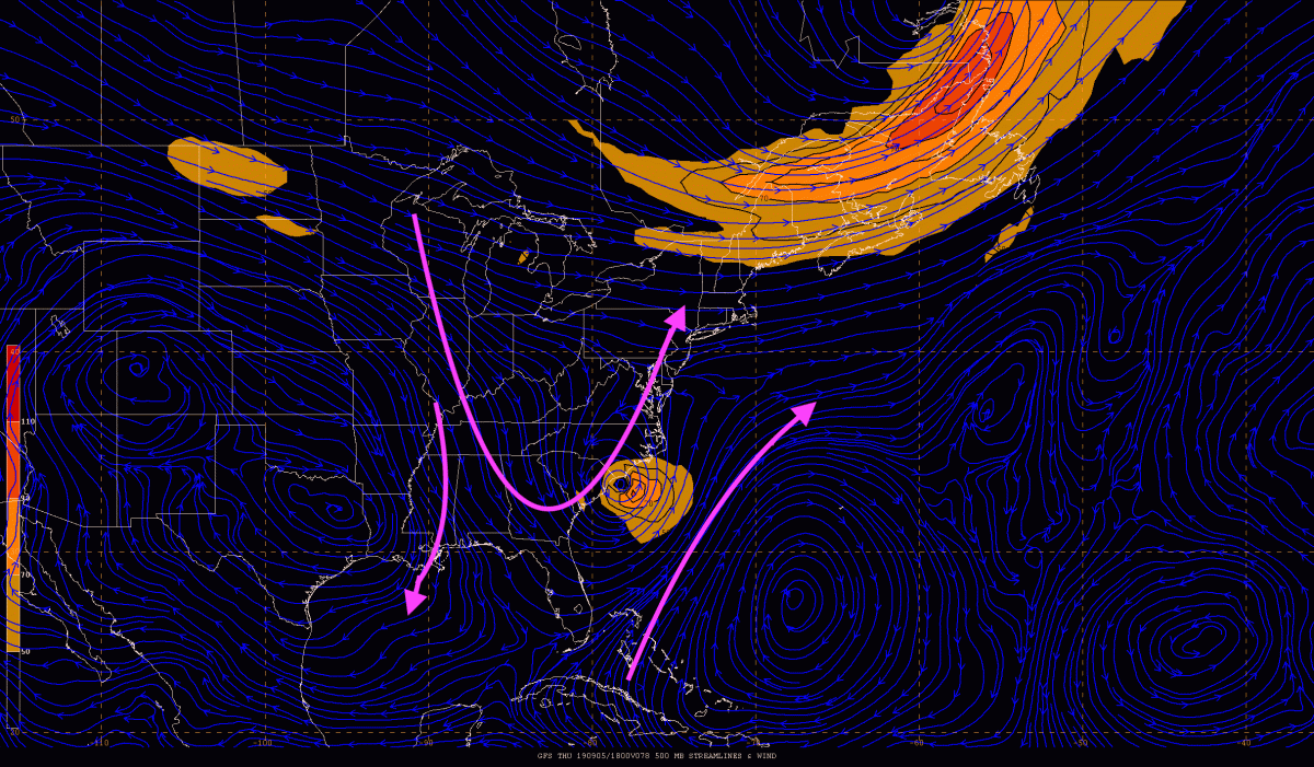
A trough of low pressure is what will slowly force Dorian out of the Bahamas. The anticipated direction is depicted in the graph above.
“It shows the trough is close enough to Dorian and will help as the major mechanism to move the hurricane off to the northeast,” according to Cline, who provided the graphs.
WATCH: Savannah residents forced to evacuate as Hurricane Dorian approaches

The storm was expected to creep into the Florida coast later Tuesday, but the overall threat to the southern state had significantly decreased since concerns were first raised last week.
In Florida, Georgia, both South and North Carolina, the threat of heavy winds, severe flooding, a storm surge and beach erosion remains. Hundreds of thousands of residents in these states have evacuated their homes.
The NCH reported Tuesday morning that Dorian’s pace is expected to pick up throughout the day. However, forecasters have been clear that Dorian’s track is far from certain.
“Now that the storm is starting to move again, there is fresh, warm water and the Gulf Stream for it to pass over, so the weakening trend should stop at least until it moves closer to South and North Carolina later this week,” Farnell said.
Despite the unpredictability, Dorian could touch a bit of Canada, too.
— With files from the Associated Press
Comments
Want to discuss? Please read our Commenting Policy first.