
WINNIPEG – It’s a long-standing speculation that the weather on the May long weekend will be soggy.

This year is no exception.
Several batches of showers, heavy rain and potential thunderstorms are shifting north across the Dakotas into southern Manitoba.
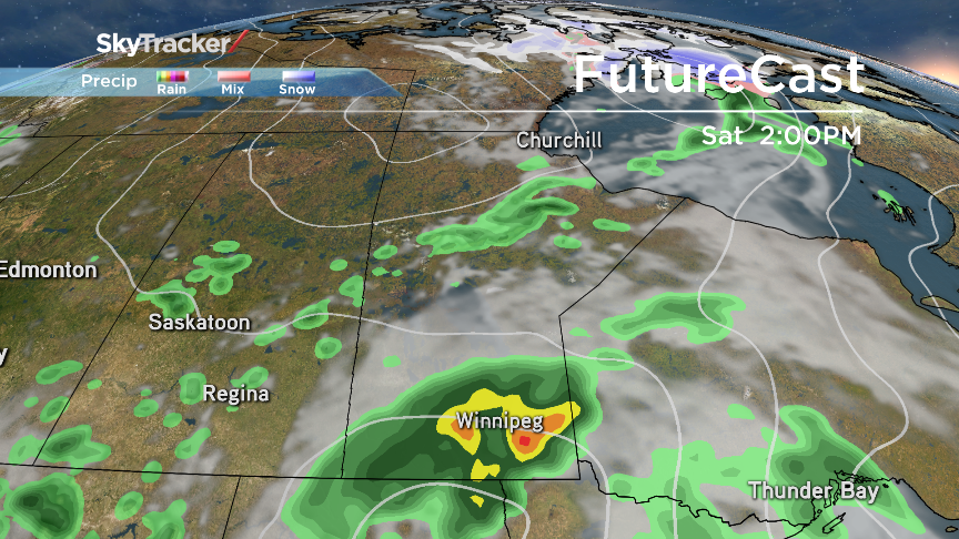
North of a warm front situated west to east across South Dakota, the first impulse of precipitation is spreading across the Red River Valley and surrounding areas. Light showers can be expected on and off throughout Friday evening with a risk of isolated thunderstorms. Saturday looks to be the wettest day of the weekend with the heaviest bands of rain moving right across southern Manitoba and edging into the Interlake in the morning. There’s also a strong likelihood of thunderstorm activity through the afternoon. Models are predicting 20 to 30 millimetres of rain Saturday.

Get daily National news
However, those models are not agreeing on how Sunday and Monday will play out. One scenario will see the low pressure system remain to the south, in which case, south-western Manitoba and the Red River Valley will see a dry second half to the weekend with showers tapering off across the south-east. The second scenario has the low moving further north into the Red River Valley. If this happens, scattered showers can be expected on Sunday and Monday.


A stable weather pattern looks to be moving in by Wednesday next week when we can look forward to sunshine and seasonal temperatures.
Comments
Want to discuss? Please read our Commenting Policy first.