

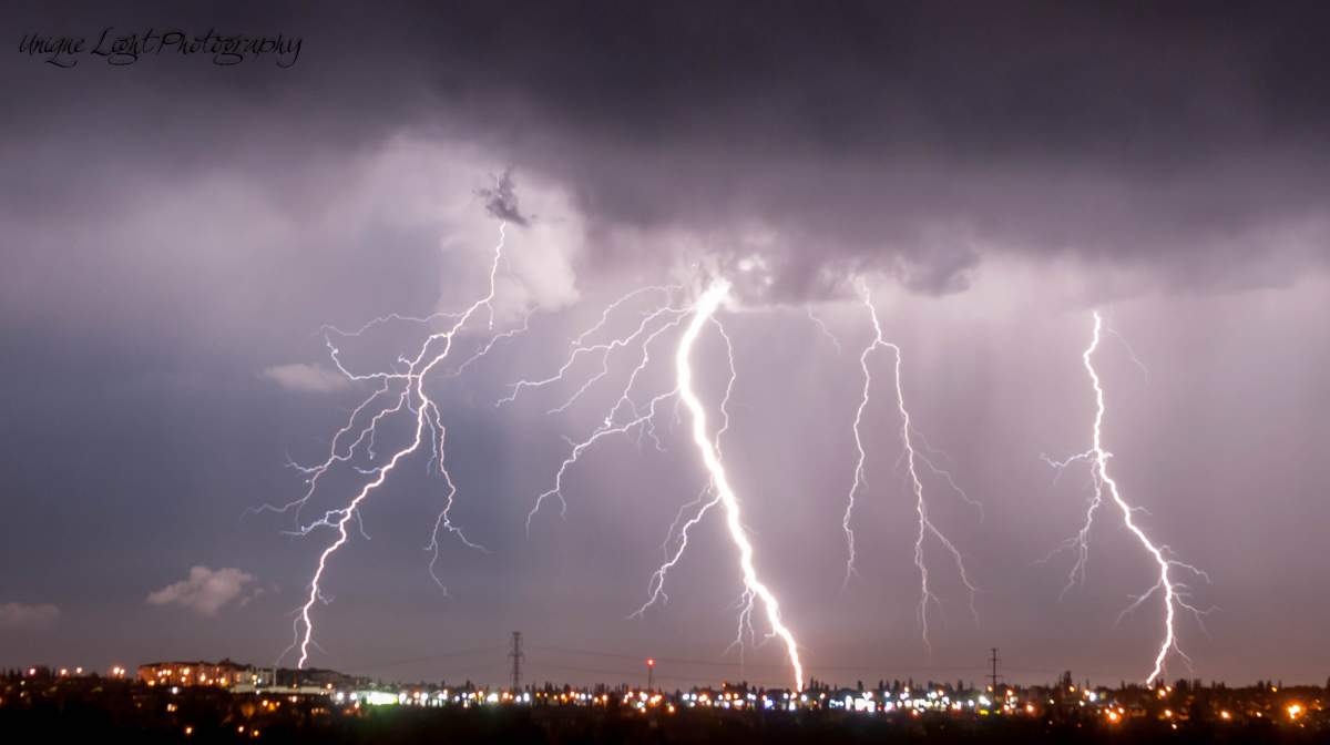
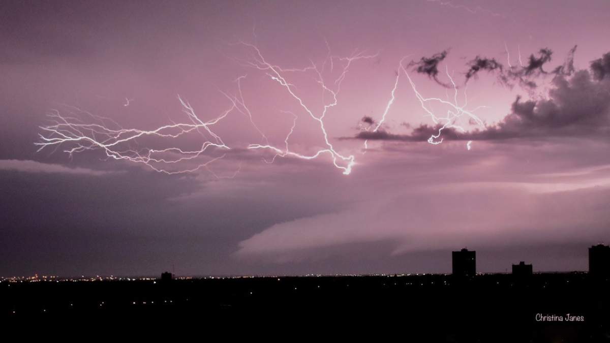
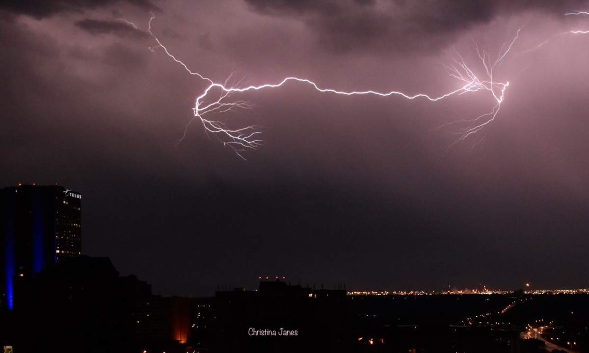
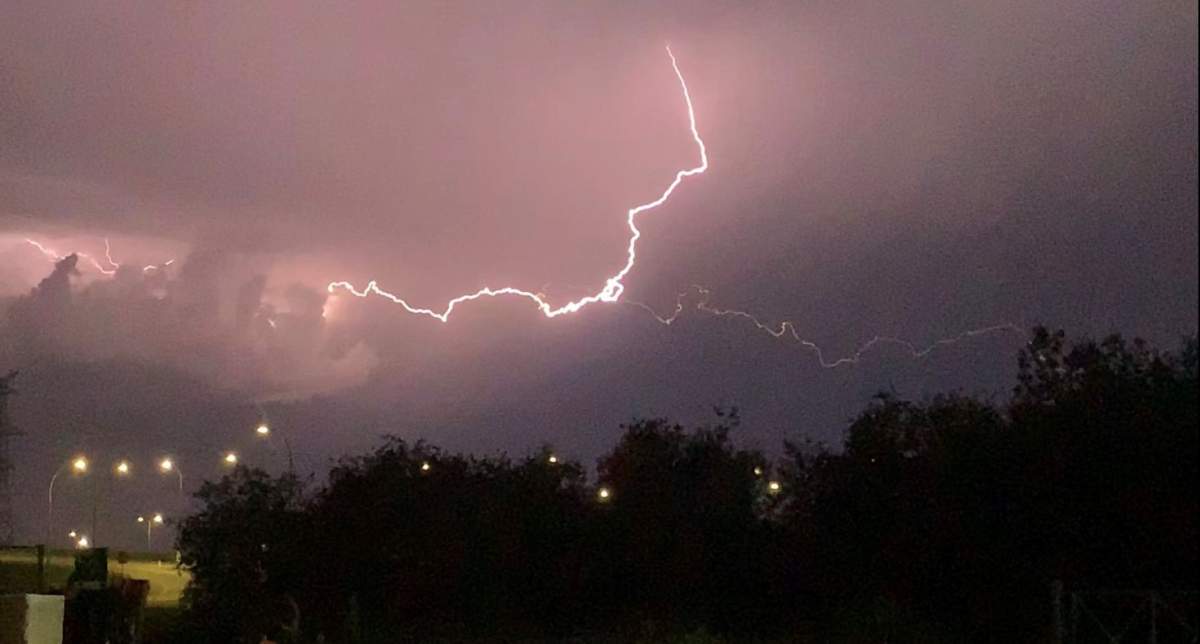
Thunderbolt and lightning, very very frightening! It was a sleepless night for many people as storms rolled across central Alberta overnight and into Wednesday morning.

Severe thunderstorm watches and warnings were in effect on and off for several regions surrounding Edmonton, including the city itself, as storms formed off the foothills and moved northeast across the prairies.
READ MORE: Severe thunderstorm warnings issued in central, southern Alberta
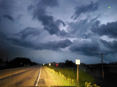
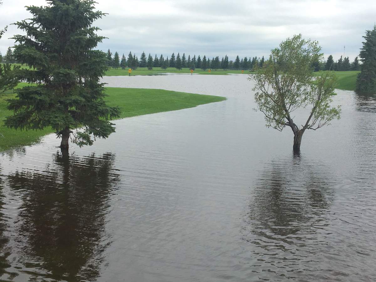
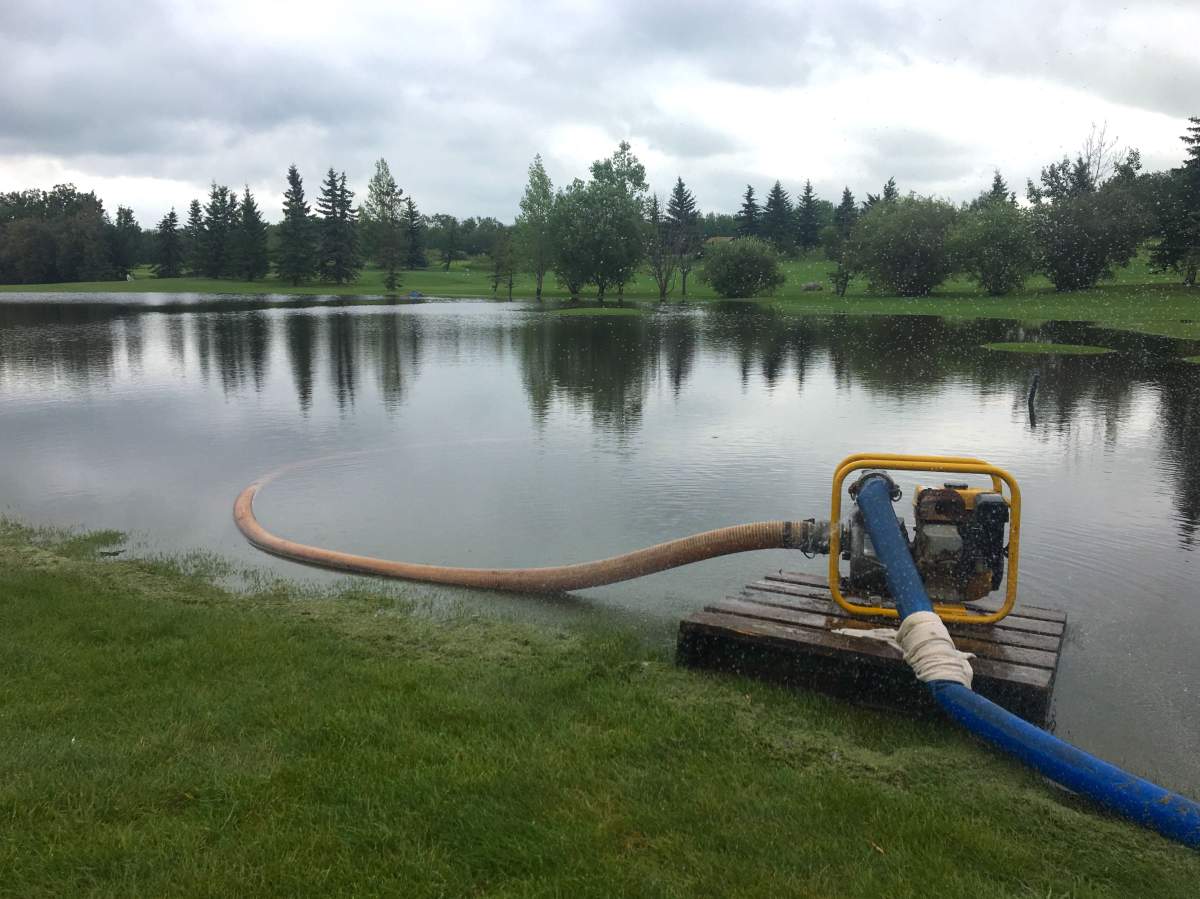
Booming thunder and bright, rapid-fire lightning filled the sky all night, keeping some people awake – that is, people who weren’t already awake due to the sweltering heat and unusual humidity that had been in place for the past two days. (Scroll down to see more videos and images)
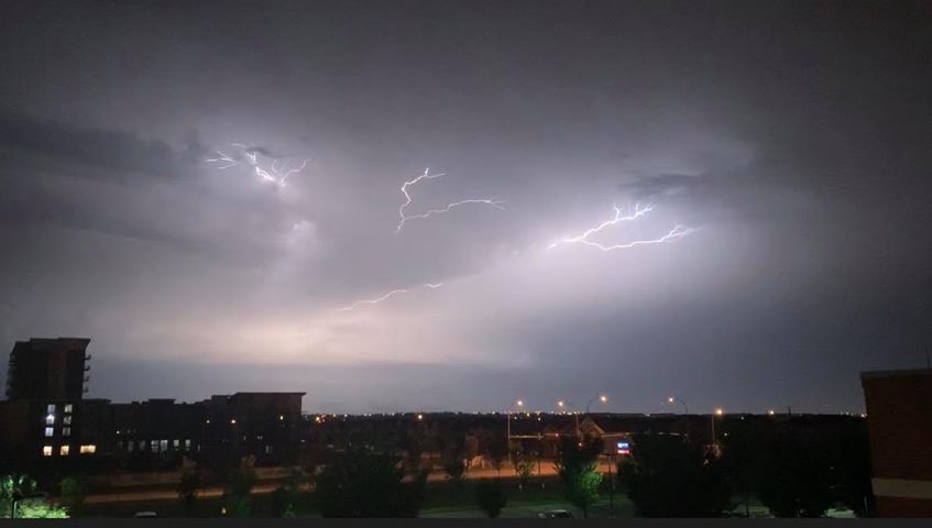
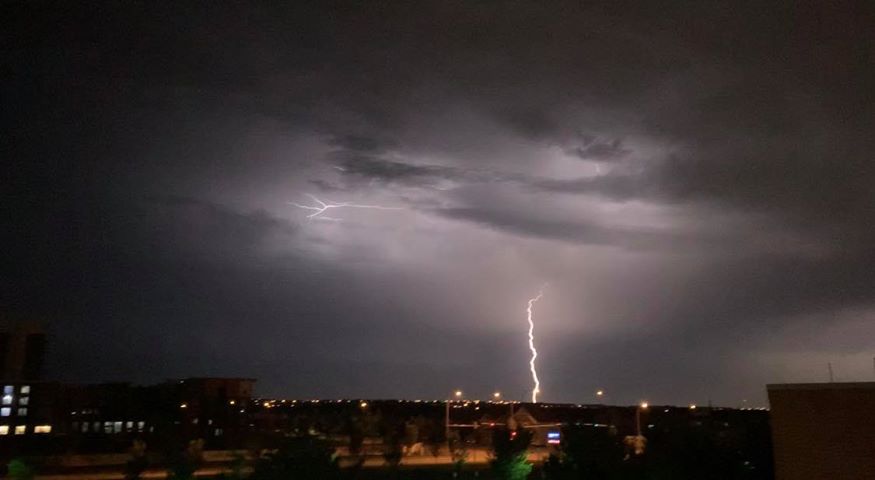
At the peak of the storm, unofficial numbers from Environment Canada indicate the lightning rate was 10,000 an hour – which would make the overnight weather the most active lightning day so far of the season.


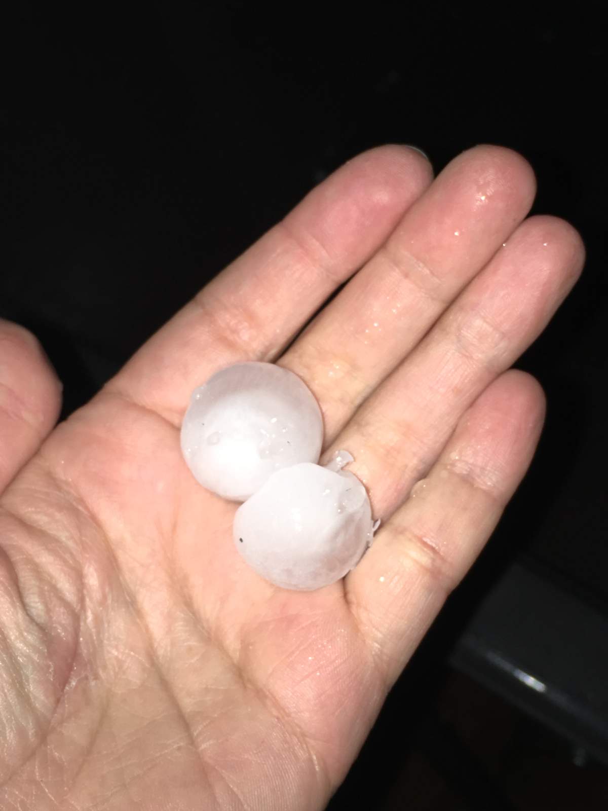


One of those storms was being tracked by Environment Canada meteorologists around 4 a.m., when they said a severe thunderstorm was moving north from the Thorsby area at 25 km/h and was capable of producing very strong wind gusts, up to nickel-size hail and heavy rain.
A photo sent to Global News showed large pieces of hail from that storm system. (see gallery above)
Then at 5 a.m. as that latest storm neared Edmonton, a severe thunderstorm warning was issued for the city and areas of the west and northwest, including Parkland County near Spruce Grove and Stony Plain and Sturgeon County near Morinville.
Environment Canada said the storm had picked up speed to 55 km/h and was located near St. Albert. That warning was then downgraded to a watch at 5:30 a.m.

Get breaking National news
READ MORE: Alberta ahead of average tornado count at 17 so far this year
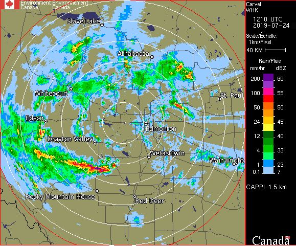
At the same time, the national weather agency said it was tracking another wave of severe thunderstorms in the Rocky Mountain House area.
As of 5 a.m., that storm system stretched from the Caroline area northwest to Bearspaw, moving northeast at 40 km/h, and was capable of producing very strong wind gusts, up to toonie-size hail and heavy rain.
An hour later, Environment Canada said the storm line stretched from near Leedale to 35 kilometres north of Saunders (See image below).
Radar showed wave after wave of severe weather moving through the region.
By 8 a.m., all of the warnings had been downgraded to watches. As the stormy weather continued to move northeast, the watches were ended as well. New watches were issued later Wednesday morning.
The good news? The heat warning that had been in place since the weekend for much of Alberta was dropped around 4:30 a.m. for all areas except the far northeast corner of the province.


READ MORE: ‘Heat dome’ brings intense heat to eastern Canada, United States
The stormy weather was expected to continue throughout the morning. Environment Canada said Wednesday would be cloudy with 60 per cent chance of showers and risk of a severe thunderstorms, and westerly winds of 30 km/h gusting to 50 m/h in the afternoon in the Edmonton region.
The wind could reach gusts of up to 80 km/h in the evening, before dropping off overnight, the weather agency said.
READ MORE: There’s a tornado warning, what now? Safety do’s and don’ts
BELOW: Videos and images of the overnight storms in the Edmonton region.
Want your weather on the go? Download Global News’ Skytracker weather app for iPhone, iPad and Android.
Comments
Want to discuss? Please read our Commenting Policy first.