
TORONTO – Newly-released time-lapse images taken from satellites over the last 20 years are giving a unique view of changes to the Earth’s surface.

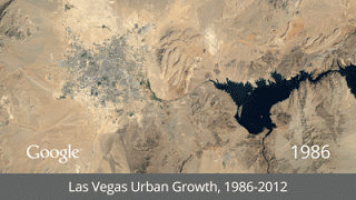
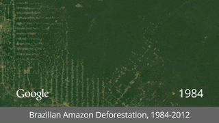
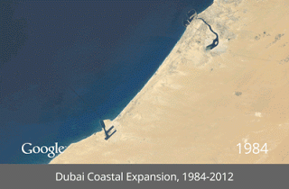
Among the changes shown in the interactive animated images are the vast urban growth and development in Las Vegas, the Dubai costal expansion, and the deforestation of the Brazilian Amazon.
“We believe this is the most comprehensive picture of our changing planet ever made available to the public,” read a Google blog post.
The time lapse of deforestation of the Brazilian Amazon, for example, combines satellite imagery taken from 1984 to 2012 to show the rapid rate at which the rainforest is shrinking.
The time lapse of the development of Dubai shows the construction of the palm tree islands – man-made islands built off the coast of the Persian Gulf. You can see the progression of the first island starting in 2002 on the timeline.


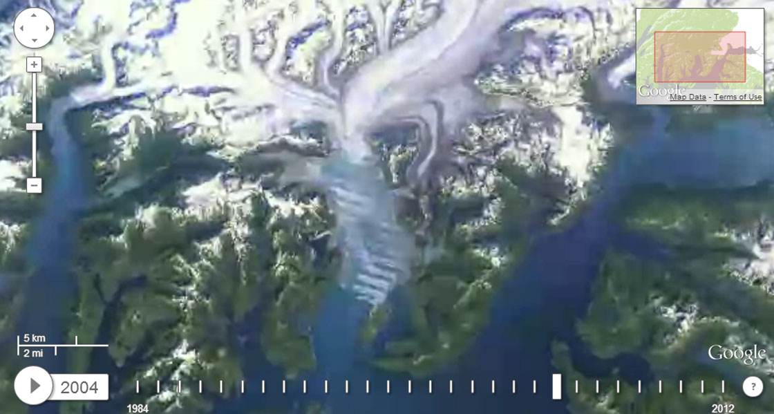
The images were collected by the USGS and NASA as part of an on-going project called the Landsat program. Together, the USGS and NASA have been collecting the images through Earth-observing satellites since 1972.
Google began working with the project in 2009 to create an archive of the images online.

Get breaking National news
“Using Google Earth Engine technology, we sifted through 2,068,467 images—a total of 909 terabytes of data—to find the highest-quality pixels (e.g., those without clouds), for every year since 1984 and for every spot on Earth,” read the blog post.
“We then compiled these into enormous planetary images, 1.78 terapixels each, one for each year.”
The images were then turned into animation with the help of the CREATE Lab at Carnegie Mellon University.
Comments
Want to discuss? Please read our Commenting Policy first.