

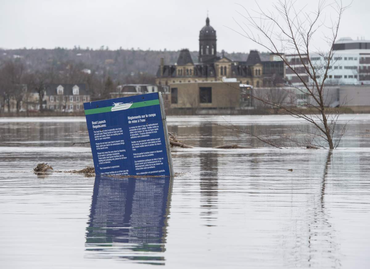
Several major cities are bracing for more flooding Friday, as rain continues to pound down from Ontario to New Brunswick.

As much as 60 millimetres of rain fell in parts of Quebec, while part of the Trans-Canada Highway was closed in New Brunswick.
Public Safety Minister Ralph Goodale explained Friday that further “dangerous and damaging flood water” could result in Ontario, Quebec and New Brunswick.
WATCH: Flooding in Eastern Canada: Video shows devastation

Global News’ chief meteorologist Anthony Farnell explained that it’s tough to pinpoint exactly what caused the extensive rainfall and flooding, as there are several contributing factors.
“We have to look back at the last several years,” he said. “After a dry start to the decade, the water table in recent years has been on the increase.”
READ MORE: Flood waters dropping slightly in N.B. but officials worried about rainfall in forecast
Farnell also noted water levels in the Great Lakes have been rising due to less evaporation in the winter and an overall increase in precipitation.
“Climate change may also be playing a role in all this,” he said.
While several communities across the provinces are impacted by the wet and active weather, flooding is worse in some areas.

Several cities within those provinces are already seeing heavy damage, and many have declared emergencies.
Here’s a look at some areas where it is worse.

New Brunswick
What has happened
The flood waters are starting to drop slightly in parts of the province after heavy rainfall.
In Fredericton, waters fell by 50 centimetres in the past day. However, in southern New Brunswick and in Saint John, the river has continued to rise, though it’s beginning to stabilize.
There are 330 households registered with the Red Cross for evacuations, totalling about 900 people.
The Trans-Canada Highway was fully closed from Oromocto to River Glade and could remain closed for several days, as the transportation department reported 84 road closures across the province.
Whether water will stabilize or continue to rise depends largely on whether the province sees more rainfall over the weekend.

Get breaking National news
WATCH: Flooding in Canada ‘most obvious manifestation’ of climate change, Goodale says

What is expected
Environment Canada issued special weather statements for much of New Brunswick on Friday morning.
In northern New Brunswick, 15 to 20 millimetres of rainfall is expected between Friday and Saturday.
In southwestern and central New Brunswick, heavier rainfall is expected, amounting to 25 to 45 millimetres by Saturday afternoon.
Southeastern areas of the province will not see as heavy rainfall. Overall, the rain will taper off by Saturday night.
READ MORE: Warning for possible dam failure on Rouge River in Quebec remains in effect
Quebec
What has happened
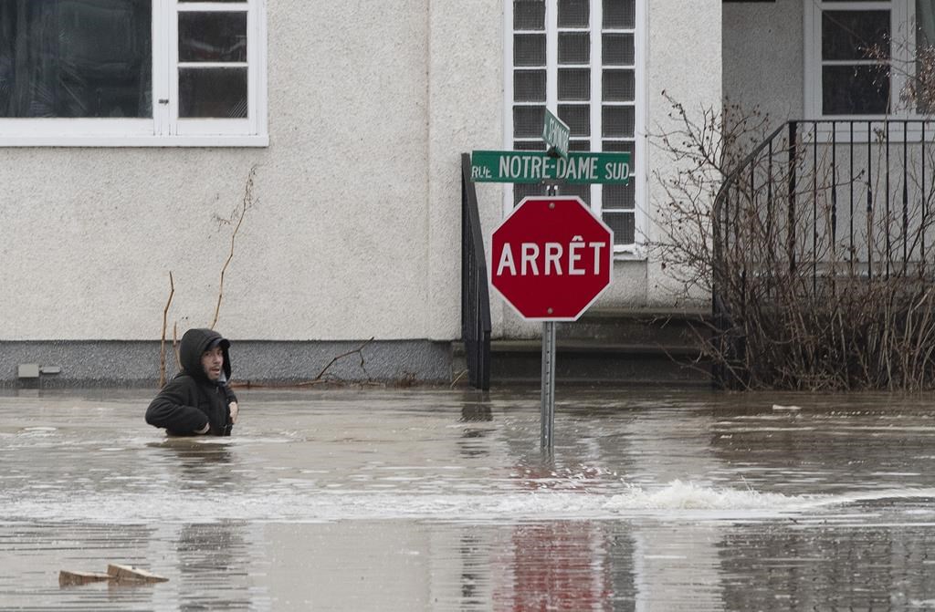
The City of Montreal has declared a state of emergency due to rising floodwaters in numerous boroughs.
The Chute-Bell dam west of Montreal has reached “millennial” water levels — meaning a flood that happens once every 1,000 years. The hydroelectric dam hasn’t failed yet, but Hydro-Québec warns it is fragile.
Quebec provincial police say that 75 residents in the area have been evacuated from their homes as of Friday morning.
Officials say they expect the dam to stay in place, but are closely watching what happens as further rainfall is expected.
As of Friday morning, 3,148 homes were already underwater and another 2,305 were surrounded by it — 1,111 people out of their residences.
- Canadian premiers face calls to improve diagnosis, treatment of ovarian cancer
- B.C. boosts monitoring of 865 repeat offenders, adds Lower Mainland intervention hubs
- Crews complete launch shaft for planned Toronto subway extension
- Ottawa halved federal emergency centre staff before wildfire season: union


WATCH: Rigaud issues evacuation order amid spring flooding

What is expected
Much of southern Quebec is under special weather advisories.
Rain began in southern Quebec on Friday morning and is expected to intensify overnight. Things are expected to start clearing up gradually on Saturday.
About 15 to 25 millimetres of rain are expected south of the St. Lawrence River as well as over the Lower St. Lawrence.
READ MORE: Ontario Premier Doug Ford visits flood areas in west Ottawa
Ontario
What has happened
Several areas around the Ottawa River are flooded after a rainstorm.
Ottawa Mayor Jim Watson declared a state of emergency due to flooding on Thursday. About 400 soldiers have been deployed to the Ottawa area to help sandbag and assist with other flood operations.
WATCH: Residents of Ottawa community continue to deal with flooding, find ways to protect homes

Outside of Ottawa, other parts of Ontario were also seeing heavy rainfall.
Town of Huntsville declared a state of emergency due to flooding on Thursday. Bracebridge, Ont., is also dealing with significant flooding.
What is expected
Heavy rain is expected to continue into Friday night for southern Ontario, amounting to 20 to 35 millimetres by Saturday morning. There is also a chance of flurries early in the weekend.
Much of central and eastern Ontario are under flood advisories.
A forecast by the interprovincial committee that regulates water levels in the Ottawa River says all that rain could increase its level near Parliament Hill by nearly a metre within a few days. Paths behind Parliament are already underwater.
WATCH: Quebec hydroelectric dam at imminent risk of failure

Manitoba
The situation in Manitoba is not quite as dire as the other provinces.
However, the rising Red River has forced some road closures and a small number of evacuations near the community of St. Jean Baptiste.
Earlier predictions for major flooding between the U.S. border and Winnipeg haven’t come to pass, largely because of less snowfall than expected in April and a slower than expected spring melt.

— With files from The Canadian Press
Comments
Want to discuss? Please read our Commenting Policy first.