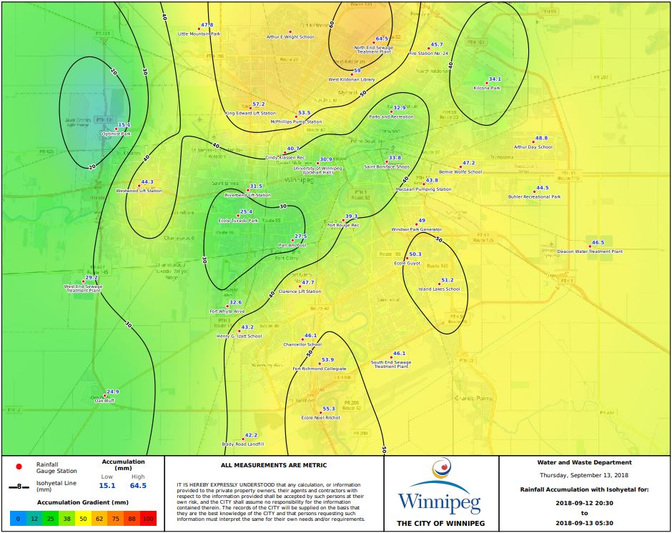
After an exceedingly dry summer that saw the province venture into moderate drought territory, more than a month’s worth of rain fell in parts of Winnipeg Wednesday night through Thursday morning.

RELATED: Winnipeg sees hottest day in more than 20 years
Winnipeg and a large portion of southern Manitoba saw thunderstorms with heavy downpours, with the Winnipeg Airport reported 62.8mm of rain Thursday morning.
In the month of September, Winnipeg will typically see 45.5mm of rain.
Rainfall reports varied around the city, from more than 60mm at the airport to 30.7mm at the Forks.
RELATED: Five times more smoke in Winnipeg so far in 2018
June, July and August saw between 41% to 72% of the normal precipitation, resulting in the 16th driest summer on record, according to Environment Canada.
Some other notable rainfall totals outside Winnipeg include:

Get daily National news
- Great Falls (79.7mm)
- Gimli (44.2mm)
- Cypress River (38.7mm)
- Portage la Prairie (37.7mm)
- Carberry (26.9mm)
There were two rounds of storms that hit the city of Winnipeg. The first was Wednesday night around 9 p.m. This wave dropped the majority of the rainfall around the city.
The second wave arrived early Thursday morning around 2:30 a.m.. This round of thunderstorm activity left around 15mm of the total rainfall accumulated.
Statistics on summer rainfall records are from Environment and Climate Change Canada.


Comments
Want to discuss? Please read our Commenting Policy first.