


There are now more than 560 wildfires burning around B.C.

More than 1,500 properties are under evacuation order and more than 9,000 properties are under an evacuation alert.
WATCH: What will the state of emergency mean for the B.C. wildfire fight?

Officials say a quarter of the fires sparked this season were caused by people, while the rest were caused by lightning.
The largest blaze is the Shovel Lake wildfire burning northeast of Burns Lake and southwest of Fort St. James.
It is 50,831 hectares in size.
The B.C. Wildfire Service says a planned ignition carried out Tuesday on this fire was successful on the west flank. The ignition secured the Hannay Road on the west side, and the objective Wednesday will be to secure this guard.
The agency says the fire exhibited aggressive behaviour Tuesday on the southwest flank, driven by high winds in the late afternoon. Equipment and crews were pulled off the line and will be re-establishing objectives for the south flank.
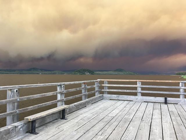
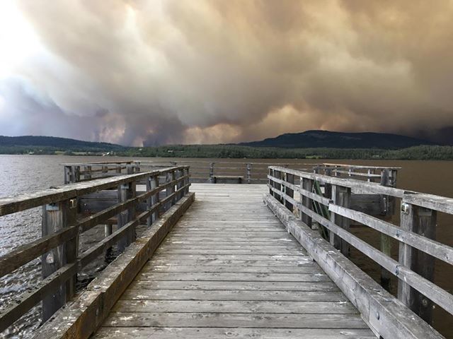
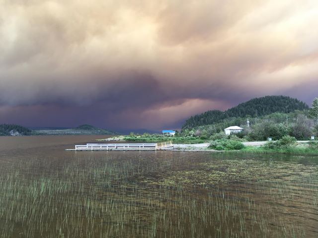
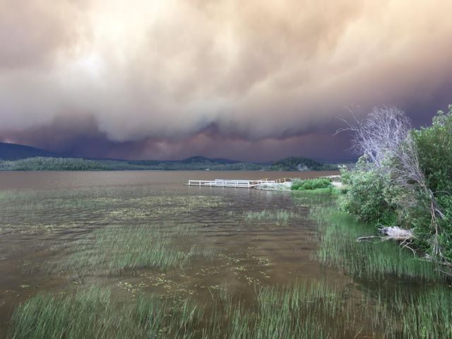
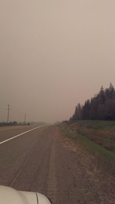
Visibility will be an issue for the next few days with the increased smoke.
The smoke is so thick in the surrounding region, it’s tricking street lights into coming on in Prince George. The Shovel Lake wildfire is a few hours drive away from Prince George.
Ash is floating in the air in Prince George Wednesday morning due to the fires burning nearby.

Get breaking National news
On Aug. 12, the Regional District of Bulkley-Nechako declared a local state of emergency in the region.
This will remain in place until Aug. 19 unless cancelled by order of the Regional District of Bulkley-Nechako or the solicitor general.
On Aug. 13, an evacuation order was expanded due to the Shovel Lake wildfire. The order is now in effect for east of the centre of Taltapin Lake to west of the Sutherland Angly FSR and Sutherland FSR, south of the Camsell FSR-Cunningham FSR Junction and Cunningham FSR-Marie North FSR Junction to Stella Rd and the north shore of Fraser Lake to the boundary of Nadleh Whut’en First Nation.
Evacuees are asked to register at the ESS reception centre at the Back Entrance of the CN Centre in Prince George, located at 100-2187 Ospika Blvd.
WATCH: Province continues to battle almost 600 wildfires

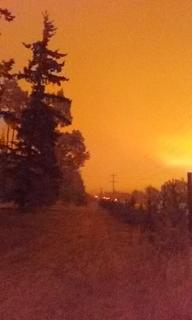
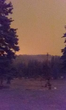
PHOTOS: The Shovel Lake wildfire:


Burning nearby is the Island Lake wildfire at 13,000 hectares, the Verdun Mountain wildfire at 4,500 hectares, the Nadina Lake wildfire at 25,000 hectares, the Shag Creek wildfire at 9,300 hectares, the Narcosli Creek wildfire at 3,400 hectares and the Tweedsmuir Complex wildfires, estimated at around 35,000 hectares in size.
Comments
Want to discuss? Please read our Commenting Policy first.