


Communities along the Fraser River are preparing for potential flooding, as water levels continue to creep upward.

The Fraser remains under a high streamflow advisory from the provincial River Forecast Centre, and water levels at the key Mission Gauge reached 5.9 metres on Friday morning.
According to the City of Chilliwack’s Fraser River freshet response plan, at 6 metres, the river is considered “beyond bank full conditions,” at which point flooding could occur in unprotected areas outside the city’s diking system.
The River Forecast Centre says persistent warm weather is expected to continue to drive snowmelt, pushing river levels higher in the coming week. Heights of between 6.4 metres and 6.64 metres are forecast between May 19 and May 24. The last time the river reached those levels was in 2012.
“We have plenty of sandbags in reserve, but we don’t anticipate we’re going to be needing them except in the outlying areas,” said Chilliwack Mayor Sharon Gaetz.
“As soon as the gauge hits 5 (metres) we immediately send crews out that daily walk the dikes and make sure that there are no opportunities for the dikes to breach.”
The District of Mission says daily dike inspections and maintenance are now underway, and says while there is no immediate risk of flooding, some flooding is anticipated in low-lying areas not protected by dikes.
The Fraser Valley Regional District (FVRD) is offering sandbags to anyone whose property may be threatened by Fraser River flooding, which can be obtained by calling the district’s emergency operations centre at 604-702-5011.
Evacuation alerts and park closures
There have been several evacuation alerts issued along with road and park closures in areas adjacent to the Fraser River in the eastern Fraser Valley.
In Hope, residents of 44 homes have been told to be ready to leave on a moment’s notice.
In Chilliwack, the Island 22 Equestrian Park and the Island 22 Riverside Trail have been closed by the Fraser Valley Regional District (FVRD).

Get breaking National news
Earlier this week, Chilliwack issued an evacuation order for three properties at Carey Point, however Gaetz says they’ve refused to leave, and have been provided sandbags from the city. About 10 more properties are also under evacuation alert in Chilliwack.
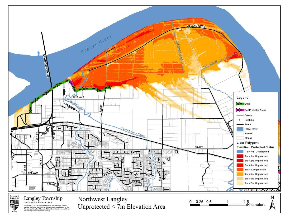
In the Township of Langley, where about 260 properties are on evacuation alert, officials say door-to-door evacuation orders could be issued in areas not protected by dikes if water levels climb above 6.3 metres, and in protected areas should waters top 7.5 metres.
Existing alerts cover unprotected flood plain areas of northwest Langley and Glen Valley, Brae Island and McMillan Island.
Officials have also expanded trail closures near the river. The Fort to Fort Trail is now closed from Salmon River Dike Station to the entrance off Allard Crescent, and the Marina Park Trail is closed from the viewing deck east to Marina Boat Launch.
The township says there may be provincial assistance available to relocate livestock for some farm businesses affected by the alert.
Gallery: Areas of Langley vulnerable to low level flooding


The FVRD has also issued evacuation alerts for all residents of Nicomen Island and properties in Electoral Area G behind the North Nicomen Dike. On Wednesday, it also issued an evacuation order to five properties at Harrison Bay.
Barnston Island, where minimum security prisoners were drafted to help with sandbagging efforts this week, remains under an evacuation alert, with access restricted to residents and businesses. However an incident commander tells Global News the alert is expected to be lifted by next Wednesday or Thursday.
Barnston Island Regional Park also remains closed due to flooding concerns.
The City of Maple Ridge has issued a flood advisory for 55 properties on the river side of the Wharf Street dike in the Hammond neighbourhood.
It has also closed 144 Avenue west of 224 Street until further notice due to localized flooding along with the boat ramp on the Haney Wharf, and has now activated its Emergency Operations Centre.
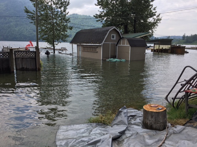
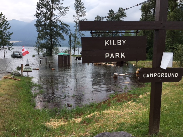
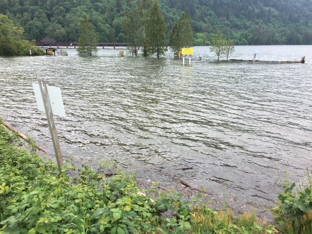
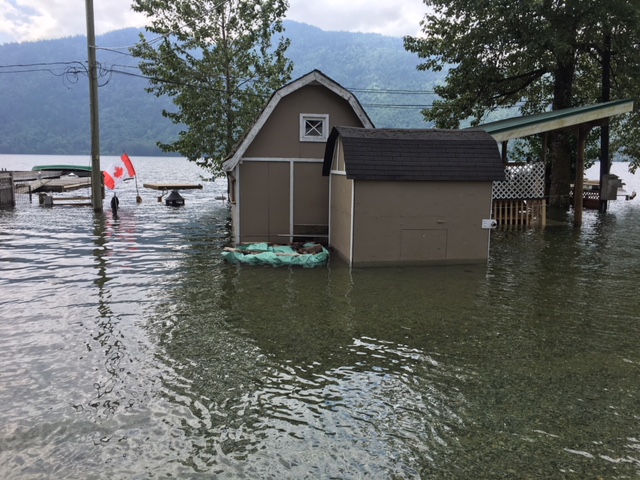
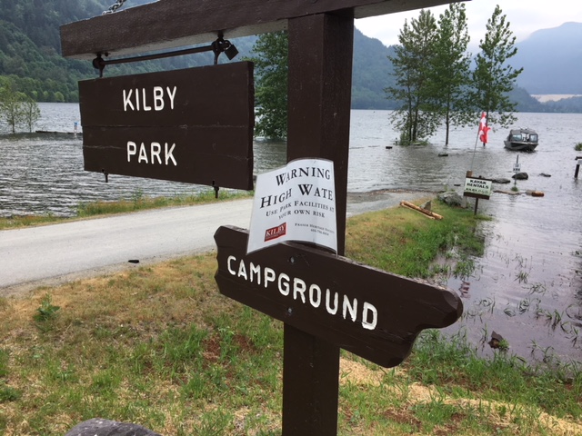
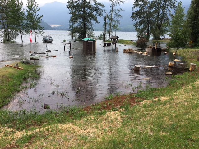
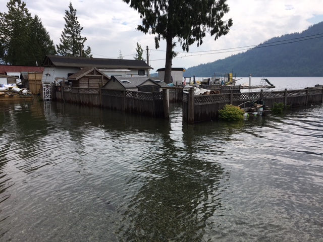
Gallery: Flooding at Kilby Park and Harrison Bay


Downriver concerns
Further downriver, flooding concerns have prompted the City of Delta to open its emergency command centre.
Officials are concerned the rising river levels will coincide with a high tide Sunday and Monday. Mayor Lois Jackson said engineers are watching closely.
“If the heat isn’t too high, it may be just enough to get us through this but we’re monitoring on a daily basis. We’re all ready here in Delta, we have sandbags and everything that we need. Everybody is on stand-by and we’re all ready to go.”
In neighbouring Richmond the risk of flooding is lower, but city spokesperson Ted Townsend said their emergency operations centre has also been activated.
“We are closely monitoring the river levels, we are doing visual inspections of our dikes on a daily basis,” he said.
The city is also reminding people out to enjoy the long weekend to be careful around river banks and to watch for debris in the water.
-With files from Emily Lazatin
Comments
Want to discuss? Please read our Commenting Policy first.