

Winter is far from over, as Saskatchewan braces for a one-two punch this weekend – with 30+ centimetres of snow possible in parts of the province.

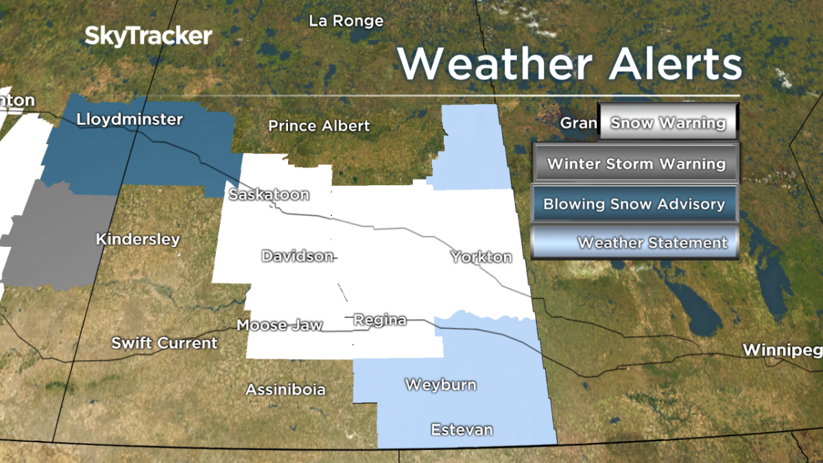
Environment Canada has upgraded Regina, Moose Jaw and Saskatoon to snowfall warnings, along with a large portion of central Saskatchewan.
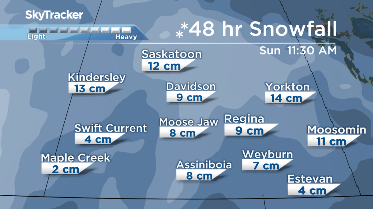
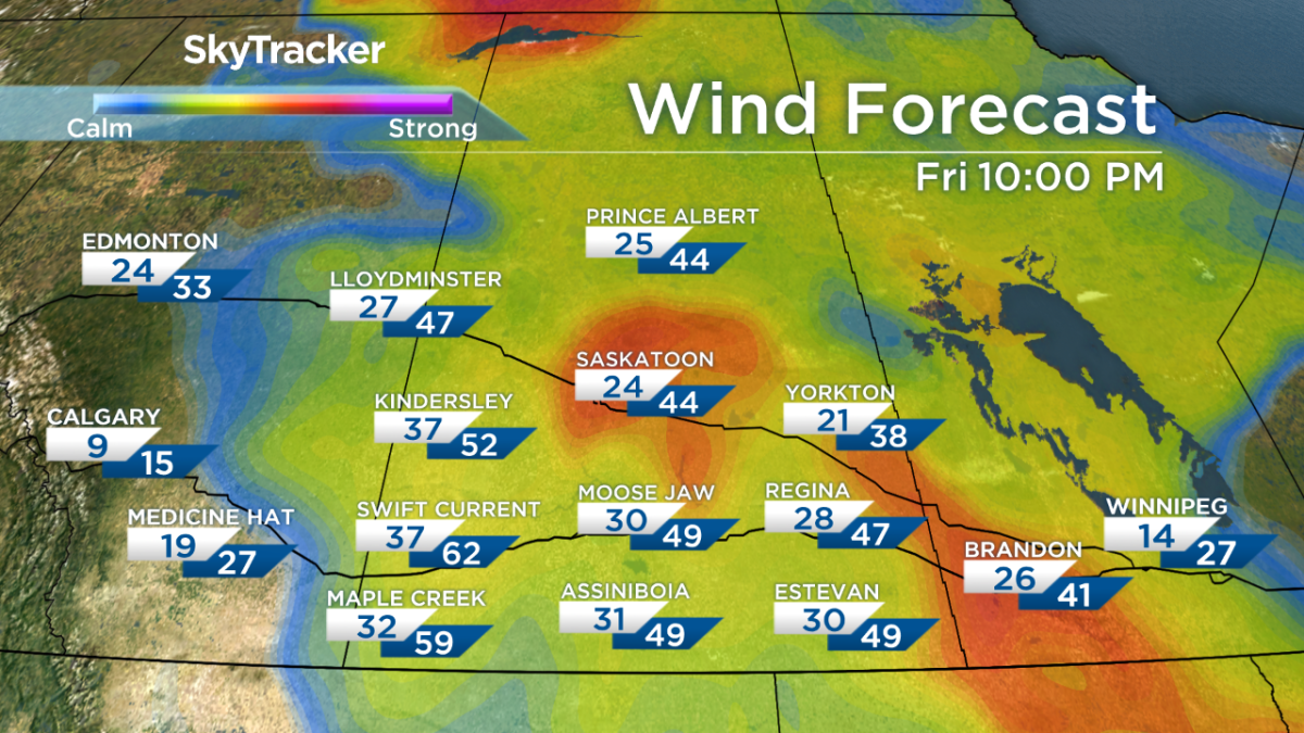
The first snow storm will move in from the west, bringing 10-15 centimetres of snowfall to parts of western Saskatchewan by Sunday morning. Combined with 40-70 km/h winds, blowing snow and reduced visibility is also expected.


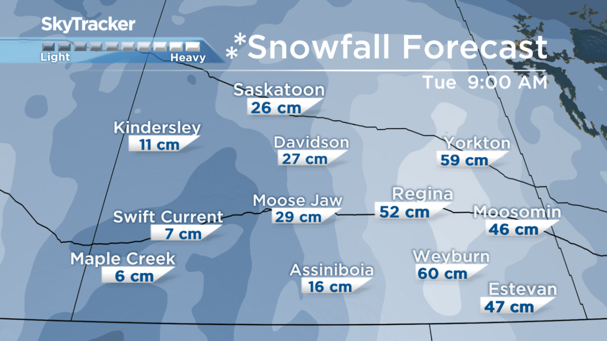
The second system, a Colorado Low, will move up from the south and into Manitoba, clipping southeastern Saskatchewan. This system is forecasted to bring in a lot of moisture. Snowfall totals could reach 30+ centimetres in the east.

Get daily National news
The image below shows snowfall totals projected by the NAM model, extending from Friday, March 2 to Tuesday, March 6. The amounts are subject to change, depending on the developing weather systems.


Strong winds are also possible with the Colorado Low, causing blowing snow and reduced visibility for Regina, east-central and southeast Saskatchewan.
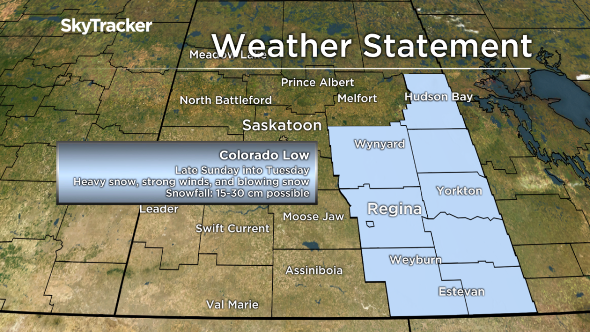
Meteorologists will be monitoring this system very closely. Snowfall warnings may be issued on Sunday.
For notifications on new weather alerts issued in your area, download the Global News Skytracker weather app for iPhone, iPad or Android.
Comments
Want to discuss? Please read our Commenting Policy first.