

A major warm up is in store for the final weekend of January before big changes move in to kick off February.

Saskatoon Forecast
Today
-28 is what it felt like with wind chill overnight as temperatures bottomed out around -20 before rising up into the mid-minus teens this morning with wind chills down around -22.
Cloud cover helped moderate temperatures by morning, which then cleared out by midday as the mercury rose up to -10 by noon!
Mostly sunny skies will stick around for the remainder of the day as we warm up into mid-minus single digits for an afternoon high.

Get daily National news
Tonight
A few clouds will stick around tonight as northwesterly winds pickup – which you would think would be a cool wind, but there’s actually milder air to our northwest, so that’ll keep us fairly mild with an overnight low only just into minus double digits expected.
Friday
Wind chills are only expected to dip back into the mid-minus teens in the morning under mostly sunny skies to start.
As the upper ridge of high pressure builds in the heat, it’ll come with a few waves of moisture that’ll bring in some cloud cover midday before clearing back out later on.
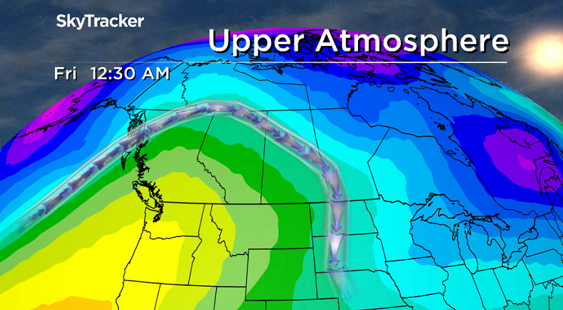
West-northwesterly winds will pick up to sustained speeds around 20 to 30 km/h and gusts upwards of 40 to 50 km/h at times as we rise to a high just shy of the freezing mark!
Sky conditions will also be ripe for more spectacular sunrises and sunsets over the coming days.
- Bridge inspector required on Toronto-area highway after dump truck incident
- Adjustable rate cap part of ‘care-first’ auto insurance model coming to Alberta
- Multiple critical patients in hospital from oilfield transport bus rollover near Grande Prairie
- Woman dead after being hit by car in Toronto parking lot on Tuesday morning


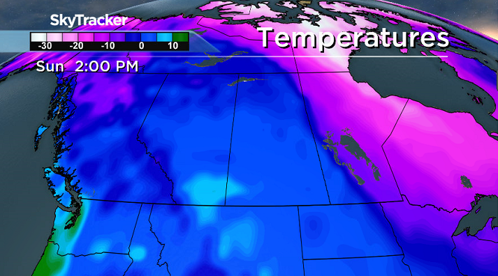
Weekend
The full effects of the warm up and upper ridge will be felt this weekend under a mix of sun and cloud on Saturday with a few more clouds likely on Sunday.
Temperatures are expected to top out just above the freezing mark on Saturday before skyrocketing up quite a few degrees above zero to around +3 on Sunday!
Work Week Outlook
A cold front slides through on Monday, bringing us back down into minus single digits during the day under partly to mostly cloudy skies with a chance of snow that’ll linger into Tuesday as we cool even further.
By mid-week we’ll be back into minus double digit daytime highs and morning wind chill values in the minus 20s under a mix of sun and cloud to kickoff February.
Gerrid Gust took this Your Saskatchewan photo near Davidson:

READ MORE: Get a 2017 Your Saskatchewan calendar today
Saskatoon weather outlook is your source for Saskatoon’s most accurate forecast and is your one stop shop for all things weather for central and northern Saskatchewan with comprehensive, in depth analysis that you can only find here.
Comments
Want to discuss? Please read our Commenting Policy first.