
UPDATE: All warnings mentioned in this story have ended

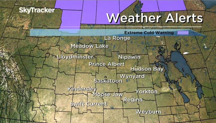
Parts of northern Saskatchewan remain under an extreme cold warning.
Environment Canada officials said strengthening winds and very cold temperatures may cause extreme wind chills Monday morning.
Temperatures near -30 C combined with 15 to 20 km/h winds could result in extreme wind chill values of -40 or colder Sunday night and into Monday morning.
READ MORE: Winterizing your home: tips on what to check during the Saskatchewan deep freeze

Get breaking National news
The federal agency issues extreme cold warnings when very cold temperatures or wind chill creates an elevated risk to health such as frostbite and hypothermia.
People are asked to dress appropriately and watch for cold-related symptoms that include shortness of breath, chest pain, numbness in extremities and pale skin. If you experience symptoms, move indoors and begin warming.
READ MORE: Sask. government urges safety in 2016 Cold Weather Strategy


For weather on the go download the Global News Skytracker weather app for iPhone, iPad or Android.
Extreme cold warning for:
- Cree Lake – Key Lake
- Fond-du-Lac – Stony Rapids
- La Loche – Clearwater River Prov. Park – Cluff Lake
- Uranium City – Camsell Portage
- Wollaston Lake – Collins Bay
Extreme cold warning ended for:
- Hudson Bay – Porcupine Plain
- Humboldt – Wynyard – Wadena – Lanigan – Foam Lake
- Kamsack – Canora – Preeceville
- Melfort – Tisdale – Nipawin – Carrot River
- Prince Albert – Shellbrook – Spiritwood – Duck Lake
Comments
Want to discuss? Please read our Commenting Policy first.