
Watch the video above: Aerial footage of the flooding in Britain.

The latest and largest storm system to batter the United Kingdom in recent weeks with high winds and rain was captured using a NASA satellite.
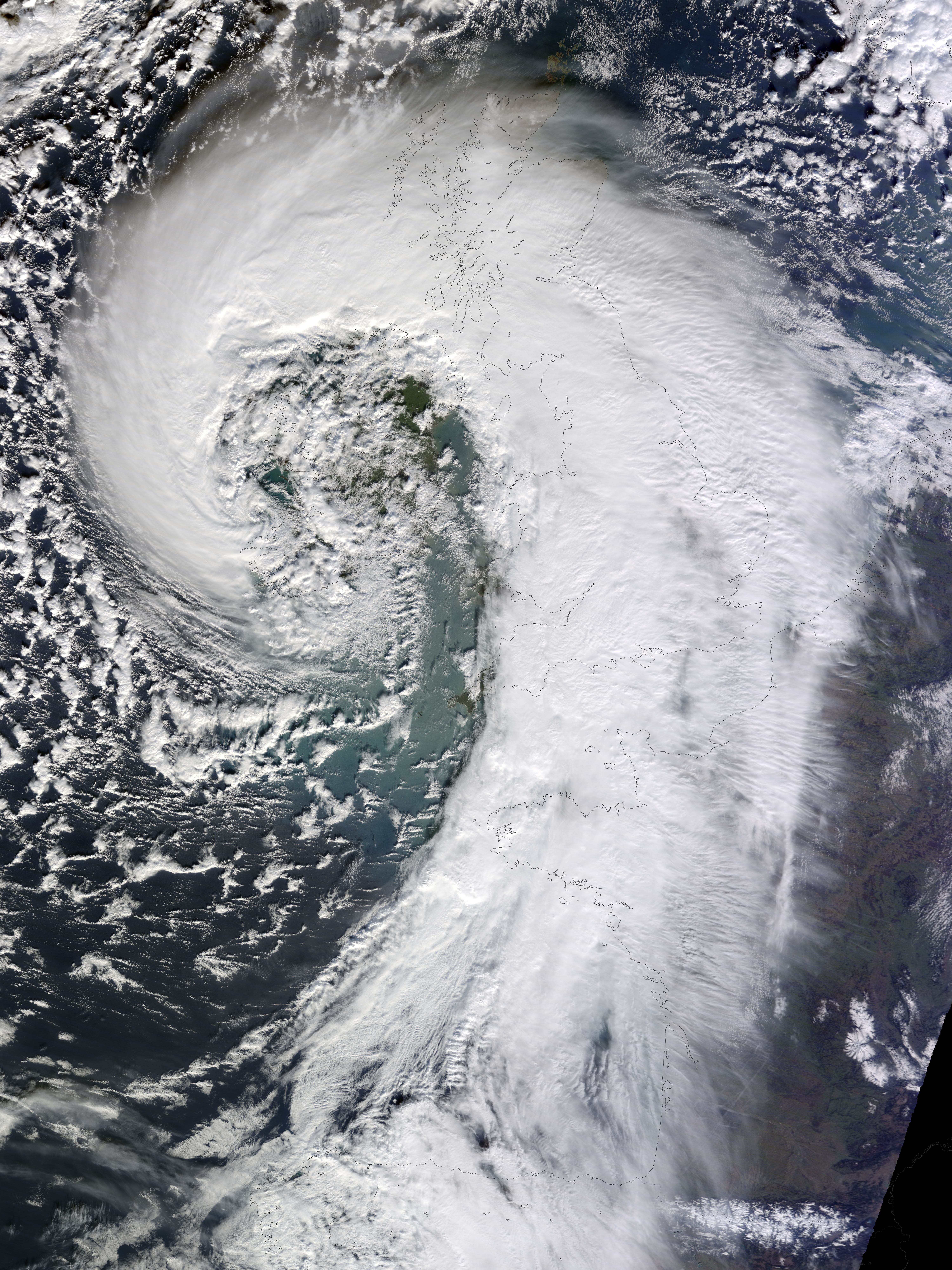
The Terra satellite imaged the system that enveloped the entire country on Feb. 12 and 13. The storm is an extratropical cyclone, an area of intense low pressure characterized by the comma shape. Extratropical cyclones are cold storms, but intensify when warm and cold air masses meet.

(For a high resolution image, click here.)
This winter has been particularly harsh for the United Kingdom, with January being the wettest month on record, according to the UK Met Office.

Get breaking National news
The southeastern part of England has received more than twice its average rainfall of just over 175 mm for the month of January, beating its previous record of 158.2 set in 1988.
But southwestern England has received the most, with 222.6 mm of rainfall in the same time period. Surprisingly, this is only the fifth wettest on record.
The storm left more than 700,000 people in the dark. On top of the rain, the system brought high winds, with gusts of up to 160 km/h, creating havoc across the country.
The wet and miserable weather is expected to last into the weekend, with most of the precipitation falling in the south.
Overall, last month was the third wettest January in the UK, as the country received more than 151 per cent of the average rainfall. However, it was the wettest January in England and Wales since 1766.
The UK has not only been wetter than normal, but it’s also been warmer than normal, 1.1 C above the 1981-2010 average, with a mean temperature in January of 4.8 C.


Comments
Want to discuss? Please read our Commenting Policy first.