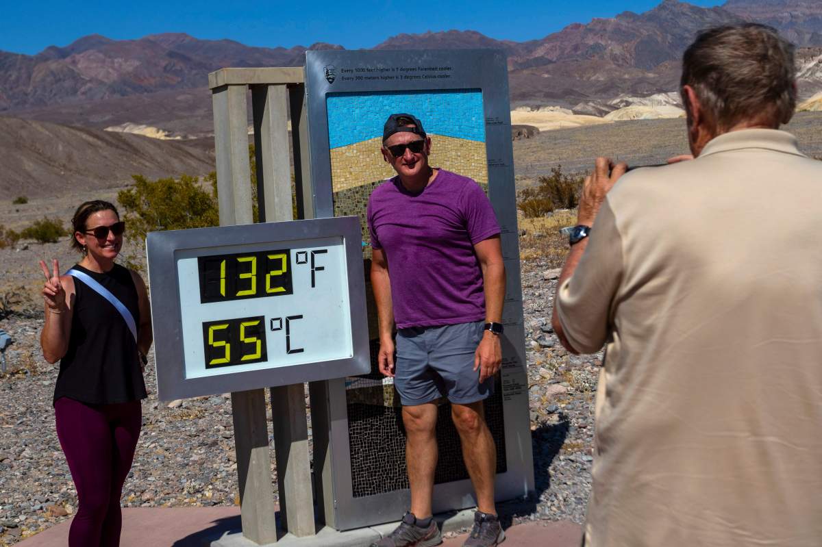
A sizzling heat wave has Canada and the United States in its grip as a global streak of the hottest months continues to shatter records.

Heat warnings were in place on Monday in parts of eight provinces — British Columbia, Alberta, Saskatchewan, Ontario, New Brunswick, Newfoundland and Labrador, Prince Edward Island and Nova Scotia — as well as the Northwest Territories.
Environment Canada is forecasting that B.C.’s Southern Interior could see temperatures climb into the low 40s C this week.
Temperatures in Alberta and Saskatchewan are expected to reach at least 30 C, with some parts of Alberta forecast to hit about 35 C by Wednesday.
In Atlantic Canada, daytime highs are forecast to top 30 C across much of the region.
Meanwhile, down south, an excessive heat warning — the National Weather Service’s highest alert — was in effect Monday for portions of U.S. states such as California, Nevada, Arizona, Oregon, Washington and Idaho. Parts of the East Coast, as well as states including Florida, Georgia, Alabama and Mississippi, were also under heat advisories.
The dangerous temperatures caused the death of a motorcyclist and the hospitalization of another visitor in Death Valley in eastern California on Saturday.

The extreme heat comes as a new report published late on Sunday revealed that June 2024 was the hottest ever recorded — the 13th consecutive month that the record for the global average temperature has been broken.
In its monthly report, European climate agency Copernicus said the global average surface air temperature last month was 16.66 C, the highest ever recorded for June since data collection began in 1850.
“Outside Europe, temperatures were most above average over eastern Canada, the western United States and Mexico, Brazil, northern Siberia, the Middle East, northern Africa and western Antarctica,” Copernicus said.
Factors like increasing greenhouse gas emissions and the El Niño phenomenon combined have had a “huge impact” on the “bizarre and extreme weather pattern” for June, Hossein Bonakdari, an associate professor of civil engineering at the University of Ottawa, said in an interview with Global News.
Given the trajectory over the past year, Bonakdari said 2024 is likely going to be another record summer and year for climate-related disasters.

Get daily National news
“The extreme weather events observed globally in June 2024 are consistent with patterns linked to climate change,” he said.

What’s in store for the rest of summer?
The current hot conditions will likely not bode well for Canada’s wildfire season, experts say.
“I believe the western and central part of the country will experience less rainfall than usual, contributing to the drought conditions and increasing the risk of wildfires,” Bonakdari said.
For June, Canadian government officials had already warned about above-normal fire activity across much of Canada, stretching from B.C. to western Labrador, New Brunswick and southern Nova Scotia.
In July, fire activity is possible from Yukon and eastern B.C. across to western Quebec. The most intense region for July will likely be from northeastern B.C. across the Northwest Territories and the Prairie provinces.

Copernicus said that June marked the 12th successive month that the world was 1.5 degrees warmer than pre-industrial times. That 1.5-degree temperature mark is important because that’s the warming limit nearly all the countries in the world agreed upon in the 2015 Paris climate agreement.
The average sea surface temperature (SST) was also the highest ever recorded for June.

Over the past year, El Niño has been an “important” contributing factor to high global SSTs, Copernicus said.
However, an expected shift to La Niña in late summer or early fall his year could bring in some wildfire relief with the possibility of wet weather conditions on the West Coast and into Alberta, experts say.
During El Niño years, trade winds weaken and the Pacific Ocean tends to release more heat into the atmosphere, making areas in the northern U.S. and Canada drier and warmer than usual.
During La Niña years, trade winds are stronger and water temperatures become cooler than average in the eastern Pacific Ocean near the equator. Hence, the northern U.S. and Canada tend to be wetter and colder.
The transition between the two phenomena can drastically alter weather conditions, Bonakdari said.
“During such transitions, the atmosphere responds to the changing ocean temperatures, which can create hot spots for extreme weather events,” he said.
— with files from The Canadian Press and The Associated Press


Comments
Want to discuss? Please read our Commenting Policy first.