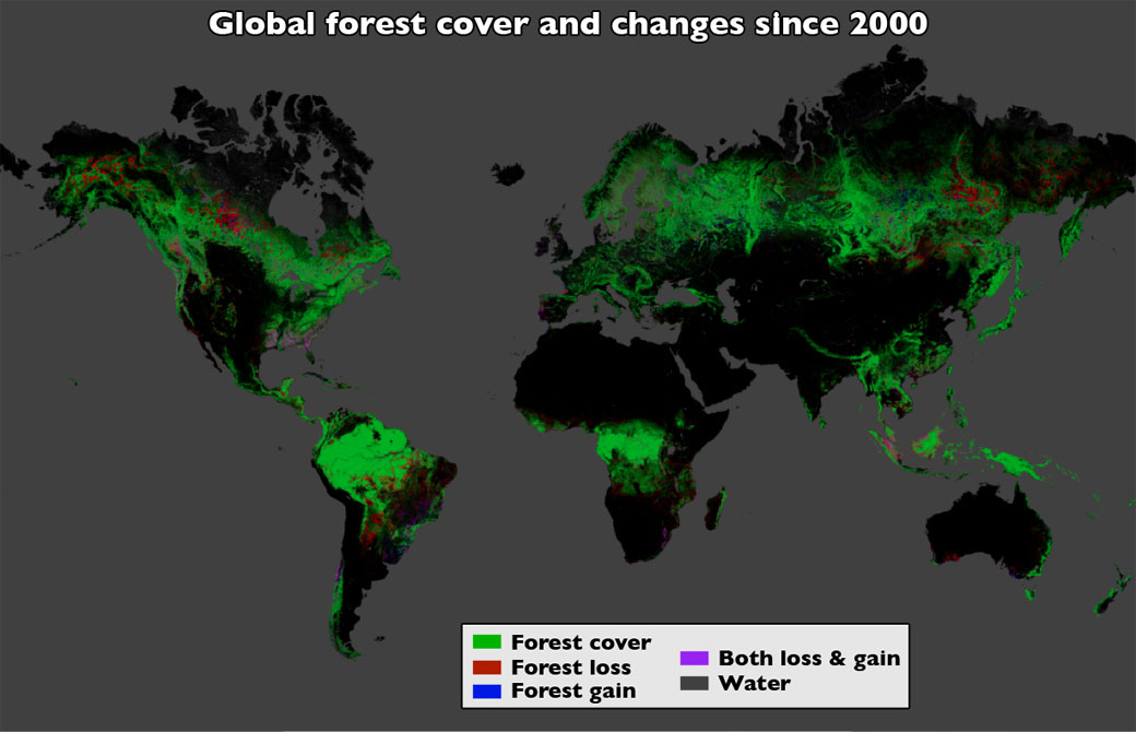
TORONTO – Between 2000 and 2012, more than 2.3 million square kilometres of forest were lost worldwide, new satellite data reveals.

NASA collected the data using the U.S. Geological Survey‘s Landsat 7 satellite.
The map shows areas in northern Alberta and Saskatchewan as well as the Northwest Territories and Quebec that have faced forest loss due to wildfires.
According to Natural Resources Canada, in 2012, 7,288 fires were reported across Canada which burned almost 2 million hectares. Insects such as the pine beetle killed about 18.3 million hectares of pine from 1998-2012.

Get daily National news
Canada has 397.3 million hectares of forest, and other wooded land which accounts for roughly 53 per cent of the country’s total surface area. Canada holds 10 per cent of the world’s forests.
In order to map out the global forests, scientists analyzed more than 140 billion pixels in 654,000 images. Google also collaborated with the team.
There’s some good news to the data: Brazil, home to the Amazon rainforest, reduced its deforestation from 40,000 square kilometres per year to about 7,700.
“That’s the result of a concerted policy effort to reduce deforestation, and it sets a standard for the rest of the world,” said Matthew Hansen, whose team at the University of Maryland in College Park, Md., led the new study.
However, in some countries, such as Indonesia, the deforestation rates increased.
Scientists hope to use the data to further monitor the state of forests around the globe.
The research is published in the Nov. 14 issue of the journal Science.
Correction: An earlier version of the story said that 2 billion hectares were lost.


Comments
Want to discuss? Please read our Commenting Policy first.