Flood advisories and warnings for communities throughout B.C.’s Interior continued on Wednesday.

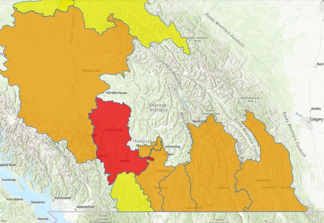
Issued by the River Forecast Centre, the notifications stretched from northern B.C. to the U.S. border.
Only one area has a flood warning, but it is quite large, stretching from just north of 70 Mile House down to Merritt. It includes Cache Creek, where a state of local emergency exists due to flooding concerns.

“Village staff are monitoring (Cache Creek) and (Bonaparte River) around the clock as fluctuating water levels and debris from upstream continue to challenge culvert capacity,” the Village said on its Facebook page.
The Village noted that more rain is in the forecast and that it anticipates water levels in the river to rise over the coming days.
Further, Highway 97 and the Trans-Canada Highway are closed in Cache Creek because of flooding at Stephenson and Collins roads. A detour is available.
BC Hydro says 30 customers near the junction of Highway 97 and the Trans-Canada Highway were without power due to flooding, and that work crews were on site.

Elsewhere, a high streamflow advisory is in place for the Similkameen region, east of Hope.
Eastward, though, flood watches have been issued for the Okanagan to the Alberta border, and local regional districts are readying for potential flooding, including having sand and sandbags available to area residents.
“With ongoing above-normal temperatures next week, ongoing rises in rivers are expected across the region, with increasing potential for flood hazard in other rivers over the coming days,” said the Regional District of Okanagan Similkameen (RDOS).
“The potential for heavier precipitation on Friday and Saturday could lead to a period of significant flood hazard through the region late this week.”

Regional districts are advising the public to stay away from riverbanks, creeks and fast-flowing bodies of water, and to avoid recreational activities such as fishing, swimming and boating.
“Remember, high streamflow can easily trap strong swimmers, increasing the risk of drowning,” said the RDOS.
In the Central Okanagan, the RDCO said “isolated flooding events have occurred in the Central Okanagan West Electoral Area near high flowing creeks, particularly in areas impacted by the White Rock Lake wildfire. We are closely monitoring electoral areas and have made sandbags available in anticipation of possible flooding.”
The Regional District of Central Kootenay added, “with hot temperatures continuing this week, snowmelt runoff is expected to increase substantially. Environment Canada is also forecasting between 30-60 mm of rain in some areas starting Friday. There is even a possibility of thunderstorms. Combined, all these factors significantly add to the potential flood hazard.”
A map showing the latest flood warnings is available online.


Comments