


An active Pacific frontal system is draped across B.C. today.

Rain will continue to fall in most coastal regions, with snowfall on the mountain passes and through parts of the Interior.
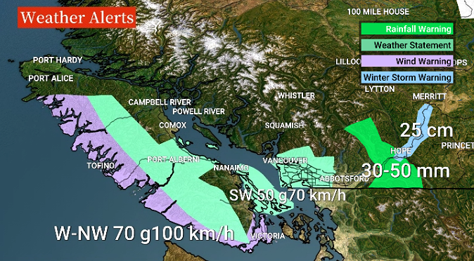
A heavy rainfall warning is in effect for the Eastern Fraser Valley, while there is a winter storm warning for the Coquihalla, and up to 25 cm of further snowfall is expected by Tuesday morning.

Wind will rapidly increase this evening in southern sections of the coast, with up to 100 km/h westerly gusts forecast near Victoria close to Juan de Fuca Strait.
In Metro Vancouver, a gusty southwest wind, possibly up to 70 km/h, will develop Monday night in southern sections, especially near the water.
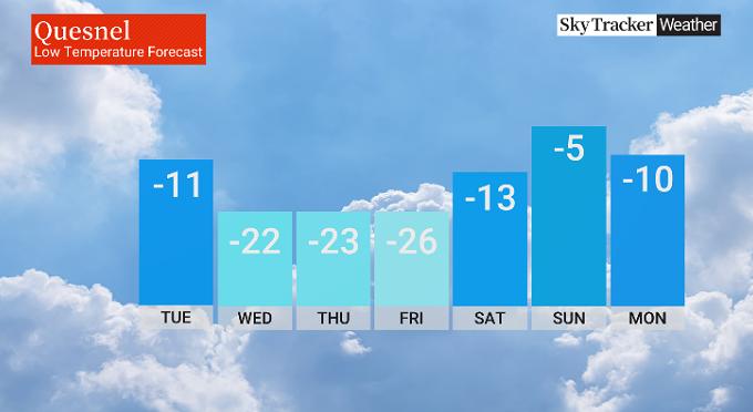
Meanwhile, colder Arctic air is making its way southward today through Northern areas of BC.

Get breaking National news
The leading edge of the much colder air along the Arctic front will sweep through the Prince George area this evening, with rapidly falling temperatures, cold gusty wind, and locally heavy snow.


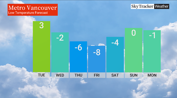
The cold air will continue southwards on Tuesday and will reach the Lower Mainland by evening, with flurries and gusty, colder outflow wind.
Very chilly weather will hold through Saturday.
The latest long-range weather charts show a high probability of snow on the South Coast later Saturday into Sunday morning.
Timing and intensity of the potential snowfall will be regularly updated.
Comments
Want to discuss? Please read our Commenting Policy first.