

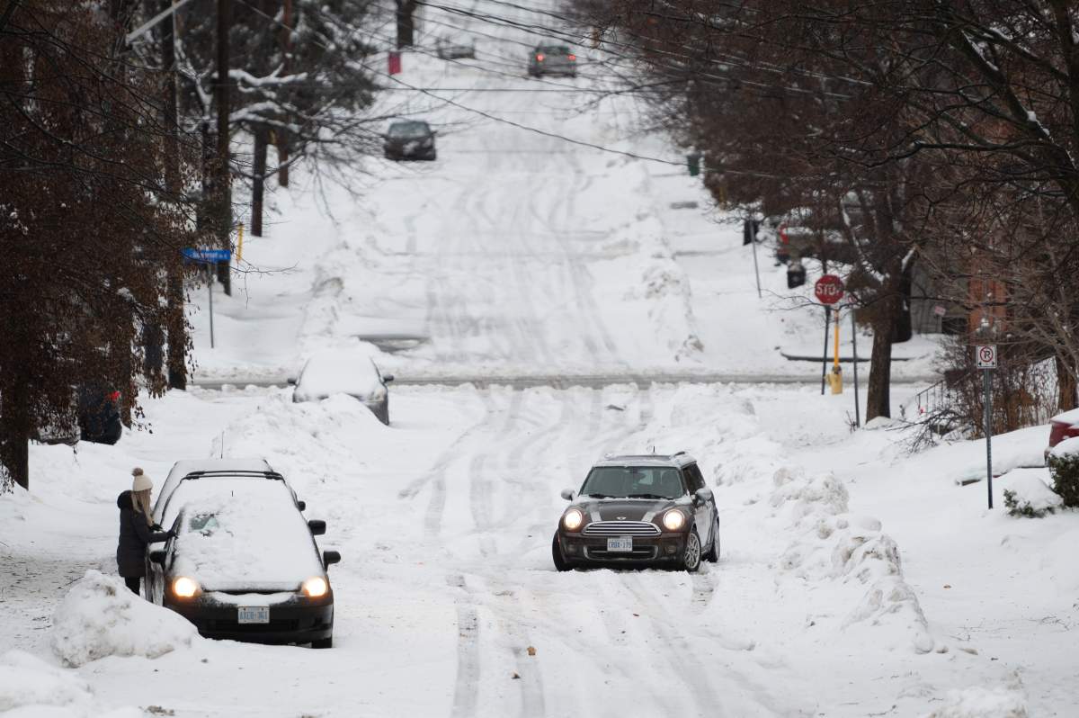
Canada is facing a massive cross-country winter storm that has caused plunging temperatures and destructive winds and has left hundreds of thousands without power from coast to coast.

The storm blew into Canada on Thursday night and is expected to wreak havoc on the country into the holiday weekend.
Hundreds of thousands of people across the country are facing power outages as of 3:30 p.m. ET. Hydro Quebec pegged outages in that province at roughly 350,000, while generator company Generac — which aggregates data from providers across the country — put the national total at around 395,000 outages.
The numbers have fluctuated throughout the day as the storm system tracks across the country.
Read more: ‘Crippling blizzard’ expected in parts of southern Ontario, with other alerts issued elsewhere
These outages aren’t going to end anytime soon, warned Global News Chief Meteorologist Anthony Farnell.
“You shouldn’t expect (power) back until the earliest, I’m thinking on Sunday. That’s Christmas Day. Because crews just cannot get out in blizzard conditions, they can’t deal with the cold,” he said in an interview with AM640 Toronto, a radio station owned by Global News’ parent company Corus Entertainment, early Friday morning.
“They have to use their hands oftentimes to try and repair some of these lines. So it’s going to be a difficult go.”
Read more: Thousands without power, numerous crashes reported in southern Ontario as winter storm hits
While some Canadians are having to plan for a candlelit Christmas Eve, Holiday travel plans have also been hampered for many Canadians, between dangerous road conditions and hundreds of airline cancellations.
“This one’s going to be a big one and they’ll be a lot of impact for a lot of people,” Peter Kimbell, warning preparedness meteorologist with Environment Canada, said in an interview with Global News.
“People should be avoiding to be on the roads if at all possible.”
Environment Canada meteorologist colleague Mitch Meredith was blunt in an interview with The Canadian Press about the magnitude of the storm barrelling down on Canadians.
“We may only see one of these storms every five or 10 years,” said Meredith. “I’ve only seen a couple of storms like this in the last 20 years.”
As of Thursday night, WestJet had cancelled 243 flights scheduled for Friday in the Vancouver region, Vancouver Island and southern Ontario and Quebec. That’s on top of 119 cancellations Thursday.

The storm has turned deadly in the United States, where at least six people have died in vehicle accidents during the treacherous weather, Accuweather has reported.
In the U.S., the National Weather Service is calling the winter storm a “once in a generation type event.”
Here’s what you need to know about how the storm is hitting the region where you live.
Western Canada
More than 7,500 people are without power in British Columbia, where many commuters have found themselves stuck at home due to the winter storm.
BC Ferries has cancelled most of its first-round trips on Friday morning, and BC Transit has cancelled all bus service in Victoria for the morning.
Speaking ahead of the storm’s arrival, B.C.’s Minister of Transportation and Infrastructure Rob Fleming strongly advised people against any unnecessary travel between Thursday evening and Saturday.

Get breaking National news
“In the interest of safety, we may need to close highways at a moment’s notice,” he warned.
As of early Friday morning, multiple highways had been closed across the province. Highway 4 is closed between the Taylor River rest area and the Tofino-Ucluelet Highway due to “downed trees and hydro lines.” Highway 5 between Hope and Merritt is also closed due to “multiple vehicle incidents.”
In Alberta, residents are being warned to stay inside and keep their pets indoors amid warnings of extreme cold.
“Extremely cold wind chill values between minus 40 and minus 50 will moderate in most regions later today,” warned an alert for Alberta from Environment Canada, issued Friday morning.
“Temperatures will be very cold again tonight in some areas in Northern Alberta.”

So far Alberta appears to have been largely spared from power outages that are affecting thousands in B.C., Quebec and Ontario, with just 68 households reporting power issues on Friday morning.
No power outages have been reported in Saskatchewan, but Manitoba is finding itself a bit harder hit, with 118 power outages by 10 a.m. ET on Friday — though that number had dropped to just seven by mid-afternoon.
Environment Canada is also issuing extreme cold warnings for both Prairie provinces, with temperatures in Saskatchewan set to plunge below -40 C to -50 with the wind chill. In Manitoba, “extremely cold wind chill values near minus 40 are expected today,” a weather alert read.
Central Canada
Roughly 350,000 people have been left without power in Quebec — a figure that has jumped by tens of thousands with each passing hour Friday morning.
Many school boards pre-emptively cancelled class for the day to allow families to stay off the roads.
So far, the Outaouais, Laurentians and Quebec City regions have been the hardest hit. The southern half of the province is facing a number of different weather warnings, including heavy snow, rain, strong winds and, in some areas, freezing rain.
Read more: Major winter storm plunges parts of Quebec into darkness, leaving over 300K without power
The perfect storm of weather warnings has created extremely dangerous road conditions. With many Quebecers set to visit their loved ones for the holiday weekend, provincial authorities have implored residents to take extreme caution.
“If you absolutely have to hit the road, be sure to adapt your driving and be careful,” Quebec Transport Minister Geneviève Guilbault wrote on Twitter.

Over in Ontario, about 78,000 households have been plunged into darkness due to a power outage.
The province is being battered with blasting winds. The highest gust in Ontario as of Friday morning had hit a whopping 115 kilometres an hour in Port Colborne — just shy of the speed of a Category 1 hurricane.
Environment Canada has also issued a blizzard warning for portions of Ontario, including parts of Kingston, Thunder Bay and the Niagara region. The warning for southern Ontario describes “crippling blizzard conditions” that are expected from Friday morning into Saturday.

“Travel will be extremely difficult to impossible at times and is not advised,” the warning read, predicting wind gusts between 100 to 120 kilometres an hour, the possibility of extensive power outages, and 25 to 50 centimetres of snowfall in some areas by Sunday morning.


With rainfall warnings sweeping parts of both Quebec and Ontario, a major concern is the risk of a flash freeze, which happens when rapidly plunging temperatures cause anything wet on the ground to harden into slippery ice.
“Surfaces such as highways, roads, walkways and parking lots may become icy and slippery. There may be a significant impact on rush hour traffic in urban areas,” an Environment Canada warning read.
Farnell told Canadians they should make sure they aren’t on the road when the flash freeze hits.
“You don’t want to be the car that is driving around the highway normally and then all of a sudden hits that patch,” he said.
Any salt that was placed on roads and sidewalks to help with grip isn’t going to be very helpful, added Farnell.
“There’s a lot of puddles. Any brine or salt that may have been applied isn’t effective. It’s already washed into the sewers,” he said.
“So now the trucks have to go out, now that we’re seeing that front come through.”

Overall, the weather is are going to be treacherous into Friday afternoon.
“Winds are not going to die down. They’re just going to pick up throughout the day and even into the evening,” Farnell said.
“The snow will be steadiest for the next few hours. That flash freeze — that’s the time you don’t want to be out there.”
Eastern Canada
Eastern Canada is not being spared by this mammoth of a storm, which is wreaking havoc from coast to coast.
Weather warnings were issued Thursday night for all of New Brunswick and Nova Scotia, as the massive storm is expected to bring heavy rain and damaging winds mid-Friday into Saturday morning. Wind gusts could reach up to 90 kilometres an hour, and a total of 30 to 50 millimetres of rainfall is expected — with higher amounts locally.
“Similar storms in the past have resulted in utility outages,” the weather alert warned.
Special weather statements are also in effect for parts of the Bay of Chaleur and south-facing shorelines of the Atlantic coast for possible storm surge.
Waves could reach between five and seven metres before breaking upon their approach to shore, the warning read.
In Newfoundland and Labrador, special weather alerts are warning of potential storm surges, rainfall and blowing snow in some areas.

Wind warnings for the province caution that gusts might reach 80 km/h — except on the west coast of Newfoundland, where they could reach up to 140 km/h.
P.E.I. is also facing Environment Canada warnings about brutal winds and elevated water levels brought on by the storm. Wind gusts, it cautioned, could reach up to 90 km/h on the island.
More than 1,800 households had been left without power in New Brunswick, and over 4,100 have lost power in Nova Scotia as of 11:50 a.m. ET Friday — though that number was down to 1,700 by mid-afternoon. Two households reported power outages in P.E.I., while Newfoundland and Labrador homes are reported to still have power.
— With files from The Canadian Press
Comments
Want to discuss? Please read our Commenting Policy first.