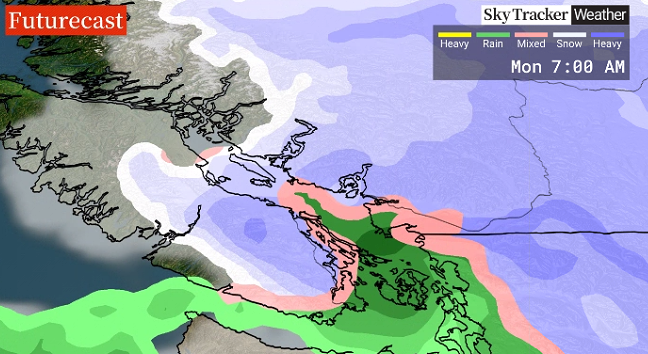
B.C.’s North, Central coastal and inland regions are under Arctic outflow warnings issued by Environment Canada Sunday.

“Very strong outflow winds of 80 km/h gusting to 110 have developed through the North Coast and Central Coast mainland inlets (Saturday) night,” Environment Canada said, in a warning.
“These strong winds combined with temperatures near zero are producing wind chill values near minus 15.”
As Sunday persists, Arctic air will continue to push into the regions that will drop temperatures to near minus 20 with wind chill.
Avalanche Canada said the Arctic air will soon spread across the province.

Get breaking National news
“We will see a surface low spinning system off the coast of Vancouver Island and wrapping areas of snow and flurries into the B.C.’s South Coast and Southern Interior,” said Avalanche Canada said.
“Meanwhile, the Arctic front sits somewhere over B.C’s Central interior and Cariboo region. Over the next 48 hours it will continue to advance southward and by Monday will be near the Lower Mainland.
“It will continue to push south and west on Monday and by Tuesday morning all of B.C. will be firmly in the grasp of the Arctic air.”
B.C. community members are being urged to prepare for the cold and possible snow.
“Minimize exposed skin with hats, scarves, and mittens or gloves,” Environment Canada warns.
“Anyone who is not dressed warmly is at risk of frostbite and hypothermia in cold weather. Be prepared for unusually cold temperatures and strong winds.”
Environment Canada still has 23 snowfall warnings in effect for much of B.C.’s South Coast and Interior regions.


Comments