
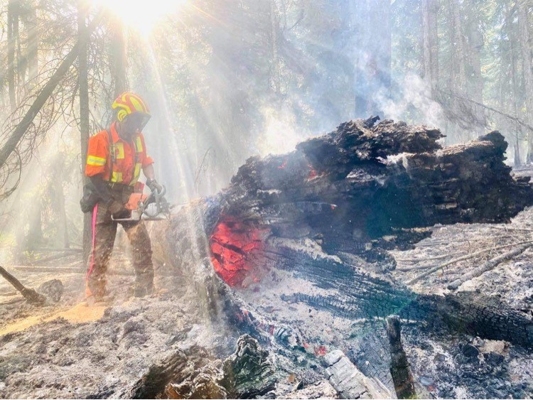
Volatile fire behaviour and growth continues along the north flank of the Thomas Creek wildfire, located just northeast of Okanagan Falls.

According to the BC Wildfire Service, due to poor visibility and increased fire activity, heavy equipment has been withdrawn from the north and northwest flank in the Derenzy and McLean Clan Lake area.
“Helicopters are continuing to deliver water along the north flank to ensure the fire does not spread into the drainage north of Christie Mountain,” said BC Wildfire.
“Where it is safe to do so, ground crews are continuing to focus on suppression efforts along the south flank.”
Read more: B.C. Christmas tree farmer believes piece of glass sparked blaze that torched almost 1,000 trees
The fire is listed at 8,242 hectares, up from 7,918 hectares on Thursday.
In the Regional District of Okanagan Similkameen, 724 properties are under evacuation alert. Another eight properties are under evacuation order.
Below is a list of other wildfires of note throughout the Okanagan, Shuswap, Similkameen, Boundary and West Kootenay regions.
Brenda Creek
More than 30 firefighters remain on the scene of this wildfire, including 19 structural crew members from six different fire departments.
The blaze, which started more than two weeks ago, just south of the Okanagan connector, remains out of control. It is estimated at 824 hectares.
On Friday, a full infrared scan was done to identify perimeter hot spots.
There is concern the fire could see some growth given the hot and dry conditions Friday and Saturday.
A number of evacuation orders and alerts remain in place.
Thirty-four firefighters, two danger-tree fallers, three helicopters and 20 pieces of heavy equipment are on scene.

Bunting Road

Get breaking National news
Burning on the west side of Mabel Lake, this fire is estimated at 3,000 hectares and is classified as “out of control.”
The BC Wildfire Service says fire activity has increased on the fire’s south side and that thick smoke is preventing crews from obtaining a size update.
Evacuation orders are in effect for some cabins.
Thirteen firefighters and two helicopters are on scene.
Crazy Creek Gorge Forest Service Road
This new wildfire of note is located around 29 kilometres north of Sicamous, in hilly terrain, and is estimated to be 1,700 hectares in size.
However, BC Wildfire says due to thick smoke in the area, it doesn’t have an accurate track of the fire’s perimeter.
The fire is believed to be lightning-caused.
An evacuation alert, issued by the Columbia-Shuswap Regional District, is in place for the communities of Queest Village and Pete Martin Bay.
Garrison Lake
Located 33 kilometres southwest of Princeton, this fire is estimated at 3,373 hectares and has grown to the south and southeast.
An evacuation alert is still in place for more than 140 properties. Two other properties are under evacuation order.
Hunakwa Lake
This fire is still burning nearly 10 kilometres southeast of Seymour Arm, and continues to grow on the east flank.

The fire is estimated at 1,100 hectares and is classified as out of control. Seven firefighters and two helicopters are battling the blaze.
Evacuation orders and alerts are in place for hundreds of residents.
Michaud Creek
Located on the west side of Lower Arrow Lake, around 21 kilometres south of Edgewood, this fire is estimated at 7,856 hectares.
Fifty-two firefighters, four helicopters and 20 pieces of heavy equipment are battling the blaze.


BC Wildfire says air tankers will be used when possible.
Nk’Mip Creek
This fire, located near Osoyoos, is now estimated at 13,000 hectares, up considerably from 6,800 hectares on Thursday — though growth had been expected due to smoky skies preventing accurate mapping.
BC Wildfire called Friday’s estimate a rough one, noting the last aerial mapping occurred on July 23 at 6,871 hectares.
“(On Thursday), growth was observed on the north and northeastern flanks, primarily driven by wind, fuel type, and dry conditions,” said BC Wildfire.
“We will continue to see smoke in the valley bottoms through the morning, with some clearing through the afternoon and evening. Fire behaviour is anticipated to increase through the afternoon and into the evening, as the inversion lifts and skies clear.”
One hundred and forty firefighters are battling the blaze, as are five helicopters and 26 pieces of heavy equipment.
Several evacuations alerts and orders remain in effect.

Octopus Creek
Located around 11 kilometres south of Fauquier, the fire is estimated at 17,520 hectares and has been a challenge to fight, though low to moderate fire behaviour is anticipated.
However, BC Wildfire said some areas may experience greater fire behaviour, which could cause growth in those zones.
Fifty-three firefighters, four helicopters and nine pieces of heavy equipment are battling the fire.
Three Valley Lake
Located around 18 kilometres southwest of Revelstoke, this fire is estimated at 309 hectares.
Evacuation orders are in place, and BC Wildfire says it is continuing to monitor it, adding structural protection specialists are on scene and that CP Rail has aerial resources responding throughout the day.
Two Mile Road
This fire, located just south of Sicamous, has remained at 1,000 hectares, though BC Wildfire says it hasn’t been mapped recently because of wildfire smoke.
Thirty-three firefighters, three helicopters and 10 pieces of heavy equipment, plus crews from the Sicamous and Swansea fire departments, are battling the blaze.
A number of evacuation orders and alerts remain in place.
White Rock Lake
Growth is expected on this fire, which is estimated at 20,891 hectares and is threatening the community of Westwold.
The growth is forecast for the north and northeast flanks, and further evacuation alerts and orders are possible. Thunderstorms, strong winds and lightning are possible Friday night.
One hundred and seventeen firefighters, eight danger-tree fallers, 39 pieces of heavy equipment and eight helicopters are fighting the fire.

Comments
Want to discuss? Please read our Commenting Policy first.