
Conditions continue their cooling trend in the Okanagan on Monday with a mix of sun and cloud in the morning and the risk of storms in the afternoon as temperatures climb into the low 30s.

The risk of showers and storms diminishes Monday night with skies clearing out, making way for a mostly sunny Tuesday with temperatures returning to the mid-30s.

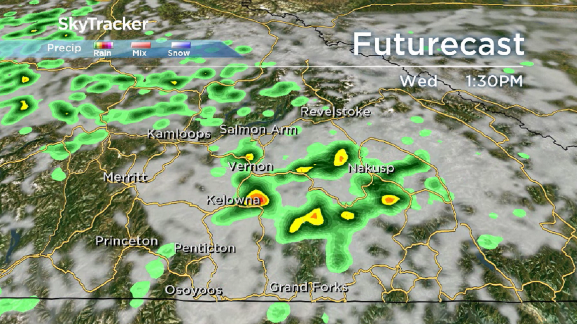
A disturbance moving up from the south will bring some brief relief on Wednesday with an afternoon high in the upper 20s and the chance of showers and risk of a thunderstorm during the day.
The potential is there for more lightning that could start fires, however, a cooler day on Thursday as well with the chance of showers and a daytime high in the upper 20s should help with the fire fight.
The heat returns on Friday with a mix of sun and cloud and the chance of a high elevation shower or storm as temperatures climb back into the mid-30s.


Partly cloudy skies linger through the weekend with daytime highs in the mid-30s both Saturday and Sunday.

For weather on the go download the Global News SkyTracker Weather App for iPhone, iPad or Android.
- What is a halal mortgage? How interest-free home financing works in Canada
- Capital gains changes are ‘really fair,’ Freeland says, as doctors cry foul
- Ontario doctors offer solutions to help address shortage of family physicians
- Canada will take bigger economic hit than U.S. if Trump wins election: report
Comments