
Dubbed a ‘snow blob’ by one highway maintenance contractor, an incoming weather system is expected to blanket several parts of B.C. Wednesday evening.

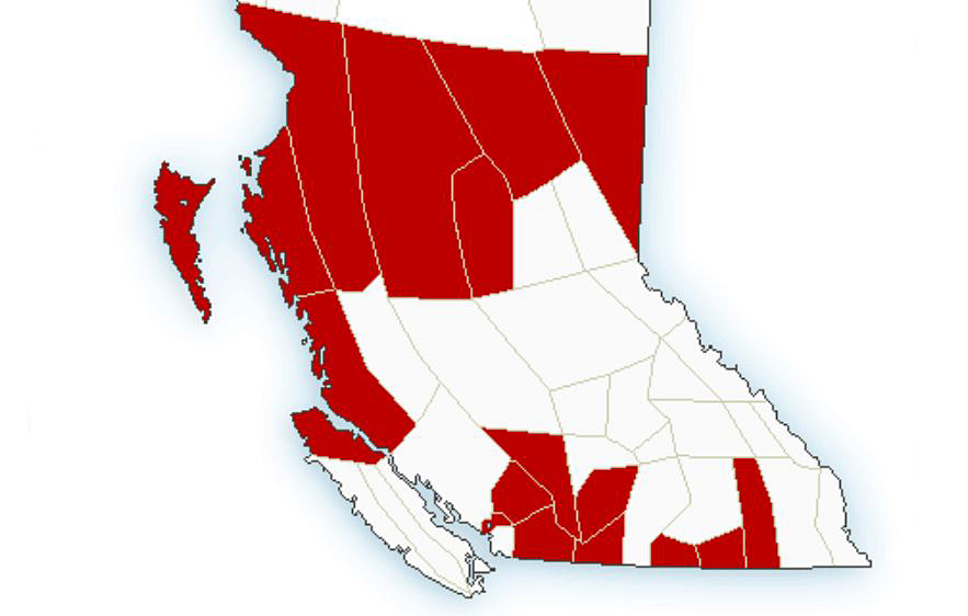
The incoming Pacific frontal system will spread snow across north-central B.C., from the coast to the Alberta border, plus mountain passes in the Southern Interior.
Winter storm warnings were issued on Wednesday afternoon for the Coquihalla Highway, from Hope to Merritt, and sections of Highway 3.
Snow is expected to begin Wednesday night then become heavy at times through Thursday, with 30 centimetres expected by Friday.
Read more: Okanagan weather: mild finish to February
Environment Canada says motorists can expect hazardous conditions.

Get daily National news
Elsewhere, snowfall warnings were issued for:
- North Coast inland sections: 15 cm
- Bulkley Valley and Lakes District: 10 cm
- Stuart / Nechako: 10 cm
- Williston (Pine Pass on Highway 97): 15 cm
- Peace River: 15 cm
- Howe Sound: 15-20 cm
- Sea to Sky Highway: 15-20 cm
- Boundary (Highway 3): 15-20 cm
- West Kootenay (Highway 3): 15-20 cm
- Kootenay Lake (Highway 3): 15-20 cm


Wind warnings have also been issued for Haida Gwaii, the North and Central Coast and North Vancouver Island, where gusts between 70 and 100 km/h are expected.
Most regions near water will remain above freezing, though those areas could see a mix of rain and snow.
Find the latest weather warnings on Environment Canada’s website.

Comments
Want to discuss? Please read our Commenting Policy first.