Metro Vancouver just saw its first significant snowfall of the season, leading to sloppy roads and “ice bombs” falling from the region’s bridges.

But now that the snow has tapered off, what happens next? Here’s five things you need to know about the weekend weather.
READ MORE: Ferry cancellations, ‘ice bombs,’ sloppy roads amid Metro Vancouver’s first snow of the season
1. The slush/snow should not freeze overnight.
Instead, rainfall overnight will wash at least most of it away. Temperatures will remain at around two or three degrees Celsius overnight.
Temperatures over the highest terrain and in the central and eastern Fraser Valley may be colder, but they will likely remain just above freezing.
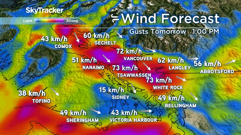
2. Tomorrow will be very windy!
A wind warning is in effect for central and southwest Metro Vancouver, including Vancouver, Tsawwassen, White Rock, Surrey, Richmond, Delta, Burnaby and New Westminster.
Northwest winds could reach sustained speeds of 40 to 60 km/h with gusts up to 70 km/h. Near the water the gusts could reach 90 km/h. The winds will begin to pick up in the morning. But the strongest winds are expected between mid morning and mid afternoon.

Get breaking National news
Despite the high winds, it will be a sunny day!
3. We are expecting power outages, tree damage & ferry delays tomorrow.
Multiple ferry cancellations were reported through the day Friday, with sailings finally getting back on track in the late afternoon.
Make sure you check with BC Ferries before heading out for the weekend and BC Hydro if power goes out.
- Old Man Winter wallops B.C.’s Mainland/Southwest region, major highway closed
- Calgary hit by unexpected blast of spring snow, causing dozens of crashes
- False spring strikes again: Saskatchewan prepares for incoming winter weather
- Albertans’ interest in alternative forms of travel growing as fuel prices spike
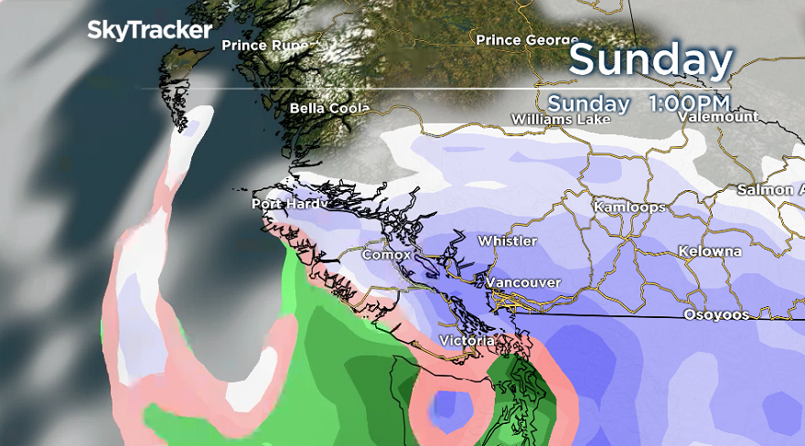
4. Snow on Sunday!
A system will move in late Saturday evening, bringing rain or wet snow for higher elevations that will then change to snow on Sunday.
Tune back in over the weekend for more details on this new snow storm.
5. Arctic air will begin to move in on Sunday.
Temperatures will drop throughout the day and will likely stay below freezing all week. Sunday’s snow will remain on the ground for quite a while.


Comments
Want to discuss? Please read our Commenting Policy first.