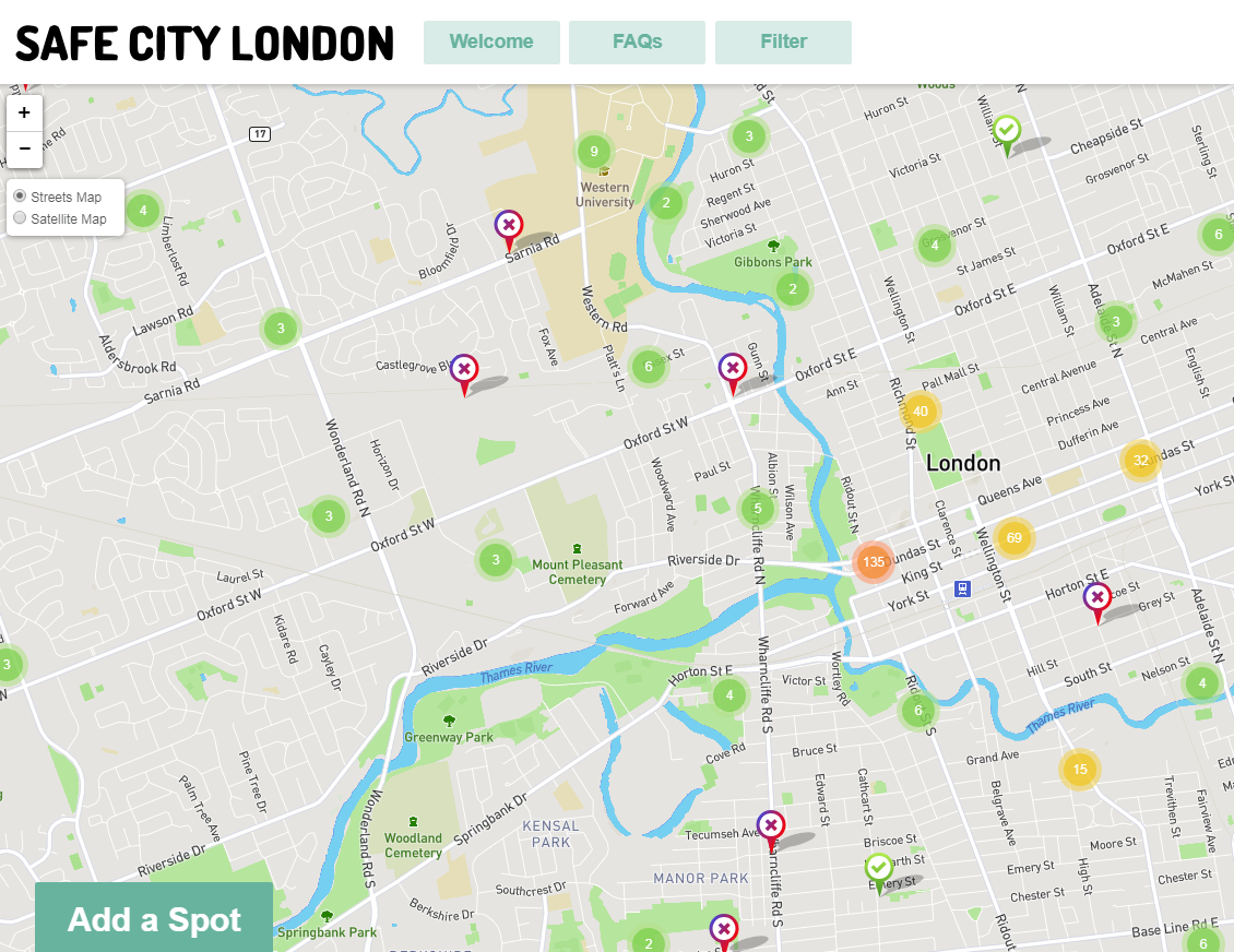
Testing has begun on a new app where you can document on your smartphone any place outside in Edmonton where you feel threatened, anxious or simply not safe.

It’s a project that was launched by the City of Edmonton after the UN Women’s Safe Cities and Public Spaces for Women and Girls International Conference.
READ MORE: Edmonton’s Downtown Business Association worried about ‘blatant drug use’ along Jasper Avenue
“You’ll put a pin in the map,” said Jackie Foord, the city’s branch manager of social development, who has been overseeing the pilot project.
“It’ll show what street you were on and then there will be some drop-down menus that will ask for your gender, what time of day it was and what was it that you felt, or saw in some cases, or experienced.”
“It might be in a residential area, so the city might have an opportunity to go in there and say: is the lighting not right? Because one of the drop-down menus will say: ‘bad lighting.’

Get daily National news
“Or it could be a business or a commercial street that says, ‘Hey, there’s been some actual sexual assaults taken place on this street, or groping or catcalling,’ and then we can look at those streets along with the business community and say: ‘What is happening on this street that we need to address?'”
READ MORE: Edmonton residents feel less safe in downtown: report
Eventually, the map generated will have a series of pin marks and if certain locations have a large blob of those markings, something will be done about it.
“We know from our scope and study for the UN, that public transportation is one area,” Councillor Bev Esslinger said in an interview. She took the lead last November to get the project going.
“We know it’s not the only area of concern for people as they’re walking or if they feel unsafe or if they’re attending events — what are they?
“That might prompt additional work on us, so we’ll have the data to say we need to dig deeper and find out what’s going on here and maybe target investment to improve it.”
READ MORE: Safe City London website aims to increase safety for women, girls in public spaces
“I have looked at some of the prototypes and had recommended a few changes,” Esslinger said. “We’re tweaking it to make it Edmonton-information because I wanted a little bit more information available. I wanted to identify the infrastructure improvements that might be needed.”
READ MORE: City of Edmonton launches public survey in effort to improve rave safety
“For example, maybe it’s lighting. Maybe it’s a location, a bar or a rave, where people feel very unsafe. Whatever those reasons are we’ll be able to look at them and then be proactively making changes as we can in those areas.”
Once testing is complete, the city will unveil the app in a report on July 4 ahead of city council’s Community Services Committee meeting on July 10.
- Mass shootings have prompted Canadian gun laws to change over the decades
- Tumbler Ridge shooting: Everything RCMP has said about the shooter so far
- Tumbler Ridge: A timeline of how the school shooting unfolded
- Tumbler Ridge student says he doesn’t know how to return to school following mass shooting


Comments
Comments closed.
Due to the sensitive and/or legal subject matter of some of the content on globalnews.ca, we reserve the ability to disable comments from time to time.
Please see our Commenting Policy for more.