After a long winter for most of Canada, spring is finally here.

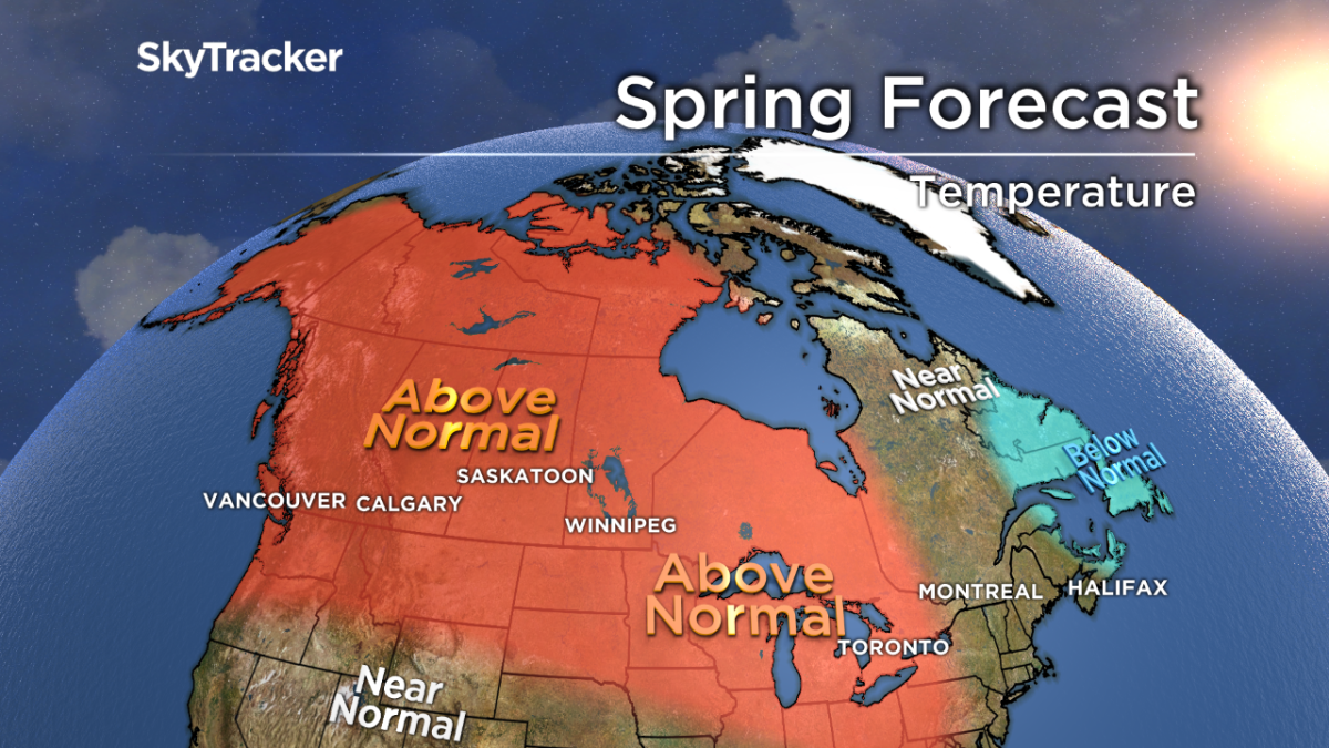
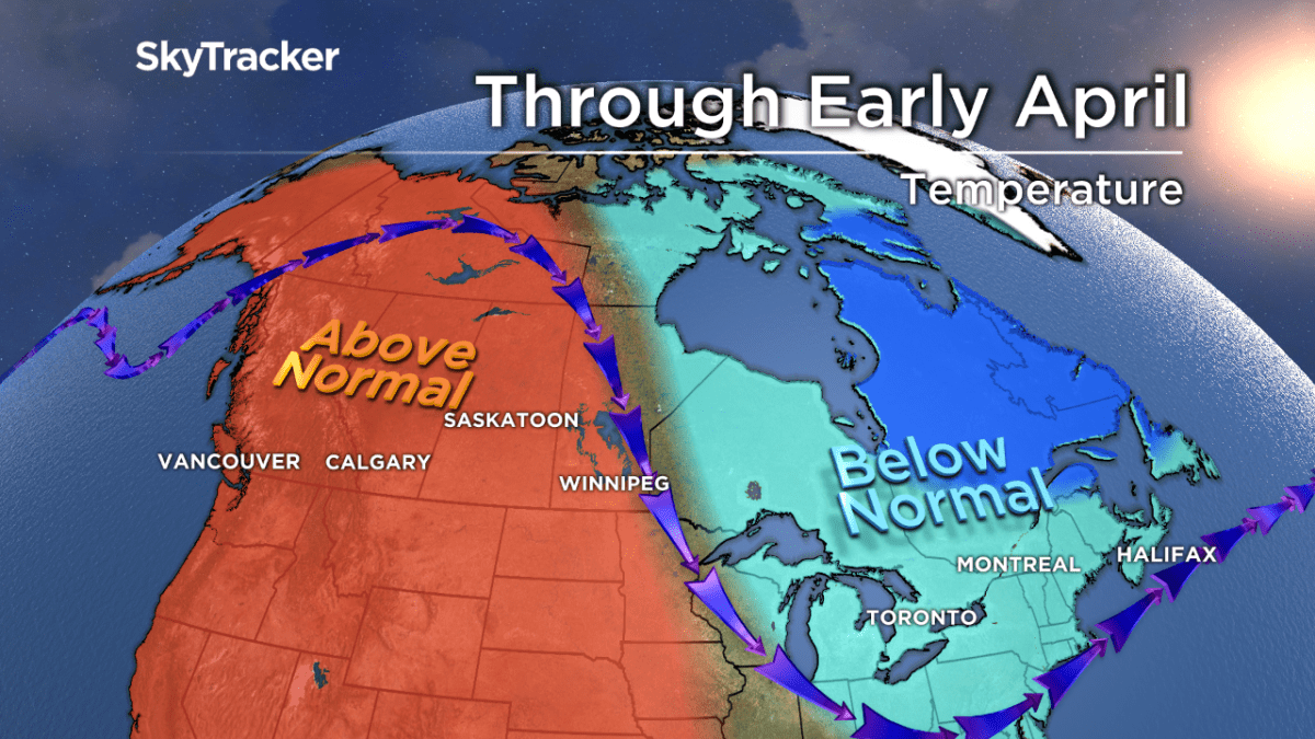
Out west, the season is off to an incredible start with numerous high temperature records being set. The ridge of high pressure responsible for the record heat will only slow down through early April, so expect mild and dry weather to continue.
At the same time, the eastern half of the country will have a harder time escaping the leftover winter chill. A back-and-forth pattern will see cold weather through at least early April, with the potential for at least one more snowstorm in Quebec and Atlantic Canada.
Here’s what Canadians can expect this spring, from coast to coast to coast.
Atlantic Canada and Newfoundland
A chilly start to spring will eventually turn milder as the jet stream becomes more zonal (west to east). Occasional storms could bring rain and snow through the first half of April, but overall, this won’t be the same wild spring we saw last year.
A slow and steady snowmelt is expected across New Brunswick, but some spring flooding is still likely due to the large remaining snowpack.
WATCH: New Brunswick launches 2019 River Watch program

Ontario and Quebec

Get daily National news
Colder than normal temperatures will prevail through early April, before the pattern breaks down and we see warm air ride in from the west. The mild conditions of mid and late spring will likely more than offset the chilly start to the season. This is completely different than last year, when April brought abnormal cold, rain, snow and a significant ice storm across southern Ontario.
The much-dried pattern forecast this year should limit a major flood threat in April, but it’s something we’ll be watching closely due to the large amount of snow left over.
Prairie provinces
Flooding is something many Manitoba residents are fearing mainly due to the snow and ice on the ground, but also because of what’s occurring south of the border. Winter left significant amounts of snow and ice across the northern Plains, including the upper reaches of the Red River.
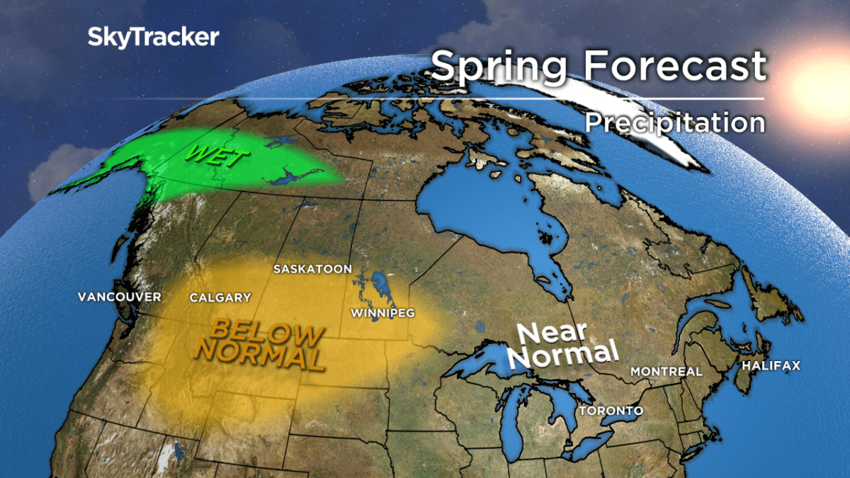
The spring melt will continue, and with the river flowing from south to north, the flood threat on that river and others is something I’ll be watching into May. Thankfully, below-normal precipitation will limit any additional runoff.
WATCH: Quick melt across Alberta prompts spring runoff advisory
- Old Man Winter wallops B.C.’s Mainland/Southwest region, major highway closed
- Calgary hit by unexpected blast of spring snow, causing dozens of crashes
- False spring strikes again: Saskatchewan prepares for incoming winter weather
- Albertans’ interest in alternative forms of travel growing as fuel prices spike

Temperatures will be above normal through the Prairies but be warmest in Alberta. Even with the mild forecast, one or two late-season snowstorms are likely in places like Edmonton and Calgary.
B.C.
The record warmth to start spring can’t last forever, but the ridge of high pressure causing it will only slowly break down. By mid-April, temperatures will return to seasonal before warming again late in May.
The early season alpine snow melt is causing significant rises on rivers and streams, but this may also prevent a bigger flood threat later in the spring. Rainfall is expected to be near or below normal for much of the province.
WATCH: Warm weather arrives on B.C.’s South Coast just in time for spring break

Northern Canada
Much of the northern territories will experience a continued mild pattern for much of spring. The above-normal temperatures will be more common across Yukon and less likely eastward in Nunavut. Precipitation will average close to seasonal.


Comments
Want to discuss? Please read our Commenting Policy first.