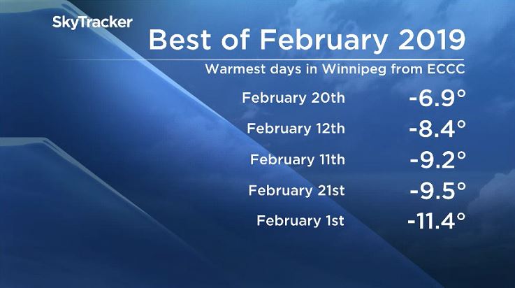
The month of February has been brutally cold in and around Winnipeg. Temperatures have been well below normal nearly every day this month and there is more to come.

Overall, the daily mean temperature this month sits at -20.3 Celsius. Typically, Winnipeg will see a daily mean average temperature of -13.2 C in February.
And while the temperatures have been milder this past week, they aren’t here to stay. In fact, the weekend will be very different from one day to the next.
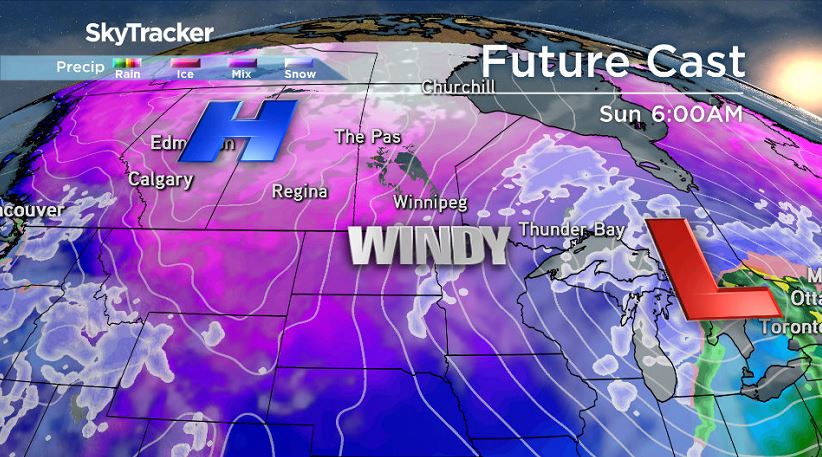
Snow is on the way courtesy of a strong low pressure system south of the border, developing in Colorado.
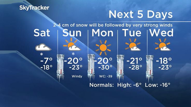
Winnipeg will see snow start early Saturday morning and continue off and on through a mild Saturday and into Saturday night. The system will likely leave around 2-4cm of snow in the southern Manitoba region with much higher amounts in northwestern Ontario.

Get daily National news
Environment Canada issued Winter Storm Watches Friday afternoon for the city of Thunder Bay and much of norther Ontario as 10 to 20 centimetres of snow and blowing snow is likely.
Sunday will be a blustery one around Winnipeg and the Red River Valley. As low pressure moves off to the east and high pressure moves in, very strong winds are likely.
Long range models indicate wind gusts around 60 or even 70 km/h are possible in the city and with the fresh snow from Saturday, blowing snow will be a factor for drivers, especially Sunday morning. Blowing snow will likely be a factor for much of southern Manitoba along Highway 1 even with lesser snowfall amounts.
These strong winds will also cause temperatures to drop. Saturday night into Sunday morning, temperatures will likely dip to -23 Celsius and stay below -20 C throughout the day.
As conditions slowly clear and winds calm, temperatures will sink further.
By Monday morning the bitter cold Winnipeg will return, with temperatures likely sitting near -30 C and wind chill values back near -40.
WATCH: Manitobans bravely face bone-chilling temperatures


Comments
Want to discuss? Please read our Commenting Policy first.