
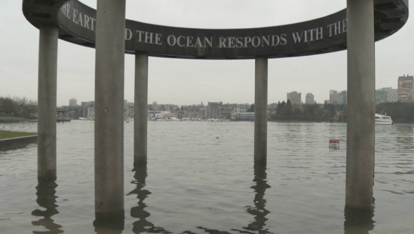
Vancouver is in the midst of another “king tide,” and the City of Vancouver is asking the public to get their cameras out to document it.

King tides, also known as perigean spring tides, are the highest tide ranges of the year. This king tide runs from Nov. 23 to Nov. 30.
They occur when the moon is closest to the earth and the sun and moon’s gravitational forces reinforce each other.
King tides can produce water levels as high as five metres, or even higher if combined with a storm surge.
WATCH: (Aired Jan. 5, 2018) King Tide threatens False Creek shoreline

They can also cause minor flooding in some low-lying areas and — from the city’s perspective — offer a potential view of what the region could look like amid sea level rise.
According to the city, the sea level on Vancouver’s shoreline has seen a 3.7-centimetre rise over the last century.
In the face of climate change, the province has told coastal municipalities to prepare for a one-metre sea level rise by the start of the next century.

Get breaking National news
As such, the city is asking the public to take photos of the tide-affected shoreline to help plan for that reality. People are being invited to share them on social media or upload them to an interactive map.
“King tides offer us a chance to see what normal sea levels may look like in the future as they rise due to climate change,” states the city in a document titled Vancouver’s Changing Shorelines.
“By 2050, when sea levels are expected to be 50 cm higher than today, our regular sea levels could look like some of today’s king tides.”
WATCH: (Aired Nov. 9, 2016) Mayor announces annual sandbagging operation a head of King Tide

The exercise is a part of the city’s plan to respond to sea level rise, which includes an assessment of coastal flood risk and an adaptation plan for the Fraser River foreshore.
The city says it’s also incorporated data on coastal flood risk into all new projects on the coastline and that it will be soliciting public input on options to respond to sea level rise over the coming year.
- First Nations chiefs call for inquiry into Ontario wildfire response
- AI data centres have 4 in 5 Albertans concerned over environment, electricity costs: Poll
- How the Northern Tornadoes Project helps verify twisters as Alberta on track for record year
- Canada’s first ‘dementia-inclusive’ park set to open in Calgary in fall 2026


Shutterbugs who want to capture dramatic images of the king tide can consult a tide forecast for the best times. The highest sea levels, 4.93 metres, will occur on Tuesday at 9:38 a.m. and Wednesday at 10:28 a.m.
Previous king tides have delivered some fairly stunning photos. Here are a few king tide images captured during the high-water mark last January.
https://www.instagram.com/p/BdnsDsqBMfk/?utm_source=ig_embed
Comments
Want to discuss? Please read our Commenting Policy first.