

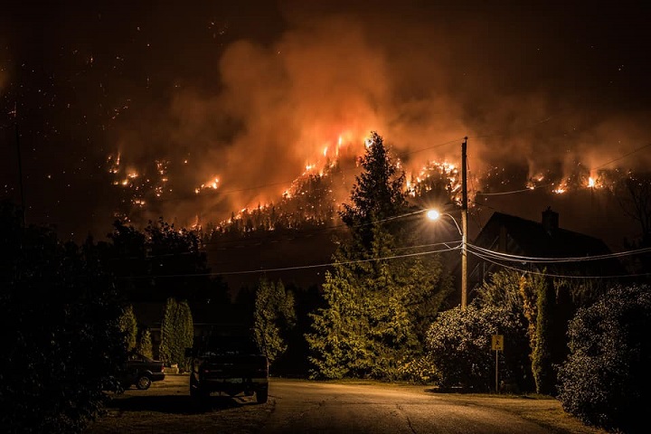
The smoke coming from British Columbia’s forests amid a furious wildfire season isn’t just reaching into Alberta.

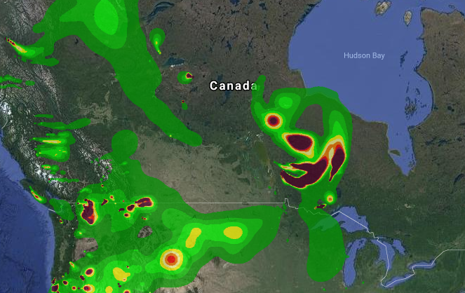
Plumes of smoke from the fires are believed to be travelling as far east as Ontario, the Maritimes and beyond — even across the Atlantic Ocean to Ireland.
Coverage of wildfire smoke on Globalnews.ca:


That’s according to David Lyder, an air emissions engineer with the Alberta government and one of the minds behind FireSmoke.ca, a website whose animated map shows the probable trajectory of wildfire smoke within North America.
“Long-range transport of smoke from wildfires is not uncommon,” he told Global News.
Lyder brought up one forecast in which smoke travelled from northern Alberta and Saskatchewan, helping to trigger air quality advisories in Washington, D.C.
And it isn’t just B.C. that sends smoke so far.
“We get smoke from Siberia,” Lyder said.
The map forms one component of the BlueSky Western Canada Wildfire Smoke Forecasting System, a project that first developed in 2007 out of concern about the need for smoke projections to help inform weather forecasters, health authorities and other parties.
BlueSky, a software system that uses data to model fire, fuel consumption, weather, emissions and dispersion, was initially developed by the U.S. Forest Service.

Get breaking National news
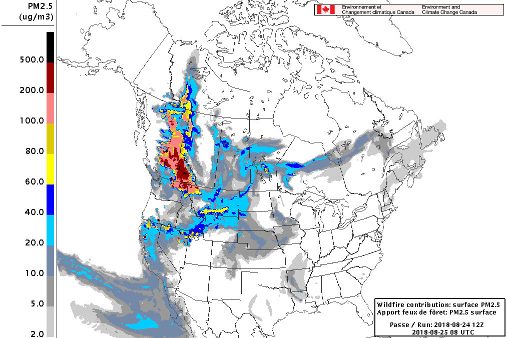
Data tracking all of these factors is pooled into a system that helps to forecast concentrations of fine particulate matter (PM2.5) — an air pollutant that can have negative effects on human health — from wildfires for up to 48 hours.
Canada’s BlueSky project uses the very same system, gathering data from the Canadian Wildland Fire Information System.
READ MORE: Smoke from B.C. wildfires impacting parts of Saskatchewan
The data helps to produce animations that display how PM2.5 concentrations will change over the next couple of days.
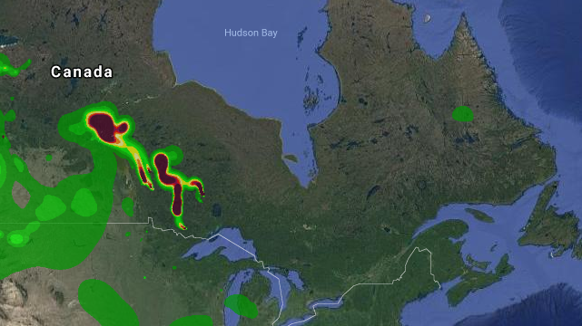
The map showed some heavy smoke hitting Ontario and lesser plumes travelling as far as Quebec and Labrador on Saturday; it had previously shown smoke hitting the Maritimes.
The people behind FireSmoke.ca are careful to note that the map shouldn’t necessarily be relied upon in isolation; it’s considered “experimental” and there are limitations.
Satellite detections, for example, are used to find fires. If areas where fires are burning are covered by clouds or smoke, then the emissions from those blazes won’t be included in forecasts.
Projections displayed by the map can be supplemented by looking at Canada’s Wildfire Smoke Prediction System (FireWork), which provides daily smoke forecasts.
- Rare sightings of killer whale: Nova Scotia boaters warned to keep their distance
- France says huge wildfire no longer growing after 220k evacuations
- What the duck? Lake Summerside’s resident waterfowl dodges rehoming attempts
- GTA environmental group nears milestone of 10 million litter pieces picked


Nevertheless, both these modelling systems have shown smoke reaching as far as the Maritimes.
FireWork, for example, showed lighter PM2.5 concentrations hitting New Brunswick, Prince Edward Island, Nova Scotia and Newfoundland this weekend, though other fires are burning further east than B.C.
Fine particulate matter is indeed reaching Eastern Canada, “but the concentrations are much lower in the Maritimes than they are in B.C.,” said Sarah Henderson, senior environmental health scientist at the B.C. Centre for Disease Control.
There are two components to wildfire smoke: PM2.5 and volatile organic compounds (VOCs).
While PM2.5 has been noted for its effects on human health, VOCs have more to do with how smoke interacts with our senses.
“VOCs are the things that make our eyes sting and that give smoke that campfire smell,” Henderson said.
“They’re not super risky, but they are irritating.”
VOCs also dissipate as smoke travels.
“The volatiles from the smoke are gone by the time they get to the east,” Henderson said.
John Clague, a professor of earth sciences at Simon Fraser University, said satellite tracking of smoke has shown that heavy concentrations of particles have been carried from B.C. and California to locations thousands of kilometres to the east.
“I would say, however, that the duration of the exposure is limited,” he said.
While the physical effects of smoke are less pronounced by the time it travels such great distances, that doesn’t make it harmless.
Concentrations may be lower, but the fine matter is still there.
“Wherever it gets to, if smoke gets there, it carries with it some risk,” said Henderson.
Still, “we would expect that smoke from B.C. may have a small impact on health in eastern parts of Canada, if and when it arrives there,” she added.
Comments
Want to discuss? Please read our Commenting Policy first.